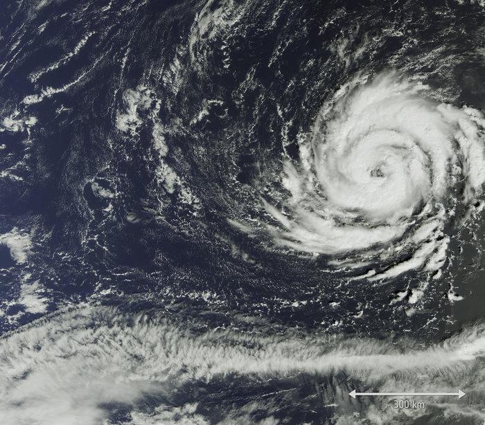
Hurricane Ophelia, now a category 2 storm, has been meandering around slowly to the southwest of the Azores thanks to weak steering currents and vertical shear. Little weakening is expected over the next two days as Ophelia stays over sea surface temperatures of 25-26C.
By Sunday, Ophelia will begin to accelerate northeastward to the east of the Azores, as it is picked up by a strong jet stream looping around an upper trough extending SE across the North Atlantic. As Ophelia moves into the developmental right entrance of a jet streak in the jet stream, it looks to maintain hurricane strength and further intensify, as per high res runs today, as it moves NE towards Ireland.
There continues to be uncertainty on the track of Ophelia as it closes in on Ireland and western UK, with disagreements still apparent between the 12z high resolution/operational runs of the three main models of GFS, UKMO and ECMWF that came out this evening.
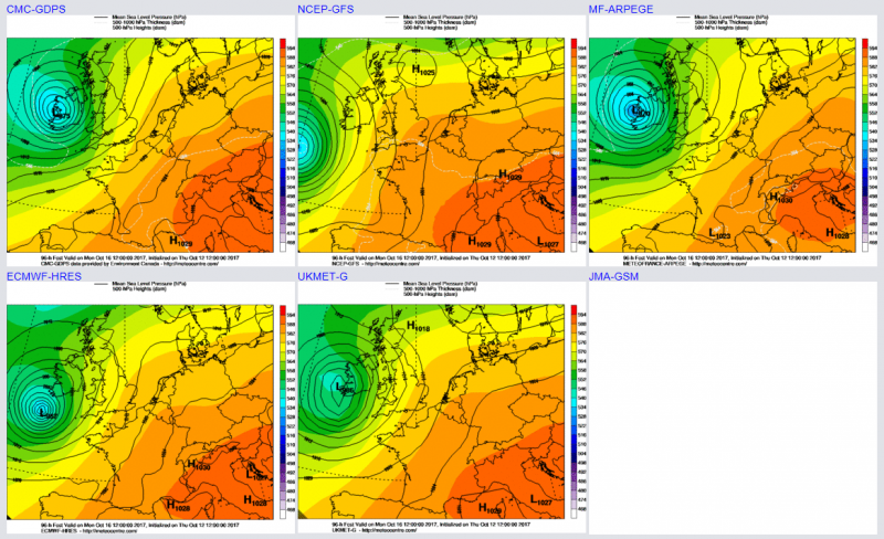
12z GFS high res the furthest west in track to the west of Ireland on Monday. 12z UKMO global makes Irish landfall and tracks across the west and north of Ireland before crossing Scotland – 12z ARPEGE model (France) also similar. 12z ECMWF a little further east than UKM, landfall as an intense depression before weakening as it continues NE across Scotland by Tuesday morning.
12z ECMWF high res forecasting Ophelia central pressure of 974mb at 7pm on Monday, with 90mph gusts along SE coast of Ireland, then strongest gusts (70mph) transferring up through the Irish Sea by early Tuesday, with gusts of 95mph over Snowdonia
Unusual for the U.S. National Hurricane Center to be talking about and forecasting the impacts of an extratropical storm on the UK and Ireland, but they seem to be siding with the European models on track rather than the GFS.
Though UK Met Office currently expecting ex-hurricane Ophelia to pass just to the west Ireland/UK on Monday.
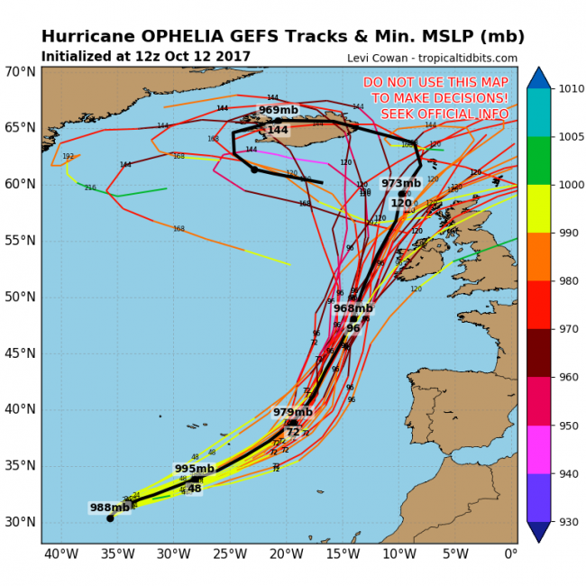
GEFS (ensembles) members mostly track Ophelia to west of Ireland, though a few crossing Ireland and one missing Ireland and heading further east over central UK:
Although Ophelia's strong winds and rain likely missing eastern England, it will drag up some very warm air, perhaps breaking some date records for high temperatures!
Loading recent activity...