
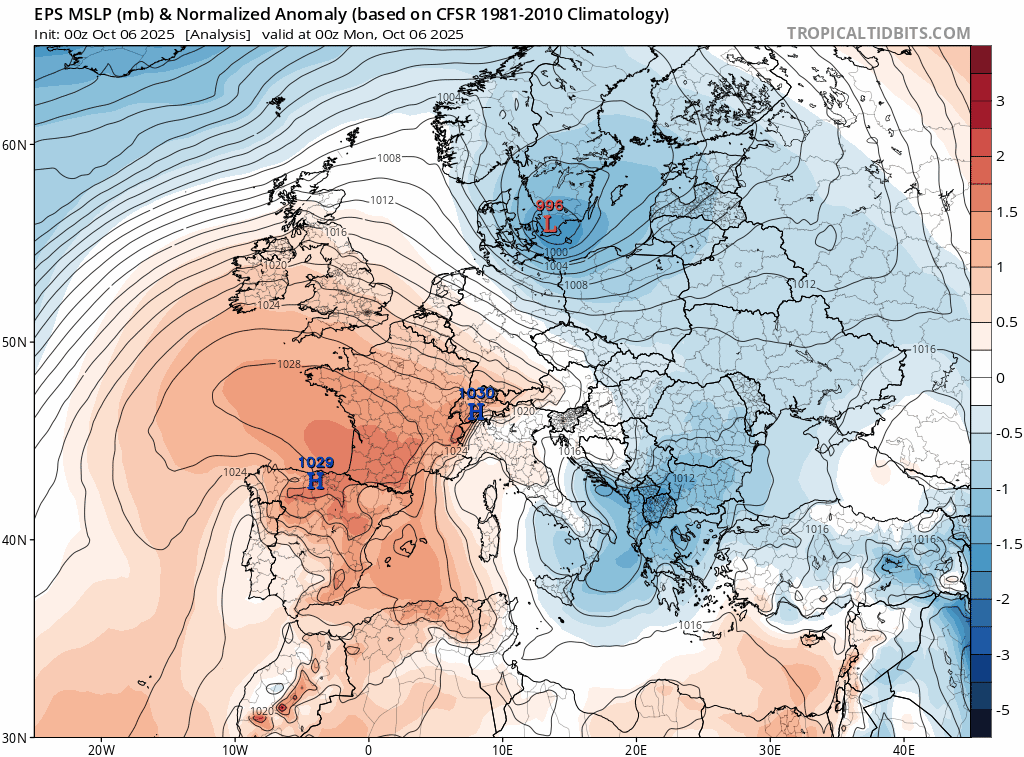
After Storm Amy brought winds over 90mph to western Scotland and N. Ireland on Friday, the weather is looking a lot calmer this coming week, as high pressure looks set to build from the south. However, despite Stormy Amy and the high pressure system building across the UK later this week being chalk and cheese, they will both have been influenced by ex-hurricanes.
The remnants of ex-hurricane Humberto helped spawn a new low over the Atlantic that deepened into Stormy Amy - as it tracked northeast towards Scotland. While the remnants of Imelda passing northeast to the south of Iceland early this week will help build a high-pressure system across NW Europe during the week while reinforcing the jet stream to the north. This will lead to drier weather in the UK and Ireland after a weakening front, with some rain, clears south today and tomorrow.
High pressure looks set to dominate the weather thereafter bringing dry and settled conditions for most or all the UK from Thursday through the weekend and likely through most of next week too.
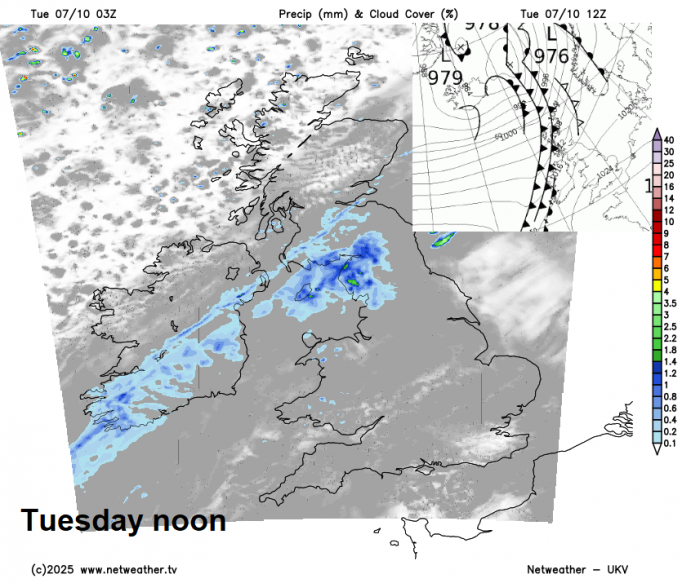
The first half of this week is under a predominantly westerly pattern with high pressure close to the south, bringing dry conditions here and weather fronts affecting the north bringing more in the way of cloud and some rain.
Southern UK had a warm, dry and sunny Monday, with temperatures reaching 20-21C across eastern England. The north saw more in the way of cloud with outbreaks of rain from Atlantic fronts. Today sees a frontal system bringing cloud and patchy rain slip southeast across northern areas, brighter conditions following from the northwest. Southern areas will continue dry and settled today, but with more in the way in the cloud around, after a misty or foggy start in places, but there should be some sunshine developing - especially in eastern areas - which will see the highest temperatures reaching the high teens.
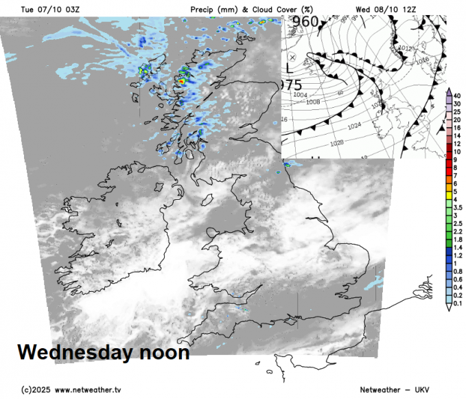
During Wednesday, a weakening cold front with a band of patchy light rain or drizzle will continue to move southeastward across England and Wales in the morning, reaching southern England early afternoon after perhaps a grey start with some early mist and fog again here. Drier and brighter conditions following, though showery rain will affect western Scotland as more weather fronts move in.
Later in the week, high pressure will start to build more widely from the southwest, with more widespread drier and settled conditions across the UK. However, it’s unlikely we will see wall-to-wall sunshine for everyone, with variable amounts of cloud and some bright or sunny spells. Western Scotland prone to thicker cloud off the Atlantic, with some patchy light rain or drizzle at times. Temperatures will be near average by day but chilly at night with a risk of mist or fog forming where skies clear.
The predominantly settled conditions look to continue through the weekend, with high pressure centred somewhere over the UK or Ireland, so expect to be dry for most, with variable amounts of cloud and some sunny spells by day, risk of fog developing at night. Scotland could be prone to more cloud and perhaps some patchy rain off the Atlantic, but some uncertainty on this, depending on how high pressure positions.
High pressure in charge next weekend
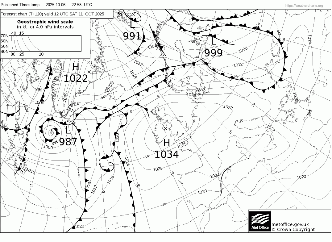
Continuing mostly dry and settled next week too, with high pressure in control. The high pressure system perhaps becoming centred over the Norwegian Sea, which may feed a northeast flow with more the way of cloud across eastern England, perhaps with a few coastal showers, but that’s a long way off.
Loading recent activity...


