The 2017 Atlantic hurricane season should be easing down as we head through October into November. Hurricane Nate is well inland now, still bring heavy rain and the Caribbean devastation of Maria and Irma will take years to recover from, never mind the flooding from Harvey.
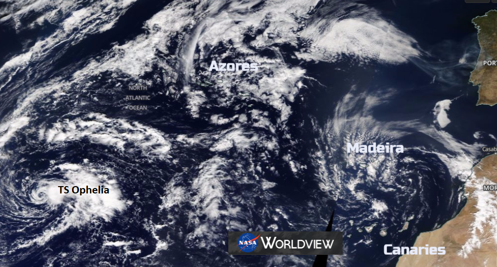
Meandering about, right in the centre of the Atlantic is Tropical Storm Ophelia (was TD17). This cyclone is managing not to get caught up in the usual easterly flow across the Atlantic towards the Caribbean or eastern seaboard as it is further north than usual. It is just pootling about and is forecast to deepen to Hurricane status and could get closer to the Azores.
.gif)
I did nearly get confused with the Cape Verde Islands, considerably further south in the Atlantic. Back in 2015, the Cape Verde islands were given a glancing blow by Hurricane Fred, a very unusual event in itself. Fred did then join the usual flow and head off NW across the Atlantic.
It is rarer still for a Tropical Cyclone to reach the Azores. One in mid Sept 2006; Hurricane Gordon troubled the very remote western islands. There was also the bizarre January 2016 Hurricane Alex which slunk about south of the Azores. The usual season is June to November.
According to a National Hurricane Center map showing the tracks of all Atlantic Ocean cyclones between 1851 and 2004, a tropical cyclone passing over the Azores Islands is a very rare occurrence; out of the more than 1,300 storms on the graphic, only a handful passed near the Azores.
TS Ophelia looks to be going the wrong way but is edging northwards and will end up slightly northeast of its current position, so closer to the Azores. It is starting far enough north to miss the main easterly flow.If it does trouble the Azores, there are no warnings yet, then it would bring strong winds, large waves and rain to this autonomous region fo Portugal. This as mainland Portugal struggles with driest Sept in 87 years after a summer of drought and wildfires.
Thereafter, a mid- to upper-level trough is expected to approach the depression, and that should cause the system to move a little faster to the east and east-northeast. -NHC
Usually, storms are steered by the easterly flow around the subtropical High and then may get caught in the westerly trade winds over the top of the high and head towards the UK. Resulting in us getting remnants of old storms and a bit of extra oomph to a wet and windy spell. This one looks to be staying well away from any land for the next few days, the Azores and Madeira, even NW Spain will have to see how it has moved at the weekend.
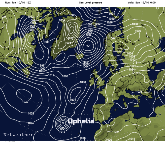
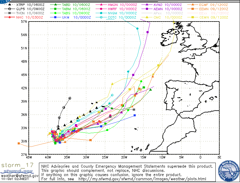
The pressure chart for Monday 16th shows the distinct low pressure closer to the islands for the start of next week. TD17 now TS Ophelia. There is a low confidence of how this depression will meander, with a large area showing for the various models' paths
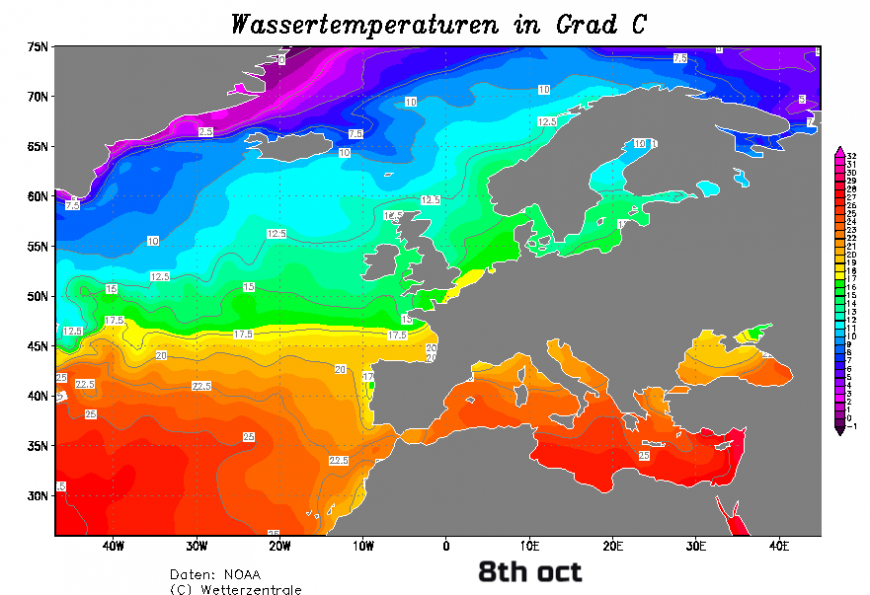
The waters are still warm enough in the mid Altantic, high 20s C to support development. The sustained winds are forecast to strengthen to 85mph, so we'll see where Tropical Storm Ophelia wanders by next week.
Discussion on the Atlantic hurricane season, tropical storms and new areas of interest.
Loading recent activity...