Storm force, hurricane-force, gales and gusts; lots of names and categories. The UK can't get an actual hurricane but can see hurricane force wind gusts.
Winds and Gusts
Around a low pressure, whether that is an autumn low or a tropical hurricane, both cyclones, you get sustained mean winds and also temporary sudden gusts.
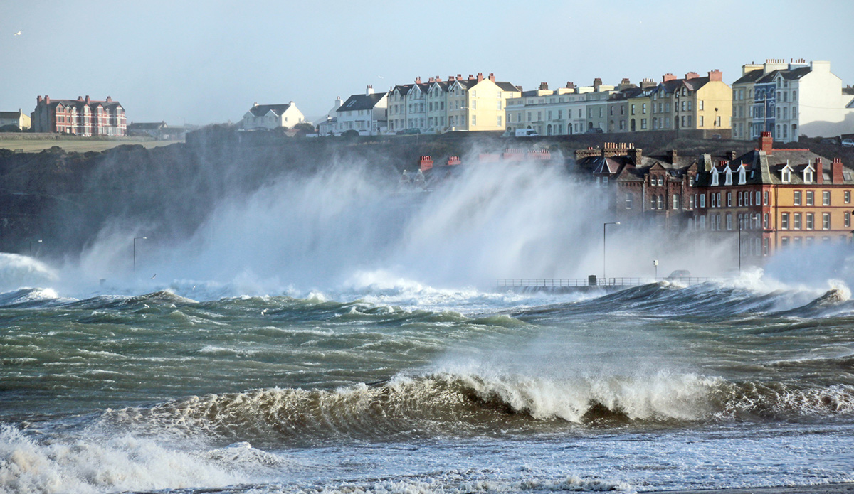
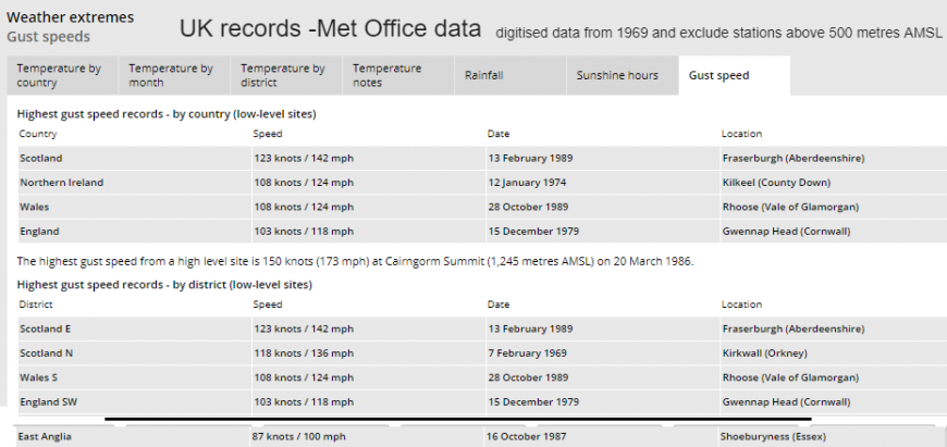
A hurricane has ongoing sustained winds of 73+mph (64+knots). Usually, for the UK we have mean winds of 40 to 50mph and gusts 60 to 70mph, even over 100mph as happened in the great storm of 1987.
There are various categories for wind strength, the Beaufort scale, originally used at sea but now adapted for land. The Saffir-Simpson scale for Atlantic ( and E.Pacific) hurricanes.
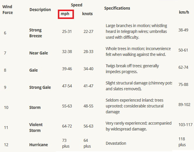
The Beaufort Scale
This can be used alongside the Shipping forecast , e.g. "Fastnet -Southerly violent storm force 11 expected later" and the Inshore waters forecast. We mention gales in our morning forecasts quite often in Autumn. These specifications relate to sustained winds but you can say "Storm force gusts"
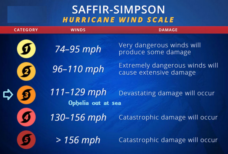
Saffir Simpson Scale
Usually used in the tropics, through the Caribbean and for the States, this looks at categories of cyclones in the Atlantic with 3,4,5 being major hurricanes.
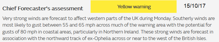
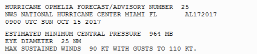
By the time hurricanes start to move north, they encounter cooler seas and the key warm core of a true hurricane can not survive. The cyclone can dissipate, not enough energy or it moves over land. It can become mixed up in other weather systems in the north Atlantic and just add a bit of extra oomph to a low pressure heading towards the UK or Iceland. Ophelia is a true hurricane which managed to survive the furthest east of any hurricane on record and then as it heads northwards it undergoes extratropical transition. It changes from a true hurricane (with a warm core, no real temperatures contrasts across the low, drawing its; energy from the warms seas and using latent heat from convection around the core to feed it) to a post-tropical hurricane. This transition to extra-tropical low includes losing the warm core, fronts beginning to form, movement changes from steering winds to being influenced by the temperatures contrasts. However, the remaining low can still be a powerful dangerous system. It doesn't just switch off and can still cause damage and disruption. An extra-tropical low can bring storm force winds and hurricane force gusts.
The Great Storm of 1987 was not a hurricane and didn't form out of a hurricane. It was a low pressure which underwent explosive cyclogenesis in the Atlantic and deepened so quickly and violently that it drew down cold, dry stratospheric air to the surface. Hurricane-force gusts did cause massive damage to SE England as a Sting Jet seared across.Major progress was made after 1987 in satellite imagery (key for these situations) and research which defined Sting Jets.
The naming Extra-tropical Low isn't great, as the 1987 one was still an extra-tropical low; a baraclinic or mid-latitude low, it is rather confusing.
Once a hurricane goes through ET Extra-tropical Transition, it can then re-invigorate as an extra-tropical low, if conditions are right.
The Met Office and Met Eireann project of naming storms relates to these mid-latitude extra-tropical lows Angus/Doris etc. Remnants of old hurricanes or post tropical hurricane/storms like Ophelia keep their tropical name.
Impact driven weather warnings Yellow, Amber, Red
Loading recent activity...