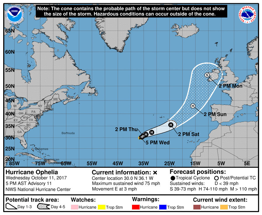
As expected, Ophelia strengthened into a hurricane Wednesday evening, some 850 miles to the southwest of the Azores. This makes it the 10th hurricane of the 2017 season. Conditions for strengthening ideal thanks to low wind shear and anomously warm sea temperatures, though only marginally warm enough for strengthening into a hurricane and there is some uncertainty how long it will maintain as a hurricane given its slow eastward movement. This is the first hurricane in this part of the east Atlantic since Vince in 2005. Later this weekend Ophelia is likely to go through an extratropical transition as it continues to move northeast over cooler waters further north, but will still maintain as deep Atlantic depression, as it then heads north/northeast towards Ireland early next week, bringing a threat of strong winds and heavy rains to Ireland and Scotland, but also some unusualy warm weather ahead of it across eastern England and much of mainland western Europe.
This blog will endeavour to update as often as possible on the forecast track of Ophelia over the coming days, with a kind of timeline to follow how the track has changed with subsequent runs, which will hopefully give a general idea of how well the models have peformed.
Also, there's a thread on the Netweather Forum here - where weather enthusiasts will be posting regular updates too.
Updates (newest at top)
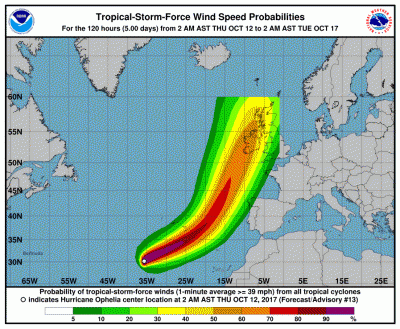
... National Hurricane Center latest wind speed probs and forecast track
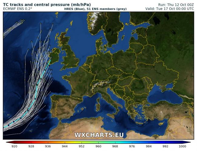
.... A look at the morning model runs: the 00z operational runs from UKMO and GFS keep Ophelia west of Ireland early next week, 06z operational run of GFS also keeps it west of Ireland. However, the 00z run of ECMWF makes landflal and takes Ophelia as a deep low across Ireland. Some date records for temperatures possibly broken across England on Monday as very warm is dragged up from Iberia. Positions of the lows from GFS, ECM and UKMO for 00z Tuesday 17th Oct:
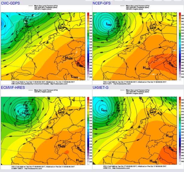
... Here's 00z ECMWF position for Monday 18z - deep over western Ireland but notice high temps over eastern England
... of the 00z EPS 51 members, many that get that far appear to take the low just west of Ireland, while the high res takes it over Ireland as above
.... as of 5PM advisory from National Hurricane Center, Ophelia now a hurricane, the 10th hurricane of the 2017 season, most consecutive hurricanes since 1893.
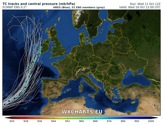
... 12z EPS 51 member spread and 12z ECMWF high resolution tracks for ex-Ophelia. A track favoured close to or just west of Ireland early next week. High res brings centre over western Ireland, as does other high res models on the 12z runs today.
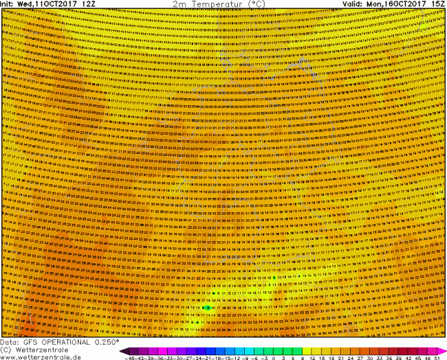
... some high temperatures next Monday across western Europe, as ex-Ophelia drags a long draw warm and humid southerly flow. Mid-twenties possible for eastern England, high twenties for SW France as per 12z GFS.
... potential for re-intensification once Ophelia becomes extratropical from Sunday?
...12z (11th Oct) model comparison between GFS, ECMWF and UKMet-global
.PNG?w=650)
Remember though, Ophelia will not be hurricane when it arrives near Ireland / SW Britain, it will be an extratropical storm.
Loading recent activity...