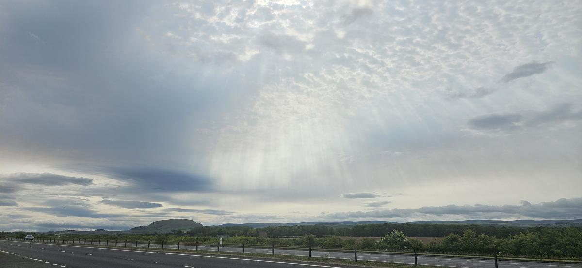
High pressure will become centred over the UK this week with a lot of settled, fair weather and lighter winds finally in the north. There will be large areas of cloud trapped under the high, so for some, it will feel cool and be bright at best. For others, there will be breaks in the cloud and sunshine so it will feel mild with little breeze. By night, temperatures will dip away under the clear spells and there will be rural grass frost. Also, fog patches will form in the steady setup.
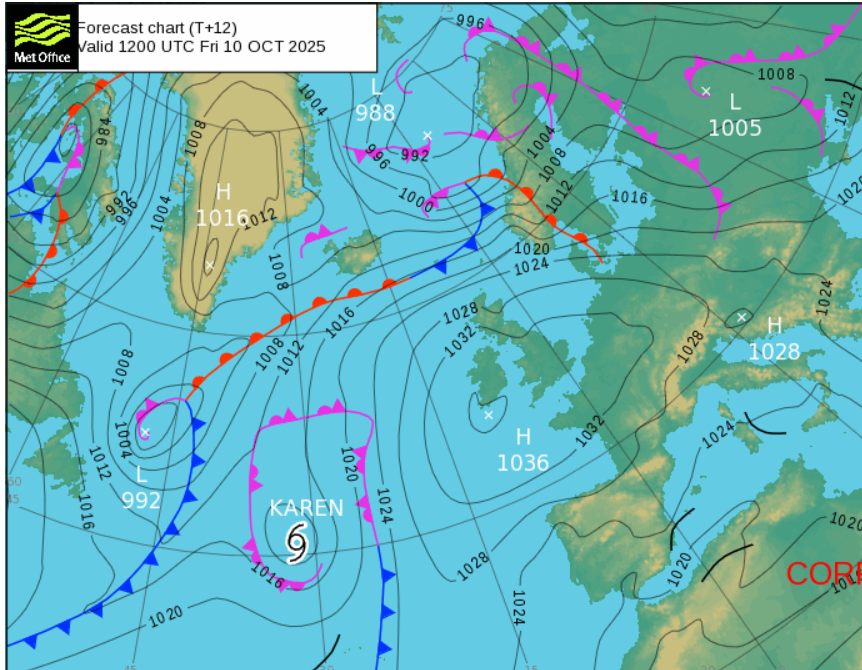
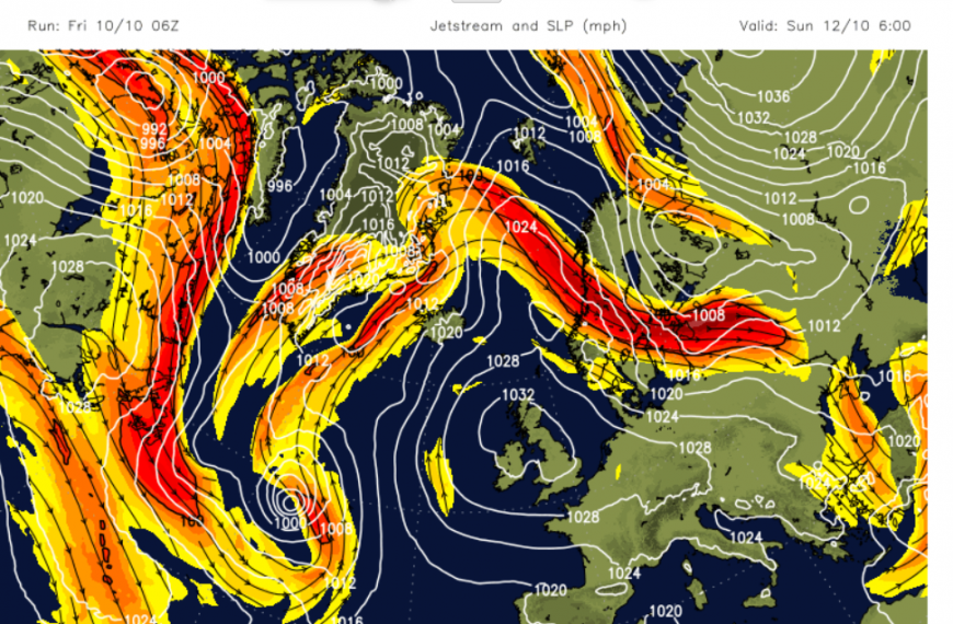
This is a sturdy high pressure, 1036hPa, over NW Europe with low pressures out over the northern Atlantic and a low pressure moving over Scandinavia and the Baltic States. The high pressure in the middle acts as a block and the setup of a significant high pressure with a low pressure on either side is known as an Omega block, after the Greek letter.
It is the pattern of the jetstream being forced north around the high pressure as the high blocks any incoming lows. Last Friday, the zonal jetstream was bringing Storm Amy right across the Atlantic and allowing it to develop explosively. This week, the jetstream is meandering in a great loop.
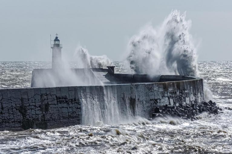
An autumn high like this can present difficulties when forecasting cloud cover. The weather is steady and generally dry but the difference between grey cloudy areas and sunny parts is great in terms of how the day will feel. Scotland has been very windy on Friday, especially in the far north further from the centre of the high and for eastern counties. The fresh westerly wind has moved over high ground and there have been high lee gusts but in brilliant sunshine.
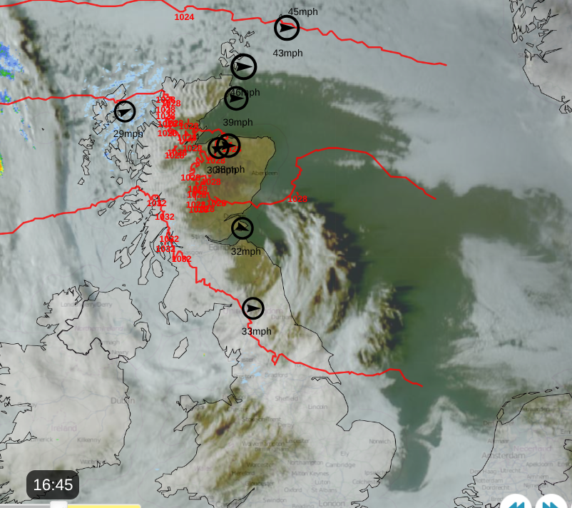
The afternoon satellite image is beautiful showing the clear skies for northeastern Britain and breaks over Wales into the West Midlands. The dark shadow of the cloud dragged out over the North Sea as the sun lowers in the west. There is another bump in the cloud away from northwest Scotland with the first signs of frontal rain. Over Caithness & Sutherland, there are the cloud ripples showing strong winds across the far north of mainland Scotland. The red lines show the pressure pattern with the high away ot the southwest and low pressure further north. With many isobars there are strong winds and showing on the Netweather Radar image are the top ten windspeeds at 4pm on Friday. The British Isles has managed to rip a large hole in the expanse of cloud cover over much of the northern Atlantic and northwestern Europe.
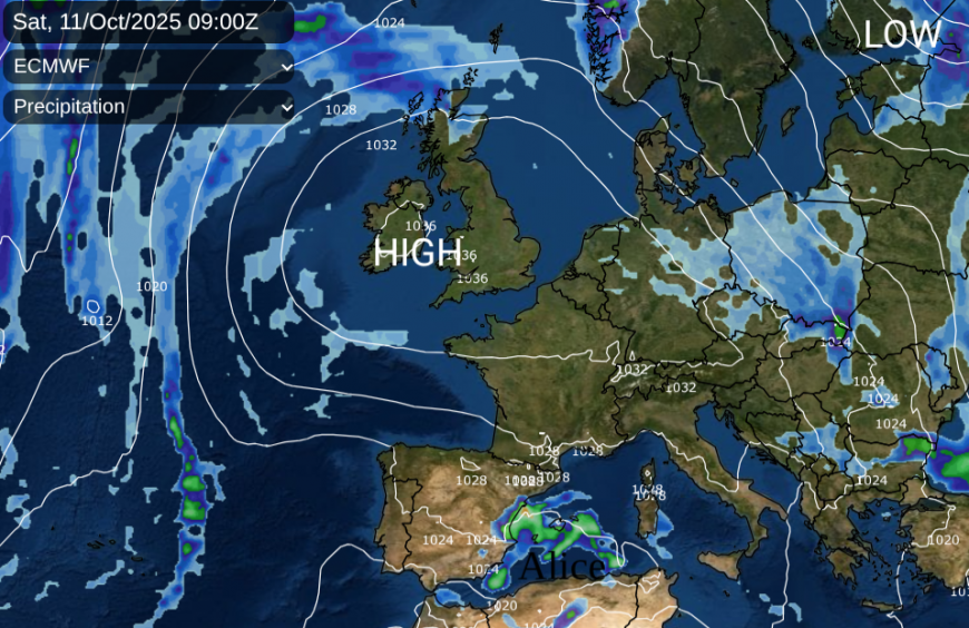
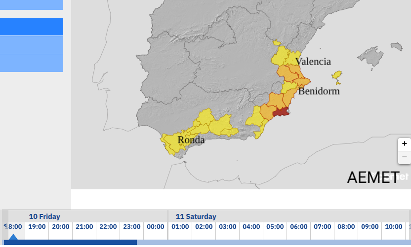
Often, when high pressure establishes itself over the UK, it is the Mediterranean which sees more disturbed weather. Spain and Portugal can see low pressures and heavy rain or Southern France and Italy. Spain is currently under red warnings for heavy rain and flooding. The southwestern storm naming group (we are in the western one) are now not only naming windstorms and snowstorms but DANA events. A DANA is an isolated/cut-off upper low which brings torrential and persistent rainfall due to its stationary nature. One is in progress over SW Spain today “Alice” or DANA Alice.
Another DANA was responsible for the devastating flooding in Valencia in October 2024, which killed at least 230 people. The weather over Spain and wider Iberia playing out the brutality of climate change patterns, with September 2025 being warm and very dry across Spain but then these epsiodes of torrential rain and flooding, in ex-Hurricane Gabrielle and now DANA Alice.
AEMET, the Spanish Met. Service start their Special Notice bulletin with
‘In recent days, a blocking high has developed over the British Isles, favouring the formation of Dana Alice, currently located in the southern peninsula. It is expected to remain stationary over the coming days as it fills, although other upper-level disturbances, forced to circumvent the high, will maintain instability in the Mediterranean region this weekend and early next week.’
When will the high give way?
More dry weather is not good news for water companies and customers still under drought or high water scarcity measures. Autumn should be a time of replenishment with sustained and regular rainfall. That is not happening in some parts of the UK, often the same parts that have seen a large deficit even since last year.
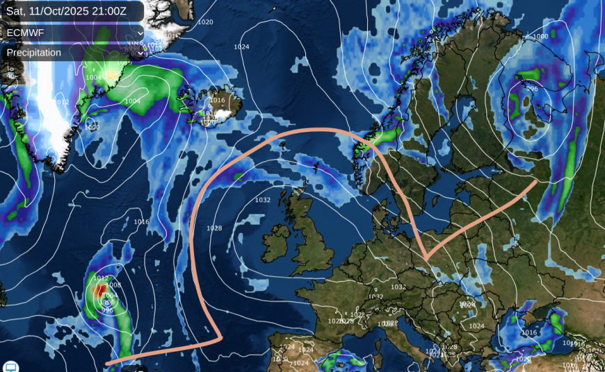
The high stays into next week. Out in the Atlantic, there is a subtropical storm, Karen. It has formed out of the tropics and will soon lose its tropical characteristics. As a post-tropical low it will be swallowed up by the larger low pressure which helps anchor the Omega block. The low swirls away to the south of Greenland into early next week. The ECMWF model shows signs of another tropical cyclone joining that low, whether that is Jerry or not. The eastern low slips eastwards towards Russia but the ECM has the high staying over the UK into next weekend. The GFS also keeps the high over us for all of next week, just elongating the high into France by next weekend with a possible cooler northerly flow following.
For now, we have a quiet weekend with the winds easing in the north. A mixture of cloudy skies and sunshine with warmth by day. However cool at night and colder under any clear spells. Most areas will be dry but there will be some patchy light rain and drizzle, from thicker cloud, more likely around coastal areas.
Loading recent activity...