The high pressure that brought much cloud is now shifting east. This change promises a dry and warmer Bank Holiday, but it also signals a transition to more unsettled weather from Tuesday onwards.
Unusually, there is a likelihood of the weather staying completely or predominantly dry through the August Bank Holiday weekend this year, and becoming warmer and sunnier for many as the long weekend goes on, after what has been a dry but predominantly cloudy week for most of us.
The reason will be a change in wind direction as the high pressure area that has dominated our weather for most of the past fortnight drifts eastwards. Last week’s cloud was associated with mainly northerly and north-easterly winds, which brought a lot of stratocumulus in off the North Sea. The cloud was more widespread than was generally expected - in those sort of setups we often see a west-east split with eastern areas seeing the cloud, especially counties bordering the North Sea, and sunshine in the west. But this time around, the cloud sheet often penetrated into western areas as well, resulting in a large majority of the British Isles being covered by a sheet of cloud.
Winds will increasingly become southerly as we head towards the Bank Holiday Monday, bringing progressively drier and clearer air in off continental western Europe. It will not become exceptionally hot but we could see temperatures widely into the high 20s Celsius on Monday, and maybe nudging 30C at a few spots.

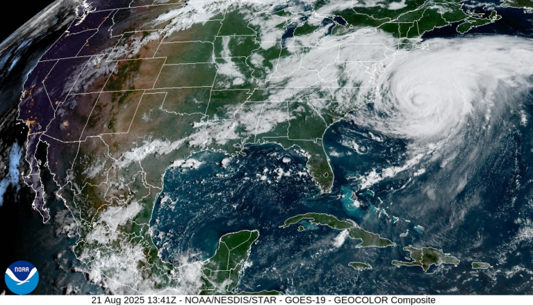
The perception that it often rains on the Bank Holiday is not completely unfounded when we’re talking about the late August Bank Holiday, mainly because towards late August the weather often turns more autumnal, we become more prone to seeing deep lows associated with remnants of tropical hurricanes, and the sun becomes lower in the sky and the darker nights draw in, resulting in high pressure being more likely to see plenty of cloud stick around, as per last week. But for most of us, this year will be an exception. It won’t be dry and sunny everywhere, though, as we can expect a band of rain to move through Ireland late on Monday, but for most of us it will be a dry and bright, and possibly sunny, day.
The shift in the positioning of the high pressure reflects an upcoming change to more unsettled conditions, as the high pressure will move away eastwards and allow low pressure systems to start pushing in from the west. Low pressure then looks set to dominate to the south of Iceland for the foreseeable future, bringing winds mainly from the south-western quarter of the compass. This means that it won’t be particularly cold, with temperatures set to be mostly near or above the long-term normal, with eastern Britain most likely to see above-average temperatures at times, although there will be no substantial heatwaves after Monday either for the foreseeable future.

There is also potential for thundery activity to be widespread from Tuesday onwards. Although it is a long way off, some runs from the GFS model have been showing potential for thunderstorms to be particularly widespread on Friday. In each of the last three years we saw widespread thundery activity at some point during the first half of September, so this year could well follow the trend of thunderstorms becoming quite widespread for a time late in the season. It will probably become less thundery after the coming week as we move into more of a standard changeable west to south-westerly type with a greater emphasis on bands of persistent frontal rain moving across the country with brighter showery weather in between.
Summer 2025 is still on course to be the warmest summer on record for the UK as a whole, despite some cooler and cloudy weather in recent days, following on from the record warm spring. For the Central England region, in the Central England Temperature (CET) series from 1659, there is a chance of its mean temperature dropping below that of 1976, but it looks likely to be either the warmest or second warmest summer.
However, the mean minimum temperature for the CET looks highly likely to be the warmest on record. 1976 was famously a very dry sunny summer for most of us, and that meant that the warmth of 1976 came mainly from high daytime maximum temperatures, with nights often being relatively cool due to clear skies and light winds. While 2025 will probably also come out drier and sunnier than average for much of the country, it hasn’t been anything like as dry or sunny as 1976. Sunshine wise it will probably also fall well short of the recent summers of 2018 and 2022, and also 2021 over much of northern and western Britain.
A recurring characteristic of this summer has been the lack of substantially cooler than average weather. I have often been thinking that during the past week’s weather, temperatures have been considerably higher than I would normally have expected in this type of setup with northerly winds and a lot of cloud off the North Sea, widely hovering around the 18-19C mark. Often in similar setups in the past we have seen temperatures widely struggling at around 15-16C at this time of year, and nearer 13C along North Sea coasts, particularly in eastern Scotland and north-east England. The likely culprit is unusually high sea surface temperatures around the British Isles following the consistently warm spring and summer. Although 18-19C by day is still below average for the time of year in most areas of the UK, especially the south, the cloudy weather has ensured that temperatures have usually been warmer than average by night.
Loading recent activity...