
Tuesday 14th June
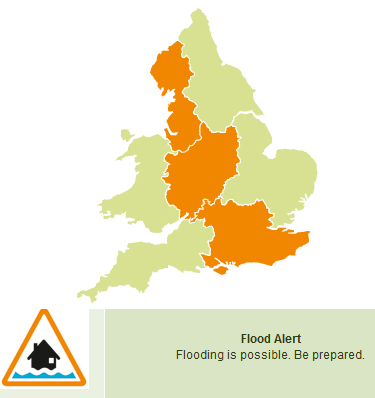
Flood alerts are beginning to appear on the Environment Agency website
Recent slow moving showers, which have stuck in bands NW/SE across the UK, have begun to cause issues. This threat continues over England and Wales through midweek, easing south and east by Friday. The Env Agency says "Where these showers occur there is the possibility of seeing some minor surface water flooding impacts such as disruption to travel from flooded roads and perhaps isolated property flooding."
The images below show forecast 24 hour rainfall totals for Wednesday. Actual shower locations will vary slightly but it gives an indication of which areas remain at risk of hefty downpours. The rain over northern Scotland is a frontal band, so more persistent but still totting up high totals as it just keeps on raining.
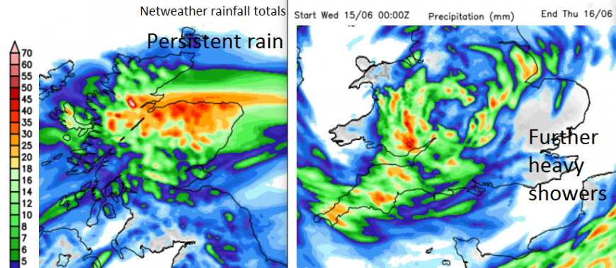
Northern Scotland also looks like having a wet midweek with rain already approaching eastern Scotland on Tuesday and then stagnanting near to the Moray Firth through Wednesday and part of Thursday. Keep an eye on the SEPA pages midweek.
Northern Ireland sees an improvement today as showers ease southwards, more hefty showers breaking out Weds pm and then damp weather from the north of Thursday,
Loading recent activity...


