A fairly deep low will affect northern and western areas in particular early next week, bringing a spell of rain Monday night and Tuesday morning across all parts then gales or severe gales across the north and west on Tuesday.
The low formed off the North Carolina coast of the eastern seaboard of the USA on Friday and has since been tracking east across the North Atlantic under a strong jet stream. The low is quite shallow and elongated along a frontal zone over the NW Atlantic early Sunday evening. However, the low will start to speed up in forward motion and deepen more over the next 24 hours as a sharpening shortwave trough coming out of eastern Canada engages the low and baroclinic zone that it lies along. The deepening low will also encounter increasing divergence aloft as it alternates between being under the left exit and right entrance regions of a strong jet stream running aloft.
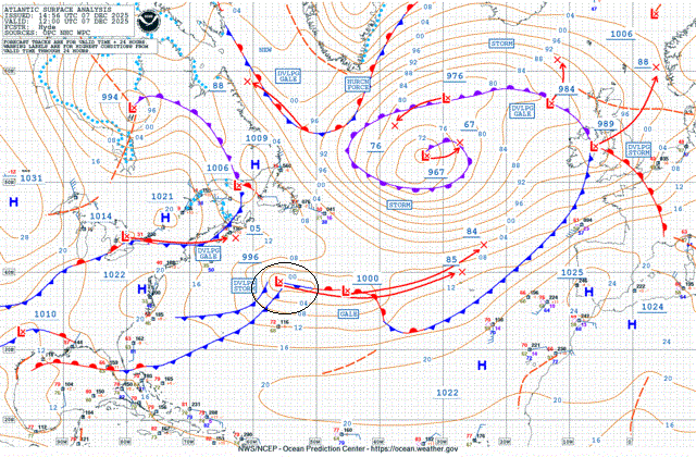
The low looks to pass just to the north of the Azores tonight, before then swinging northeast towards Ireland on Monday, then tracking north just west of Ireland on Tuesday where it will undergo most rapid deepening in the left exit of a strong jet streak moving north here.
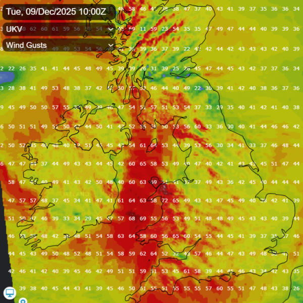
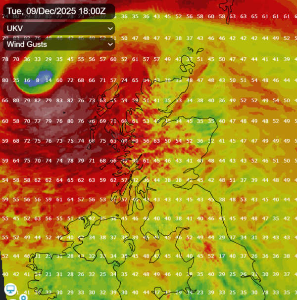
Very strong and gusty southerly winds with gales possible near coasts will develop from the south in the early hours of Tuesday across Ireland, N. Ireland, Irish Sea coasts of Wales then later across western Scotland. Gusts of 60-70mph possible near coasts and over hills in these areas. There are yellow wind warnings issued by the Met Office for SW England, Wales and western Scotland and by Met Eireann for southern Ireland.
There are also yellow warnings for rain for Monday, Tuesday and Wednesday for SW England, Wales and NW England. The Met Office warning states:
There will naturally be some variation in rainfall totals across the area, but accumulations of 20-40 mm are likely in quite a few places, with 60-80 mm over Dartmoor and high ground in Wales. There is a small chance of 80-100 mm falling over the most exposed, prone hills
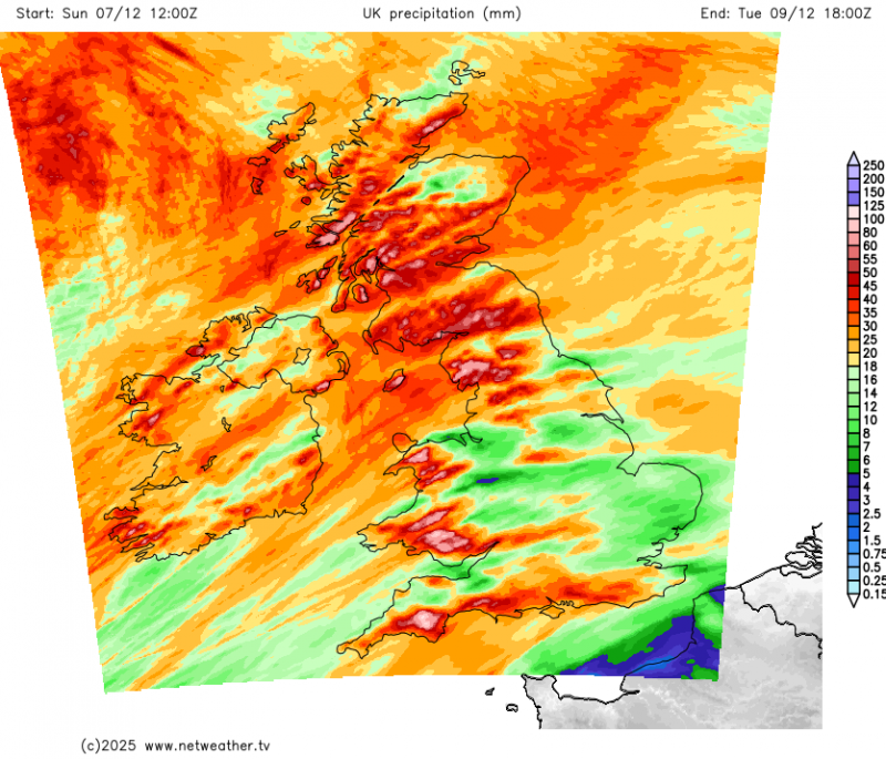
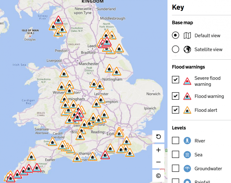
So for these areas there is an increasing risk of flooding as we head towards the middle of next week. There is already 12 flood warnings this evening across England, mostly across the north and west, also 66 flood alerts which are more widespread. In Wales there is one Flood Warning in Tenby, Pembrokeshire, while there are 16 Flood Alerts across the rest of Wales.
After a mostly dry day with sunny spells on Monday, with showers confined to the northwest, a spell of rain for a few hours at least will spread north across all areas from Monday night and through Tuesday morning, heaviest across the west, hence the warnings. Rain clearing northern Scotland in the afternoon, brighter but windy conditions with showers following.
Wednesday starts with some showers around, mostly in the west, but a temporary build of pressure will bringing a dry afternoon, night and Thursday, before wind and rain arrives off the Atlantic across the west in the evening, before clearing northeast across the north overnight. Another spell of rain spreading northeast across England and Wales on Friday. Mild or very mild throughout the week in the southwesterly flow. Continuing unsettled, often windy, but mild next weekend too.
Loading recent activity...