
High pressure will generally control the weather for the rest of the week, initially from the east of the UK but increasingly from the west later this week and through the weekend. This will mean the UK weather will often be dry but who sees sunshine and who sees cloudy skies will vary day-to-day, thanks to subtle differences in flow around the UK and also some weak fronts. So it will be a case of chasing the breaks in the cloud this week to see any sunshine.
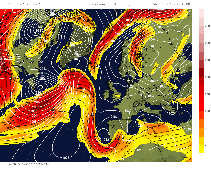
The jet stream comes out of eastern Canada and across the Atlantic, as is usually the case. But over the next few days before it arrives across the UK, it splits, with a northern arm of the jet stream flowing NE toward the Barents Sea north of NW Russia - and a southern arm dives south to Morocco, before flowing east along the southern Mediterranean/North Africa. A blocking high over NE Europe and NW Russia is causing this split in the jet and has also fed in a cold, cloudy and damp easterly flow over recent days across the UK.
Jet stream and mean sea-level pressure for 12z today - shows high to the east and splitting jet to the west of the UK:
However, we will see subtle changes in the flow today, as the high to the east retreats, with more of a SEly flow in the south, which will bring brighter and milder conditions over the near continent to southern areas eventually along with western areas, though we will keep the onshore flow from the North Sea further north, bringing cloudier skies and some showers across northern and eastern areas. After perhaps a murky start, Wednesday promises more in the way of sunny spells with light winds as high pressure now builds in from the SW across the UK. But, again, eastern areas will see an onshore flow off the North Sea, which will bring cloudier skies. So best of the sunshine in more western areas.
High pressure slips south a little on Thursday, which will allow Atlantic weather fronts to move in from the west across Scotland and N. Ireland by the evening. Drier and brighter with some sunny spells further south, hopefully with more in the way of sunshine for eastern areas as we lose the onshore flow off the North Sea.
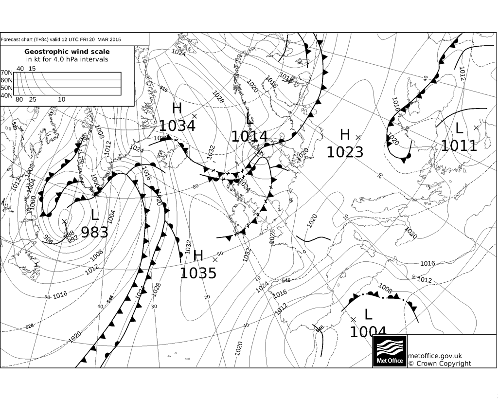
The cold front introducing cloud and rain to Scotland Thursday evening will slip southeastwards across the UK on Friday morning (see fax chart above), weakening as it does so, but bringing an area of cloud and light rain. Depending on the timing of passage of the front, some places may miss out on seeing the partial Eclipse on Friday morning, for now, it looks most likely that central areas of the UK (northern England, Wales, Midlands and parts of eastern England) may stay cloudy - with some sunny spells across the far south of England and also coming in across Scotland. But this may change. We will also have a 'Supermoon' Thursday night (new not full) where the moon and earth are closest to each other as they can be. Moon not visible, but having a larger than normal effect on the world's oceans. Hence the March Equinox.
A noticeably cold northerly wind will develop Friday and into Saturday following the passage south and southeast of the cold front. On Saturday, high pressure looks to build again across the west, so a cold northerly wind across eastern areas, bringing cloudier skies and some light showers towards eastern coasts, western areas staying dry with the best chance of sunshine.
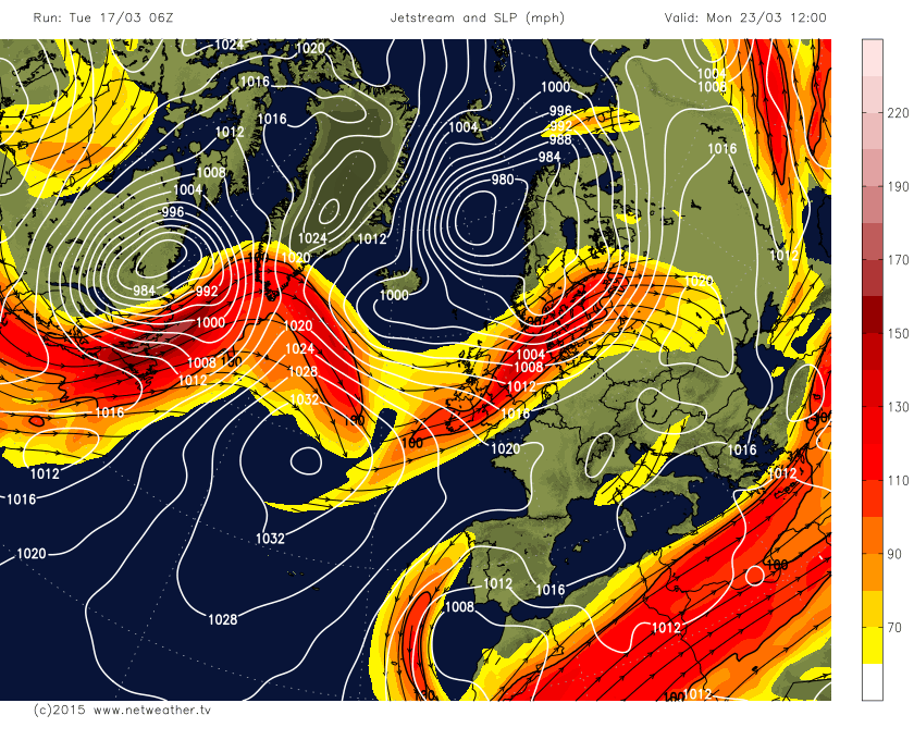
Later in the weekend, we start to see the jet stream begin to re-configure, with that split early this week having moved much further east into Europe by then, with a strong Atlantic jet pushing further south into the UK as we head into early next week (see chart below).
This means the weather will turn more mobile and unsettled, with a westerly or northwesterly flow beneath low pressure systems passing east close to north, bringing sunshine and showers as we head through next week. Though it will be milder and high pressure will never be too far away from the southwest, so it may turn out to be drier in the south than some models currently indicate.
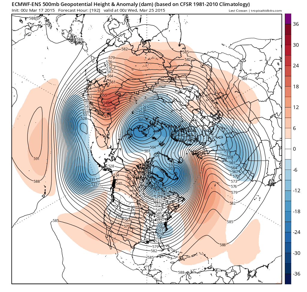
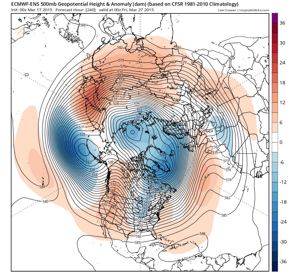
ECMWF ensemble mean for day 8 (below) shows high pressure perhaps returning to the south mid-next week though by day 10 (at the bottom) it's looking a lot more mobile again as the high slips south again (images courtesy of tropicaltidbits.com):
Day 8 - Weds Mar 25
Day 10 - Fri Mar 27th:
Loading recent activity...