Following a historically cold February across parts of the Midwest and northeast of the USA and bitterly cold start to March in these same areas, a change in the weather pattern is looking likely next week, which should see these areas warm up:
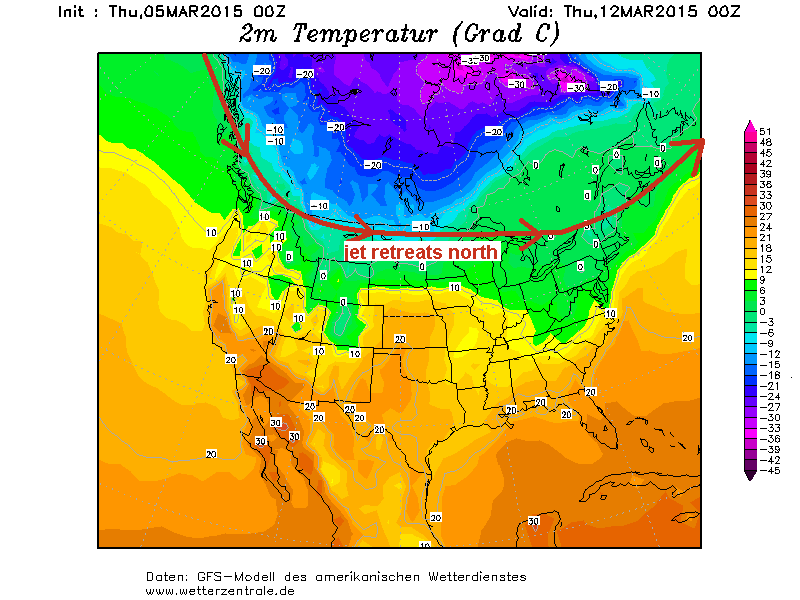
Currently:
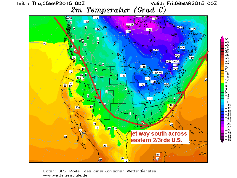
This time next week, cold is retreating into Canada, as the jet shifts north and flattens too, letting milder air in from the south and west:
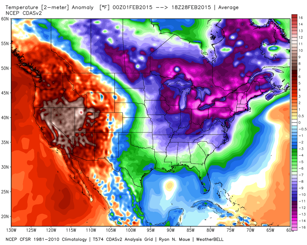
The brutal cold which has gripped central and eastern parts of the USA since late January saw many locations in the mid-west and northeast set new records for February. For example, a new record coldest month was set in Bangor, Maine which saw an average temperature for the month of just 6.1F (-14.3C). Buffalo in New York State saw the all time coldest month with an average temperature of just 10.9F (-11.7C). The average February temperature in Cleveland, Ohio was 14.3F (-9.3C), making the second coldest month ever here. Generally, dozens of cities east of the Mississippi river had their coldest February in decades. Not only were the very low temperatures notable, but also the February snow records, Boston set a new record, the February total reaching 64.8 inches of snow beating the old record of 41.6 inches by a long shot.
But on the other side of the States, it was a different story, with a persistent area of high pressure over the eastern Pacific and western North America pushing temperatures well above average. Portland in Maine saw its coldest February on record, but in Portland Oregon on the other side of the country saw its warmest on record, as did San Francisco, Seattle, Reno (Nevada) and Las Vegas (Nevada). We also continue to see California gripped by severe drought, with the snowpack, which brings much of the state’s water, at only 19% of the average for early March. Alaska has seen one of its warmest winters on record too.
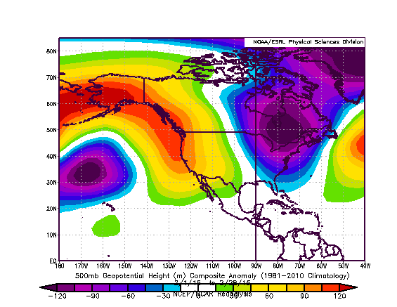
The persistent ridge of high pressure across the west caused very cold direct from the arctic to lock in across the eastern two thirds of the USA for much of February and still now in the first two weeks of March. The cold corresponding with persistently deep upper troughing over eastern N America, driving the cold air south and also spawning snow storms to move northeast or east.
500mb heights for February 2015 shows the persistent ridge in the west and trough in the east:
There is a study that provides some ‘evidence’ that points to a wavy jet stream bringing prolonged cold to the east and warm temperatures/drought to the west – which may be linked to a warming arctic:
http://phys.org/news/2015-02-evidence-link-wavy-jet-stream.html
It’s still bitterly cold across much of the eastern two-thirds of the USA away from the Deep South, with a new snowstorm impacting a swathe from northeastern Texas across the Ohio Valley and on to the Mid-Altantic States and parts of eastern New England. Parts of Kentucky have already seen up to 15 inches of snow and anywhere east of Kentucky through West Virginia, Virgina, Washington D.C. Maryland, Delaware, New Jersey, Philadelphia to New York City could see 6-10 inches or perhaps more locally.
But, it looks like the cold winter pattern across central and eastern USA will break next week, as we see the wavy jet stream de-amplify and flatten out, which will allow mild Pacific air to infiltrate east across the states, with the brutal cold retreating north into Canada. So it should start to feel more comfortable outdoors for those in the eastern two-thirds of the States. Temperatures are expected to recover to highs of around 50s and 60s degrees F next week across the Plains, lower Mid-west and Mid-Atlantic States, while highs reach 40-50F for the upper Mid-west/Great Lakes through to New England. Though this warm-up will lead to flooding as the deep snow pack melts and ice break ups in the rivers causes jams.
Loading recent activity...