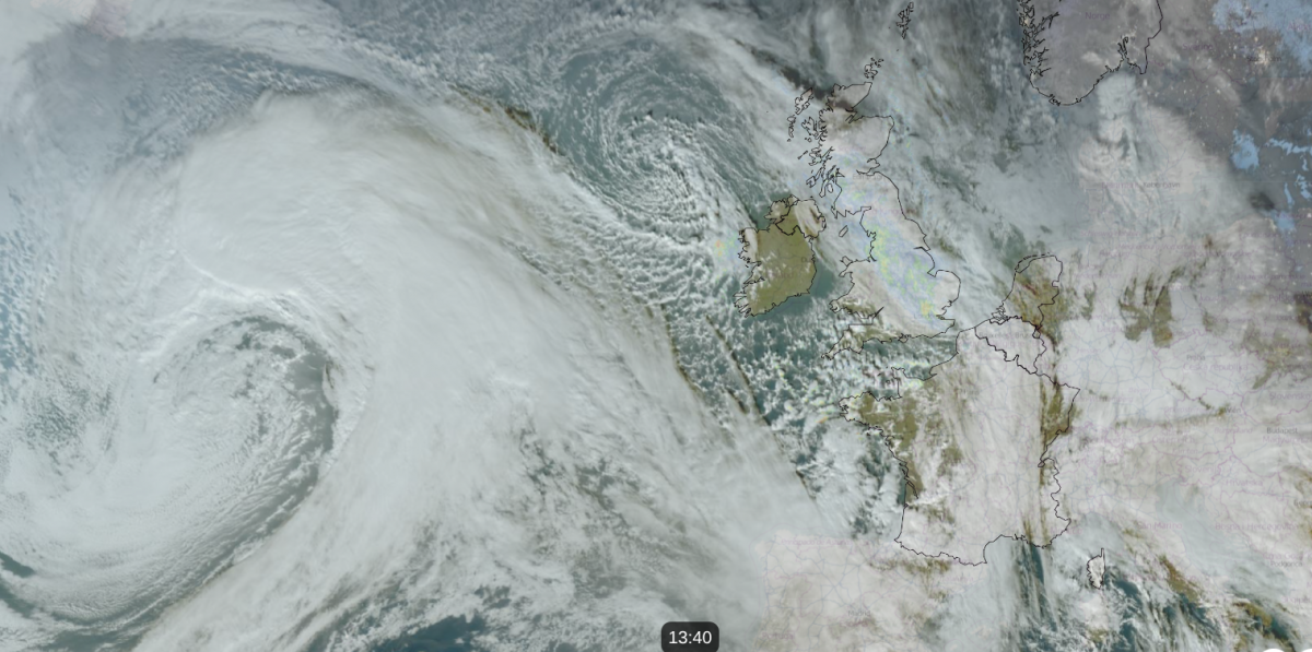
Friday will start off chilly but fine for much of the UK. Where there have been clear skies overnight, allowing a view of the Supermoon, temperatures will be well down into single figures with widespread frost. There will also be areas of fog in southeast England, which might affect travel around the M25 and into London first thing, with a low risk of fog for central southern England, even up to Buckinghamshire. Friday starts with hardly any breeze for Britain, but that will change as a large low pressure heads our way from the Atlantic.
NE Britain will have seen more cloud and outbreaks of rain overnight, and a small low centre will continue to throw showers over eastern Scotland on Friday morning before they drift north to the Northern Isles. The Cairngorms can expect a bit more snow. Cumbria and the Western Isles should also expect some early showers but the main change sets in mid-morning for Cornwall, Devon and Pembrokeshire.
A southerly breeze will pick up, stirring any lingering fog in the southeast. Cornwall, western Wales, around the Bristol Channel and the Irish Sea will have a freshening southerly wind by mid-morning.
Rain will set in for Cornwall, then Devon, spilling showery outbreaks over SW Wales and Northern Ireland by midday. Cloud will increase ahead of the frontal rain, although much of Britain will still be fine, even sunny at lunchtime, away from the southwest. Although Friday morning will feel cold, with the sunshine and light winds, it won’t be too chilly.
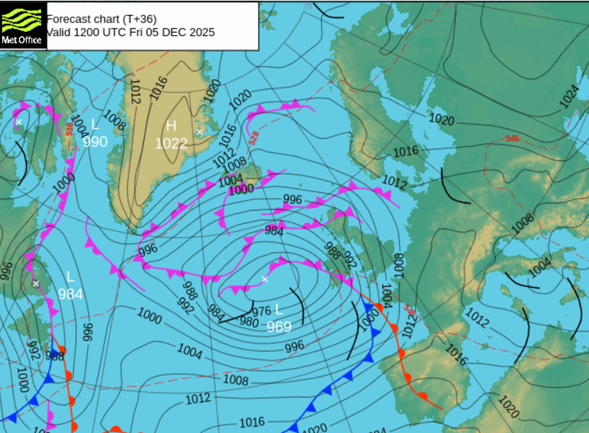
This active frontal band will bring a band of cloud and rain with strong winds, even gales.

The Inshore Waters forecast mentions gales and severe gales for the Irish Sea, with very rough seas around the Bristol Channel region. Local coastal flooding is possible in the spring tides for Friday into Saturday for the south coast of England and of Wales. There will also be large waves along the west coast of Scotland early on Friday and to Cornwall through the day and especially on Saturday.
The frontal band will slowly creep northeastwards over the UK on Friday. Behind it will be a scattering of showers with the risk of thunderstorms over SW Britain and along the English Channel later in the day and perhaps some hail.
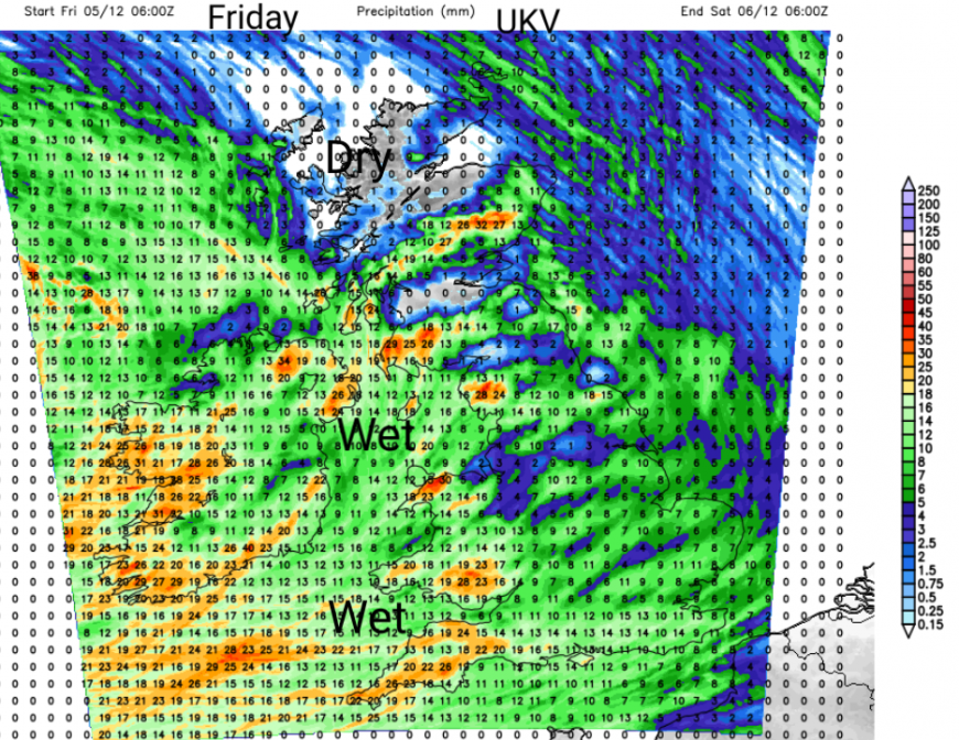
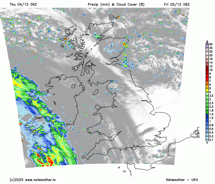
24 hour forecast rainfall totals from the UKV model, Friday and Friday night
Northern Ireland will see a fair start, but with cloud cover soon increasing. There will be rain from the south by midday as the S/SE winds freshen. Temperatures inland should reach 8C before the rain sets in. The afternoon will be wet and windy with some heavier bursts before the rain begins to clear eastwards on Friday evening. Friday night will be better but with a scattering of hefty showers. It will be mild in a moderate southerly wind.
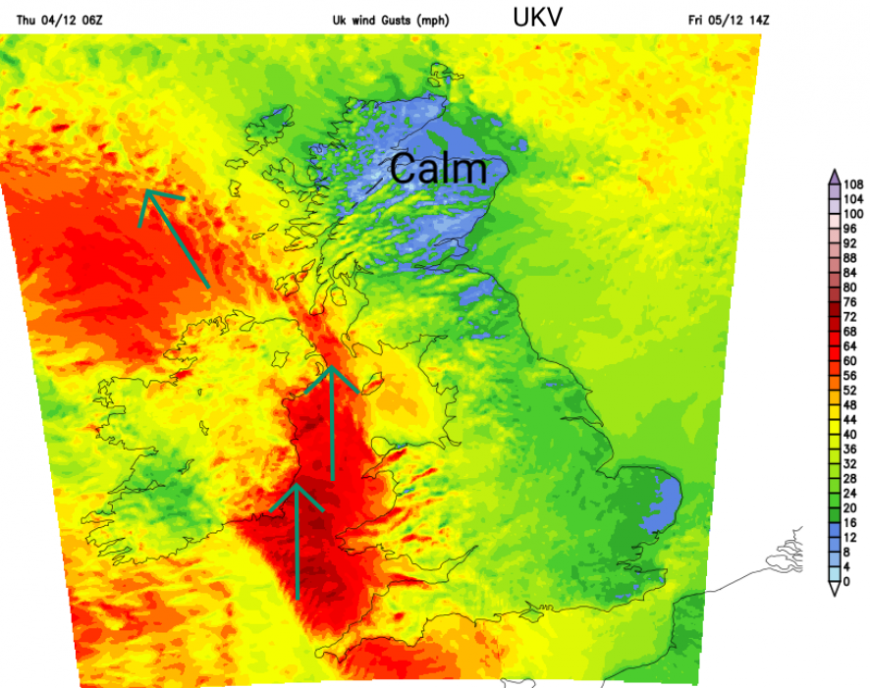
Wind gusts for early afternoon
Wales will have a fair start, but the wind will strengthen along the west coast before rain arrives from the southwest at lunchtime. The rain will be patchy at times over the high ground with a fresh S/SE wind and lee gusts. Expect a very windy afternoon, especially in the west and north of Wales with tricky driving conditions in any heavier rain. Temperatures will be around 6 to 9C.
The wind will pick up slowly on Friday for Scotland, but by the evening, there will be a strong SE wind for the west coast and coast of Dumfries. Although there will be a few scattered showers about during the day, it will be the frontal rain from Ireland that changes things. This should reach SW Scotland late afternoon and will set in for Friday evening. The UKV model has some strong orographic effects with wet weather over the Southern Uplands and the Trossachs, but little for the Central Belt on Friday evening. The rain could reach Aberdeen by midnight, so slow progress with a windy night, making it feel cold.
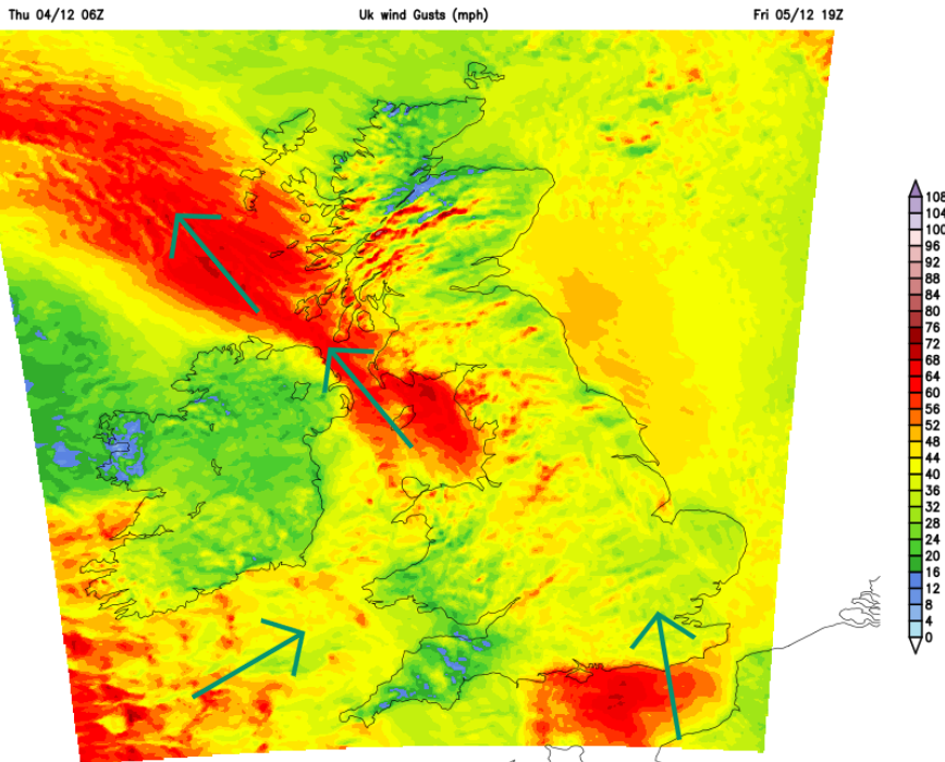
Wind gusts for early evening
Across England, the southwest will have a very wet and windy lunchtime. The rain and wind will spill over Merseyside, Manchester and the rest of the West Country through the afternoon and early evening. The day will end on a different note than how it began. Commuters beware. Through Friday evening, the rain band will edge over the Pennines, the Midlands to the Home Counties and London with freshening southerly winds. Milder air will arrive in the southwest as the frontal band clears and the wind veers to the southwest.
However, there will be cold air in-situ over northern Britain as this frontal band moves in for Friday evening. As well as some issues on the roads with surface water in the heavy downpours, there could be wintry precipitation over higher levels routes, perhaps for the Pennines, the Southern Uplands even into central northern Scotland. This would bring a short-lived risk of ice before the mild air takes hold.
Saturday looks showery but not as windy. Weekend outlook
Loading recent activity...