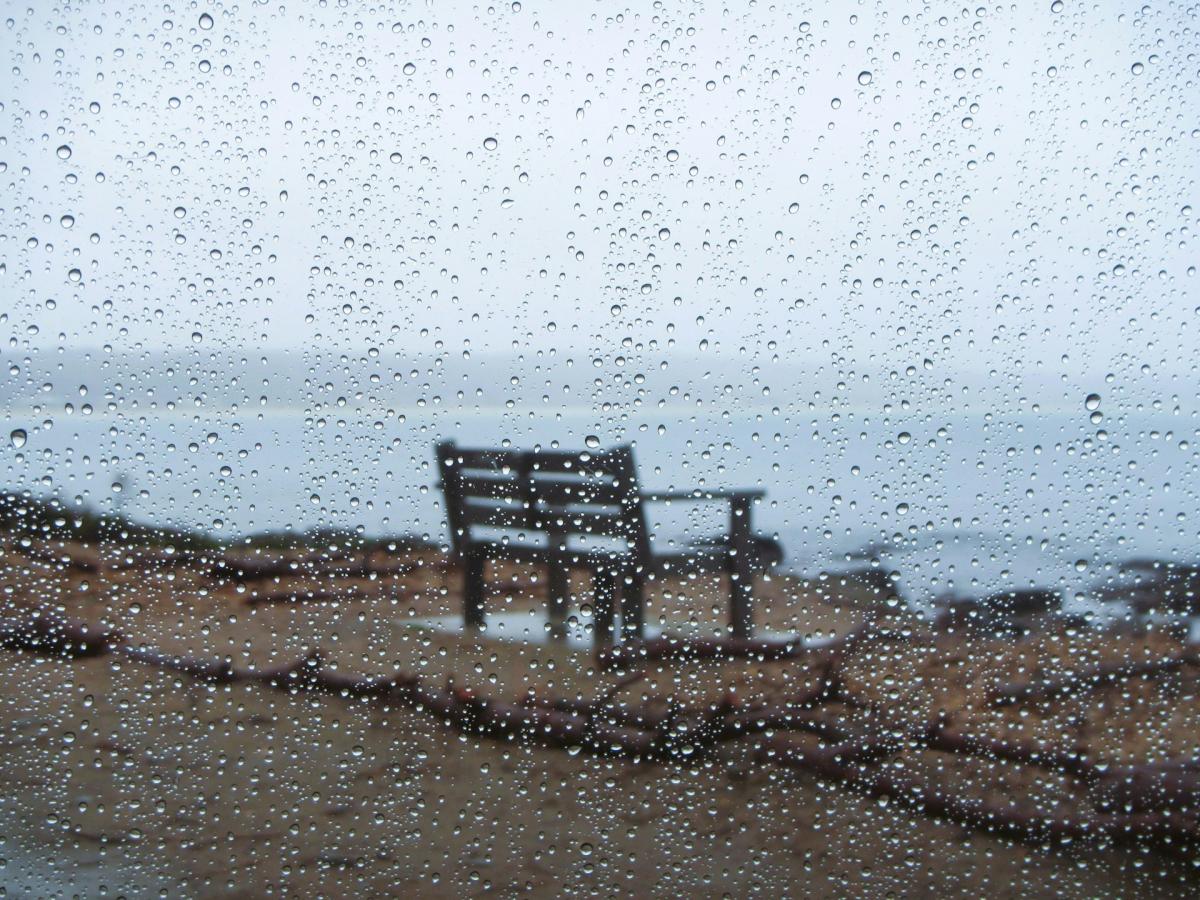
Weather systems moving in off the Atlantic are now slowing down, with a set of fronts set to meander across much of Scotland, Northern Ireland and the north and west of England through the remainder of today, before moving a little further eastwards overnight. Meanwhile, higher pressure on the nearby continent, although moving away, is keeping the east and south drier and brighter. So Sunday afternoon sees the driest weather here, giving a few sunny intervals over East Anglia and the South East with just the odd shower across the Midlands. But further north and west it's a totally different story, with bouts of rain heavy and persistent in places.
There are currently yellow and amber Met Office alerts warning of continuous and at times heavy rain across North West England, the west of Scotland and West Wales. Cumbria in particular, as well as Dumfries and Strathclyde, could see 150 to 200mm of rain falling, with flood warnings in force across many of these areas, so expect some disruption here. A yellow warning also covers Northern Ireland where 20 to 30mm is expected widely, with over 50mm on higher ground.
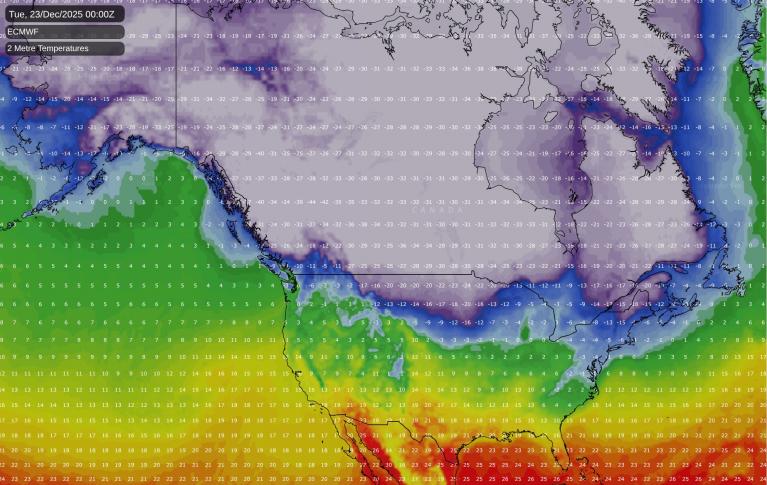
The rain will be accompanied at first by a strong southerly wind that will give gusts in excess of 50mph, but it'll be very mild. Overnight however, drier, somewhat colder weather with more broken skies towards Highland should have spread to much of Scotland and Northern Ireland by morning. Across the east and south it continues mainly dry after dark with skies breaking in places. But much of Wales will turn wet, with North East England and the North and West Midlands probably also seeing a few showers before morning. Lowest temperatures across the board 6 to 10C.
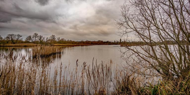
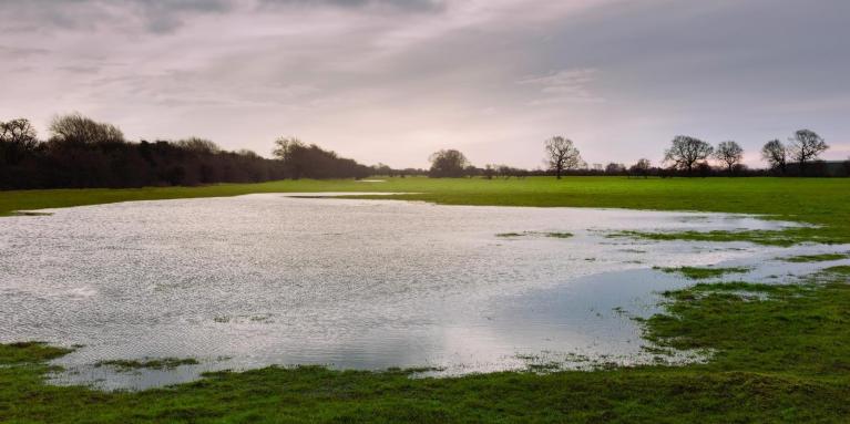
By tomorrow our front will be lying across central parts bringing outbreaks of rain, some still heavy, mainly over North East England, much of the Midlands, Wales and the South West. The Met Office has issued an amber warning for south and south-west Wales, where 50 to 80mm is expected quite widely with close to 100mm possible in places. Yellow warnings cover Cornwall, Devon and Plymouth, where 20 to 40mm could fall with up to 60mm in places, and parts of North East England and North Yorkshire, where 20 to 30mm is likely with 40 to 50mm in a few spots. Given saturated ground from recent wet weather, the risk of flooding and disruption is higher than the totals alone might suggest.
Further east and south the drier weather will just about be hanging on, although with more cloud than of late. On the other side of the front, across Scotland, Northern Ireland and probably Cumbria, it'll be brighter with sunny intervals and largely dry. But towards Highland, the northern and western Isles and across Northern Ireland, expect some showers that may become more frequent later.
Winds generally will be lighter, although a south or south-westerly could still be quite fresh towards the south-east and across the far north-west later. It will also be a little less mild for most, although temperatures between 7 and 11C will still be somewhat above what we would normally expect in mid-December.
Although perhaps still dry to the south and east of the capital for a time, much of East Anglia and the South East will probably be seeing some rain or showers by now, but it shouldn't be as heavy as the front begins to weaken a little. There may also be further rain from say Hull to Bristol eastwards for a while, before more broken skies probably begin to move in from the west. The yellow warning for North East England and North Yorkshire remains in force until the early hours of Tuesday.
Elsewhere, across a swathe of the country, you can expect a dry evening and night with clear spells in light breezes. But over Northern Ireland, mainly Derry, Tyrone and Fermanagh, you may see a few showers. These will probably be more frequent over the north and west of Scotland where a south to south-westerly wind will be more noticeable.
Where you keep largely clear skies in light winds, it could turn cold enough for a touch of frost towards dawn, with temperatures perhaps falling close to freezing in the coldest spots. But for most, somewhere between 3 and 8C should be nearer the mark.
Although briefly somewhat finer towards mid-week, the mild and at times wet weather returns, particularly to the north and west. It remains unsettled into next weekend, but in the run-up to Christmas there are definite signs of it turning colder.
Loading recent activity...