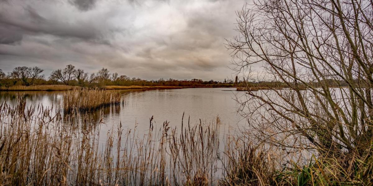
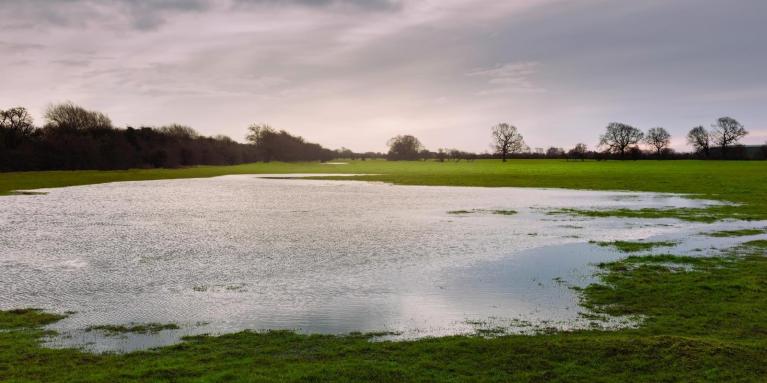
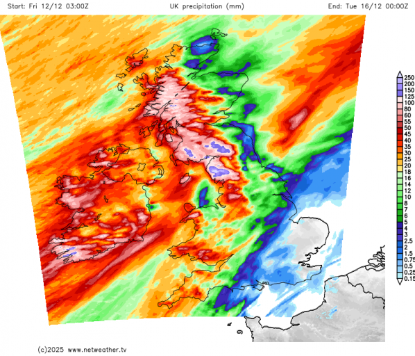
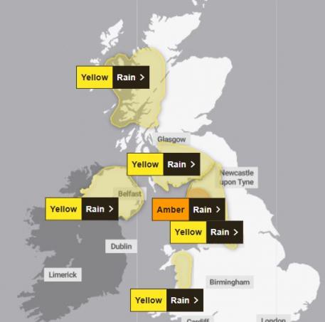
Low pressure has been in charge since the beginning of the month, bringing well more than a month’s rainfall during the first third of the month already across the west and some windy conditions at times too, with Storm Bram on Tuesday. The next few days will see some very wet weather across the west and northwest of Britain, with an amber rain warning in force over parts of Cumbria for Sunday and Monday and yellow rain warnings in force across the west for the weekend and Monday
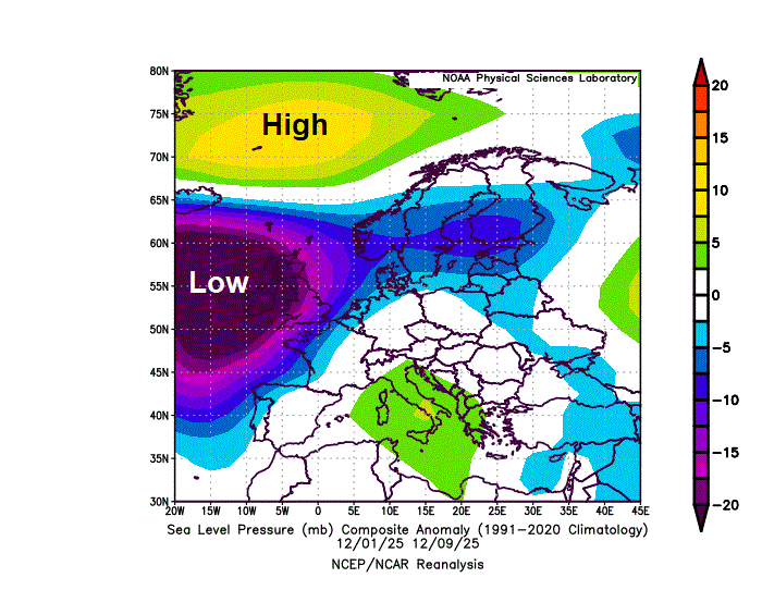
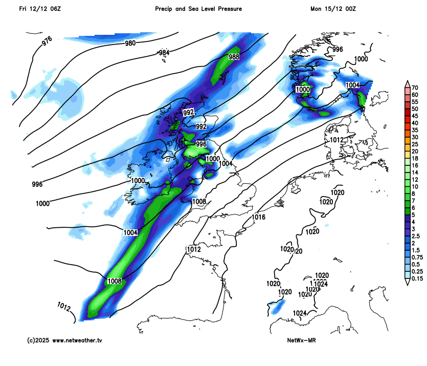
Low pressure has been dominant since the start of the month, 01-09 Dec MSLP anomaly below:
However, there are tentative signs from the weather models that the weather may settle down and turn drier across all areas in time for Christmas, with an increasing signal for high pressure to build over northern Europe, deflecting the lows away to the west and south. It may turn colder than of late too, with overnight frosts, though how cold is too early to say.
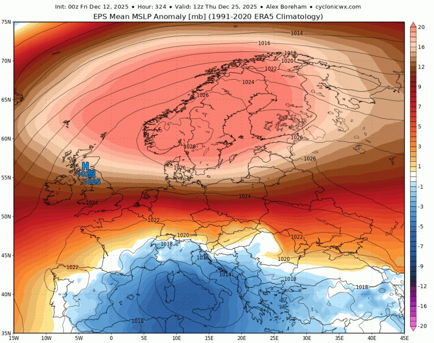
00z EPS (ECMWF ensemble) mean shows a strong high pressure anomaly over Scandinavia and northern UK for Christmas Day, so chance for more settled and cooler weather by then?
Areas of low pressure will continue to move into the northwest bringing further wind and rain to the north and west through the weekend, though southern and eastern England are looking mostly dry, as high pressure builds here. Rainfall totals are really going to add up across parts of the west and northwest by the end of Monday, with Met Office amber rain warning in force for parts of Cumbria, for 100mm widely in the warning area and over 200mm in the west of the area. Yellow rain warnings are also in foce for North Wales, NW England, N. Ireland and two areas of western Scotland.
The wetter and windier conditions in the northwest will spread further southeast early next week, as high pressure towards the southeast relaxes to allow frontal systems to move further east, so rain can be expected at times across all parts through next week.
A band of rain looks to erratically clear east early next week, not clearing SE England until Tuesday morning, drier and brighter conditions following, but with showers in the northwest. Another frontal system looks to roll in off the Atlantic for Wednesday cross most areas, clearing SE England Wednesday night. Further rain may push back in across the south on Thursday, though uncertainty on this, otherwise a bright and blustery westerly or southwestely flow looks most likely for the rest of the week, with showers in the west.
However, the last few runs of the ECMWF and GFS diverge quite starkly on what happens from later next week.
ECMWF and its ensemble mean indicate trough disruption takes place over the NE Atlantic, as the upper flow quickly amplifies upstream over the North Atlantic. This means the upper trough over the far NE Atlantic will disrupt to form a cut-off upper low over southern Europe, while heights rise to the north to allow high pressure to build to the north of the UK before eventually extending east over Scandinavia into the Christmas week. The UK and Ireland would become drier and more settled as a result, also becoming colder too, as a continental flow develops from the east. Too far out to have confidence on how cold, but the potential for overnight frost certainly increasing.
However, the GFS has been taking its own different route of a strong jet stream being aimed at the NE Atlantic / NW Europe, continuing low pressure domination and the unsettled and perhaps even stormy conditions during Christmas week.
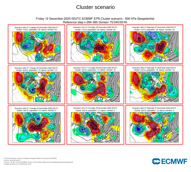
ECWMF ensemble clusters analysis tends to be the best guide when the models fail to agree in their extended ranges. For the period Tuesday 23rd December to Thursday 25th December – all three clusters of ensembles feature a blocking regime, however the clusters vary over how far north the high pressure centres, which will determine how cold it might be for the UK, the further north the cold it would be with an easterly flow off the near continent. But taking a mean of the ensembles suggests high pressure in control appears the strongest contender for dominating the weather on Christmas Day over low pressure in control, like GFS.
However, Christmas is still to far off in forecasting to have any high confidence, so GFS scenario of more unsettled and milder Christmas can’t be ruled out for now. But the balance of probability is currently swaying towards more settled weather in time for Christmas, but how cold and whether it will be white for some is too early to say.
Loading recent activity...