It has been a very sunny April to date, with large areas of England and Wales already reaching their average total sunshine for the month. It has also been very dry. Despite a change to unsettled conditions in the last few days, some central areas are yet to see any rain. However, these places will eventually see some wet weather either today (Tuesday) or tomorrow, as a large, complex area of low pressure drifts slowly northward across the country.
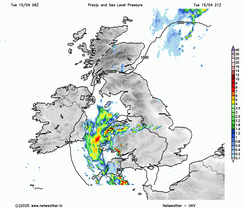
A stationary trough that brought wet weather yesterday across East Scotland and the West continues to bring locally heavy bursts of rain this afternoon to Wales and the South West, with further showers in East Scotland. Further west and over Northern Ireland, you will see some sunshine. Meanwhile, another area of rain across eastern England, ending the dry spell here, will soon clear into the North Sea. This will leave an afternoon of sunny spells and a few locally sharp showers, although not everywhere will see one.
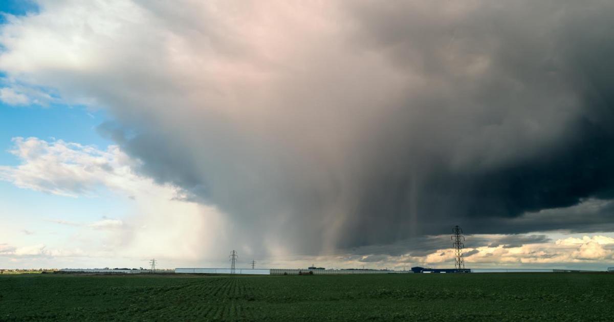
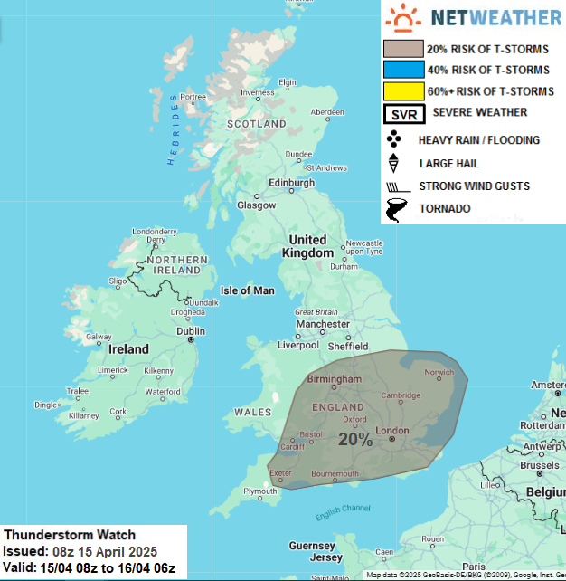
A convective forecast has been issued for today, as there is a risk of thunderstorms.
Temperatures will be close to normal but could reach 19C or 20C across parts of East Anglia and the South East in the best of the sunshine this afternoon. It will be cooler in the west, with mostly light winds.
Another pulse of rain moves up from the south this evening, clearing from central and southern parts into the early hours of Wednesday. A fresh south-west wind may develop towards dawn in these areas. Elsewhere, it remains unsettled and showery, with bursts of rain perhaps moving into western Scotland and parts of Northern Ireland later, where a northerly wind will feel chilly. Despite this, it is not expected to be a cold night, with lowest temperatures mostly between 6C and 9C. However, it could drop as low as 3C or 4C across sheltered parts of the Highlands, where a touch of grass frost is possible.
As a depression continues to track slowly northward on Wednesday, the wettest weather will be over Northern Ireland, much of Scotland, and the North West. Across remaining areas, it will be brighter with sunny intervals, but there will also be scattered showers, most frequent the further north and west you are. A fresh south-west or southerly wind will decrease towards the evening. It will feel fresher across the east and south, with top temperatures mostly in the range of 14C to 16C, but only 9C to 12C in the rain across the north and west.
Showers should eventually clear from Northern Ireland overnight, but it will remain wet over Scotland. For England and Wales, there will be broken skies into the evening and a few clear intervals after dark, with much lighter breezes. While the emphasis should be on dry weather, you could still catch a shower, mainly towards the south coast and across the far South West. Lowest temperatures are expected to be between 4C and 7C.
Thursday sees the weather improving over Scotland, with a day of sunny spells and just a few showers, mainly in the North and West. Although conditions will remain somewhat unsettled into the Easter break, there are some signs that the eastern half of the country may see a finer, warmer interval on Good Friday. This could be followed by a chillier east or north-easterly breeze developing over the extended Easter weekend, when most of the showers should be confined to the south.
Loading recent activity...