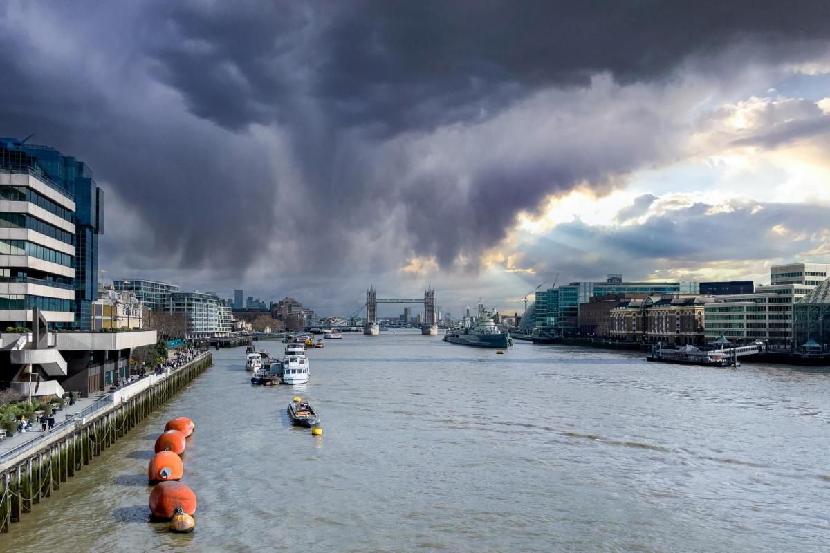
A complex depression to the South has brought some welcome rain this weekend, but it's been hit and miss. Saturday brought local torrential downpours and thunderstorms to parts of the Midlands, Yorkshire, and North East England. However, other areas, mainly across Wales and the South, remained dry or saw nothing more than a light shower.
Sunday began with a lot of grey, misty weather, especially in central and eastern areas. But any showers still remaining over Scotland and Northern Ireland should fade later this afternoon, as a ridge of high pressure slowly builds across these parts. For England and Wales, while it will brighten up, most parts will keep a lot of cloud, and it will remain murky and misty along some North Sea coasts. Showers are possible anywhere, and where the sun appears, a few heavy ones may develop again this afternoon. These will be chiefly in the East and South, with some giving local hail, possible torrential downpours, and thunder, although not everywhere will experience them.
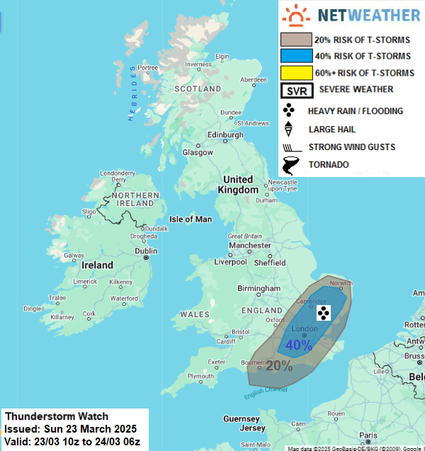
A thunderstorm watch has been issued for today.
Temperatures may briefly reach 15 or 16C in any sunshine, but for most areas, 12 to 14C will be more typical. Across the far North and along some North Sea coasts, 9 or 10C is more likely, where a North or North Easterly breeze will feel chilly.
After dark, England and Wales will see further showers, mainly across the east and south. It will turn misty again, especially in central and eastern areas, but temperatures here should not fall below 5 to 7C, despite a northerly wind. Meanwhile, over Scotland and Northern Ireland, a ridge of high pressure will bring lighter breezes and clearer skies, allowing a slight frost to develop in places, with lowest temperatures of -1 to +3C.
The new working week sees a ridge of high pressure moving into England and Wales. This will eventually allow brighter skies, giving some sunshine to move in from the north and west, although the east and south may keep a lot of cloud for much of the day. Here, after a grey, misty start, especially in the east, there will be further showers, but they will be fewer and generally lighter, and not everywhere will experience them before they fade. Top temperatures will be 12 to 14C in a North or North Westerly breeze.
After a bright but cold start in the east, Scotland and Northern Ireland will see cloud amounts increasing from the West as Atlantic systems move in. These will bring some rain to Northern Ireland and to the west of Scotland, but much of the day should be dry further east. Light winds at first will freshen from the South West, making it feel a little chilly, but temperatures should eventually reach between about 10 and 13C.
Much of Scotland and Northern Ireland will see some rain after dark, but this should have cleared from all but Lothian and The Borders by morning. As skies break, a touch of frost is possible in some sheltered Highland glens around dawn, in a West or South Westerly breeze. The north and west of both England and Wales may also see some rain later in the night, but elsewhere it will be dry under clearer skies. With lighter winds, a touch of frost may occur from the Midlands southward, with lowest temperatures probably in the range of 2 to 6C.
A ridge should bring a finer period mid-week, especially in southern and central areas, where it will become very mild again. Atlantic systems will then return, making the remainder of the week breezier and unsettled again, especially in the North.
Loading recent activity...