


Will it ever stop? This week's persistent rain has been phenomenal for NE Scotland, January records broken in just a few days, widespread flooding and now the top level severe flood warnings due to a Danger to Life.
Thursday 7th Jan 2015
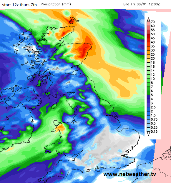
The onslaught of heavy rain continues tonight for NE Scotland. The well forecast, persistent wet weather has caused more and more flooding problems this week in an area that had already seen huge flooding issues after Storm Frank at the end of 2015.
There are now 2 severe flood warnings (as of 6pm). Details from SEPA
Inverurie - A SEVERE FLOOD WARNING has been issued for Inverurie.
This means that extensive flooding is expected to properties and businesses including those in Port Elphinstone, along Old Canal, and Inverurie Paper Mill. The Waste Water Treatment Works and railway line will also be significantly affected. Many roads, including the B993, will be impassable in and around Inverurie.
River levels will significantly exceed those experienced in 2002 and 2009 and are not expected to peak until the early hours of Friday morning. Be aware that flooding impacts will also extend up the River Urie where levels are expected to be the highest in recent history.
Kintore - A SEVERE FLOOD WARNING has been issued for Kintore.
This means that extensive flooding is expected to properties and businesses including those in Castle Hill and Kingsfield Road. Many roads, including the B977, will be impassable in and around Kintore.
Other incidents
The Meadow nursing home in Huntly has been evacuated and the usual movement of cars to higher ground near Tesco on the A96 has taken place
Aboyne had already exceeded its monthly rainfall amount in the first few days of January
There is a new January Rainfall record for Fyvie Castle, Aberdeenshire (144.8mm up to 5pm today), previous record was 137.6mm
There is a long list of roads closed or affected by flooding in Angus
http://www.angus.gov.uk/info/20038/roads_and_pavements/713/roads_affected_by_weather
Roads around Kintore/Inverurie and Aberdeen are closed due to flooding including the main route between Aberdeen and Inverness the A96 and near to Aberdeen airport. Schools have been closed today and those who have travelled by road have encountered disruption and divisions due to the phenomenal amount of water.
Join our online discussion forum in the Community part of the website, if you have experienced the flooding this week and today and do share any photos
https://forum.netweather.tv/topic/84475-scotland-weather-discussion-20th-november-2015-and-onwards/
When will it ever stop?
This continual feed of rain off the North Sea, coming up against the Grampian and swamping NE Scotland will keep going through tonight. There is a Met Office Amber warning in place until 8am Friday morning. By then the heavy rain should be clearing away from Peterhead and Fraser burgh. The journey to work and school will be difficult and for areas with severe flood warnings do remember this means there is a danger to life.
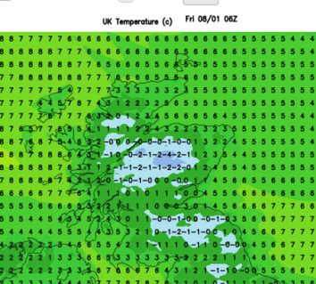
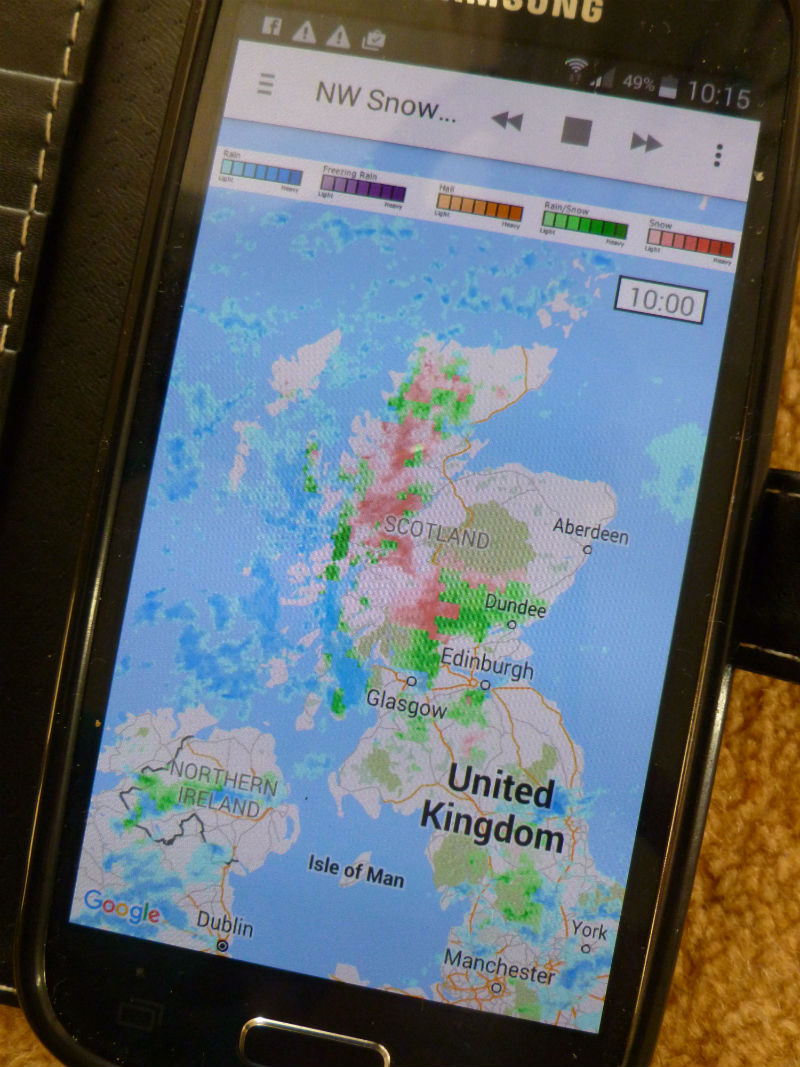
Up over the higher routes there is now snow, and tonight temperatures inland are forecast to dip to freezing, so ice will be another problem.
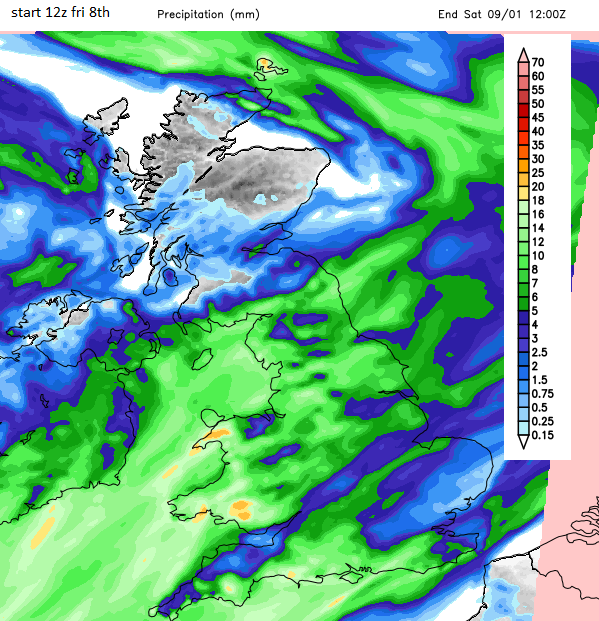
The good news is that once this rain band clears early on Friday morning, there will be a lull. The rainfall total chart Friday noon til Saturday noon is empty of rain.
There will be more wet weather during Friday evening and at the weekend but nothing like what has occurred this week.
Is it going to snow next week?
Next week sees a marked change in the weather, it will turn much colder and there will be snow showers but more, thankfully, dry weather in-between
Keep an eye on the Netweather Storm App for the rain radar and the Netweather Snow App.
Useful links
SEPA http://floodline.sepa.org.uk/floodupdates/
Traffic Scotland https://trafficscotland.org/
Netweather 7 day forecast


