


With saturated ground and still high river levels, more rain will not be welcome in certain parts of the UK. Flooding remains likely.
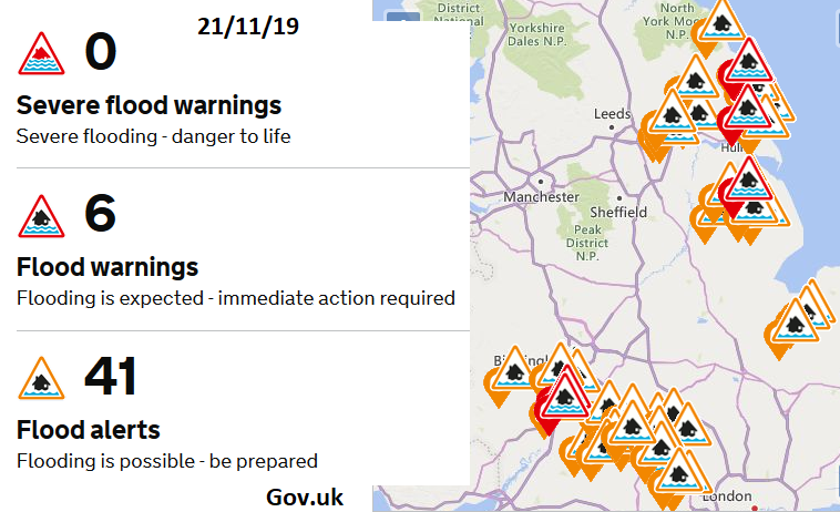
There has been a lull in the autumn wet weather for the flood-hit areas of England and Wales. Northern Ireland has stayed wet with a lingering weather front affecting western Britain at times this week. But over much of Britain, it has been fair and drier with the number of flood warnings decreasing this week. There were over 100 flood warnings for England in early November, which is now down to 6 on the 21st . Two along the River Severn in the Tewkesbury area, another river warning in Lincolnshire. There are two river warnings for East Riding of Yorkshire where Env. Agency pumps continue to work and a groundwater flooding warning for Barrow upon Humber.
There are also numerous alerts still ongoing. The ground remains saturated, river levels high but the environment agencies have been working hard in the drier lull to clear debris and inspect flood defences and also just recover themselves after the events a few weeks ago.
The forecast isn’t so encouraging for the end of this week into next. At the moment there aren’t signs of the heavy and persistent rain, as was seen earlier in November but after such a wet autumn and with the current conditions any extra rainfall is being viewed with caution. The main message is to sign up for flood warnings and make a flood plan.
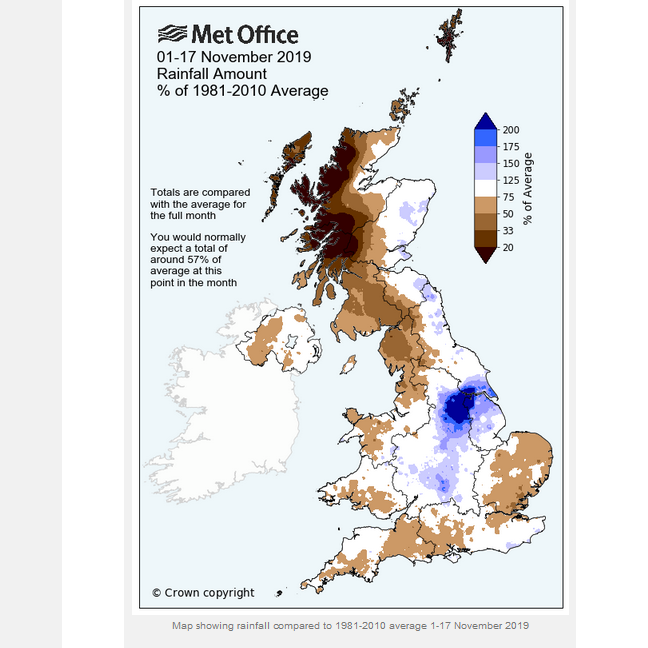
It’s not been wet for the whole of the UK, the NW Highlands and Shetland have had a dry and sunny November so far but with the widespread flooding for central parts of Britain and high rainfall totals by mid-month, some double the average already the climate data for November 2019 and Autumn 2019 will be rather interesting.
The problem has been with slow-moving or stagnating low pressures, lurking nearby, stuck in meanders of the Jetstream which just bring long periods of rain. Usually in Autumn, the jet stream smashes its way across the Atlantic, low pressures develop and whistle across the UK, we get named storms, a half-day of wild winds, some damage and a short burst of heavy rain, then all change.
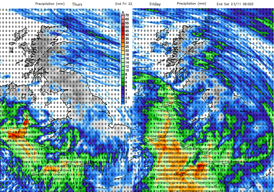
The low pressure which has been sitting west of Ireland so far this week will bring more rain to Ireland and SW Britain with the threat of some heavy, even thundery showers for SW England and southern England. These could cause localised flooding and surface water and make conditions on the roads difficult temporarily. With a scattering of showers tonight and on Friday morning the rain begins to gather itself over SW Britain during Friday as bands rotate up from the south.
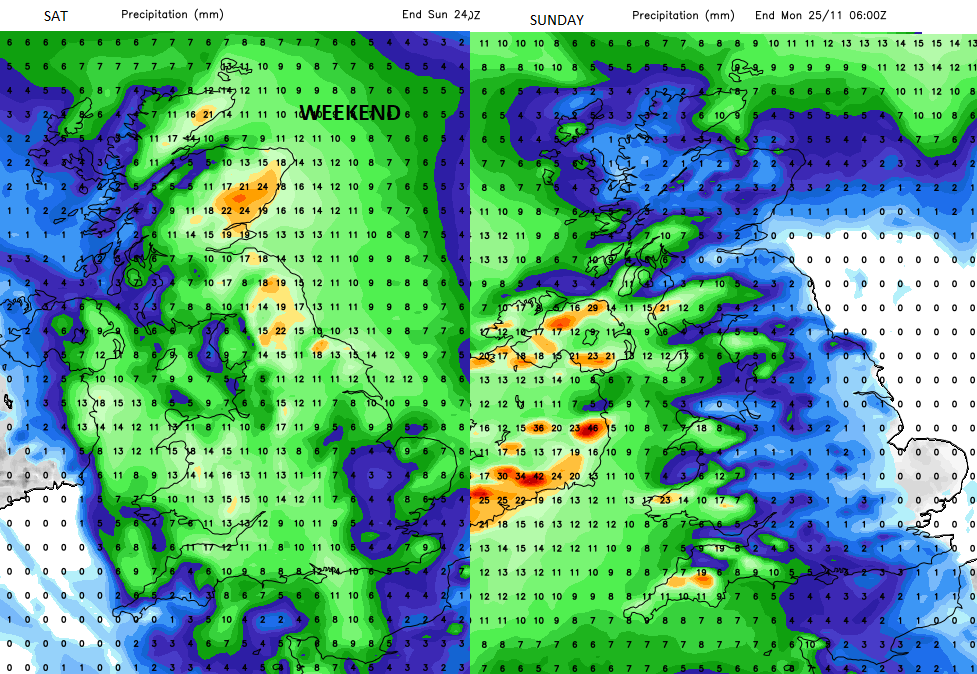
A new low pressure from the Bay of Biscay is going to influence our weather. This low will bring rain from the SW up through the Seven catchment area, over the Midlands and Lincolnshire, into Yorkshire then northwards to Scotland by the end of Saturday. Sunday looks drier for much of Britain but later in the day another low heads in from the Atlantic bringing wet and windy weather to Ireland.
"Local surface water and river flooding is also possible across parts of the south of England and possible but not expected more widely across England and Wales on Monday." Environment Agency.
This brings a spell of wet and windy weather for Monday morning across the UK with potentially another low for the middle of next week.


