Outbreaks of rain spreading east across England and Wales today, though heaviest rain avoiding flood hit areas. Remembrance Sunday mostly dry and bright. Turning unsettled again next week.
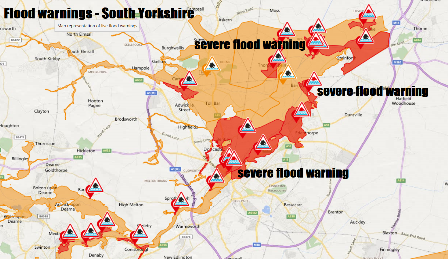
Parts of northern England and the Midlands are still reeling from the effects of a month’s worth of rainfall that fell in 24 hours, with 7 Severe Flood Warnings along the River Don in South Yorkshire and 64 Flood Warnings still in effect, mostly across Yorkshire, the north and east Midlands.
More rain is forecast to spread east across England and Wales today, but fortunately it won’t hang around like the other day and the rain will be heaviest across Wales and southern England this time. Most areas will get chance to dry out and enjoy some late autumn sunshine on Sunday, as a transitory ridge of high pressure builds in. However, we return to unsettled conditions early next week, as low pressure near Iceland extends across northern Europe, bringing spells of rain or showers, even some snow on northern hills as colder air feeds in a brisk northwesterly wind.
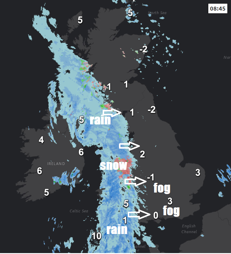
For now, the morning so far has seen a band of cloud and outbreaks of rain moving in from the west across SW England, Wales, N. Ireland and SW Scotland. Snow falling above 200m across the Welsh mountains. Further east, clearer skies overnight have allowed temperatures to fall close to or below freezing, the lowest reading of -7.0C at Braemar, making it the coldest night of the autumn so far. So, with a lot of water around from recent rain, perhaps coming off fields onto roads, there is a risk of icy stretches on untreated surfaces. Also there are some locally dense fog patches to watch out for this morning across central and southern areas of England.
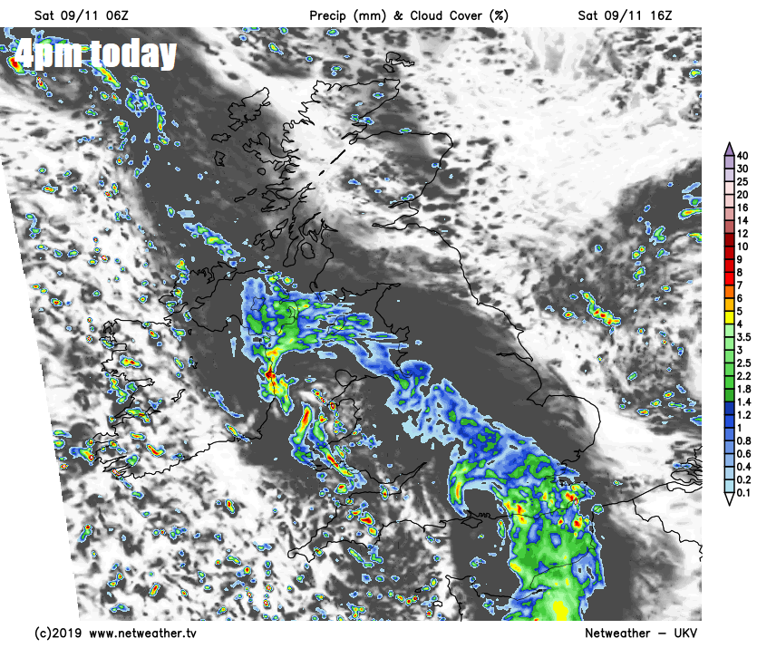
The rain band across the west to start the day will gradually spread east and southeast across England and Wales through the rest of the morning and into the afternoon. The rain will persist across the eastern side of N. Ireland for much of the day, with a yellow warning issued here by the Met Office. As the rain spreads east, it won’t be too heavy across flood-hit northern England, but will be locally heavy as it spreads further east across southern parts of England, with another yellow warning issued by the Met Office for parts of southern England.
Today’s rain moving east grazing parts of western and southwestern Scotland, but not really getting any further north and east as the rain gets pulled away southeast across England, so much of Scotland away from the southwest and far west and NE England staying dry and bright or sunny. A chilly day, temperatures reaching 5-8C generally, perhaps 9-10C across the southwest.
Cloud and rain over England and Wales today will gradually sink south overnight, though will linger across southern England bringing a damp night here. Further north, clearer spells will spread south across Scotland, northern England, north Wales and the north Midlands, so becoming cold overnight with a frost developing. Perhaps some wintry showers affecting eastern Scotland.
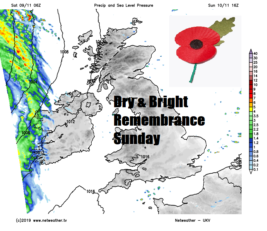
The weather is thankfully looking fine and dry for Remembrance Sunday, any lingering cloud and patchy rain across southern England should soon clear away in the morning to leave most areas with a dry day with sunny spells for much of the day. Temperatures reaching 7-10C generally.
All change Sunday night, it starts dry and clear in the east, but a band of rain and strengthening winds will move in across the west Sunday evening, rain locally heavy with hill snow in the north, before outbreaks of rain spread eastwards across most parts in the early hours. Outbreaks of rain clearing the east Monday morning, followed by sunny spells but also blustery showers across the west, which will fall as a wintry mix over higher ground, a strong northwesterly wind across all parts making it feel chilly.
Sunny spells and blustery showers on Tuesday, most of the showers across the north and west, feeling chilly in the strong northwesterly wind. After a cold and frosty start to Wednesday, a bright morning with a few scattered showers will give way to cloud and rain spreading in across the west, though eastern parts could stay dry. Low pressure tracking southeast into France on Thursday looks to pull a cold and brisk northeasterly wind, bringing showers or longer spells of rain, this persisting into Friday.