Last weekend, it looked probably that a mild and changeable south-westerly type would likely dominate for most or all of the rest of January. However, we are now in a situation where the lows coming in off the North Atlantic are struggling to make headway against a large blocking high to the east of Britain. For the next five days or so, it will stay on the mild side because the near Continent will be relatively mild, and the winds will mainly be southerly. It will probably be generally cloudy, and wet at times, especially in the south-west, as rain bearing frontal systems push in and stall over parts of the country.
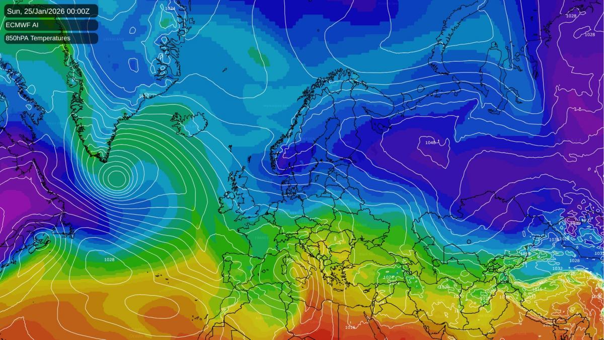
But there is growing agreement among the medium-range forecast models that there will be a substantial push of cold air from the east in around a week's time. It is not guaranteed to reach the British Isles. Some model runs have the lows coming in off the Atlantic just holding the cold air away to the east, and this sometimes happens, I remember an instance back in February 2007 for example when a very cold easterly had repeatedly been forecast by the GFS model, and the ECMWF model showed it for one run, but in the event the cold air stayed on the other side of the North Sea.
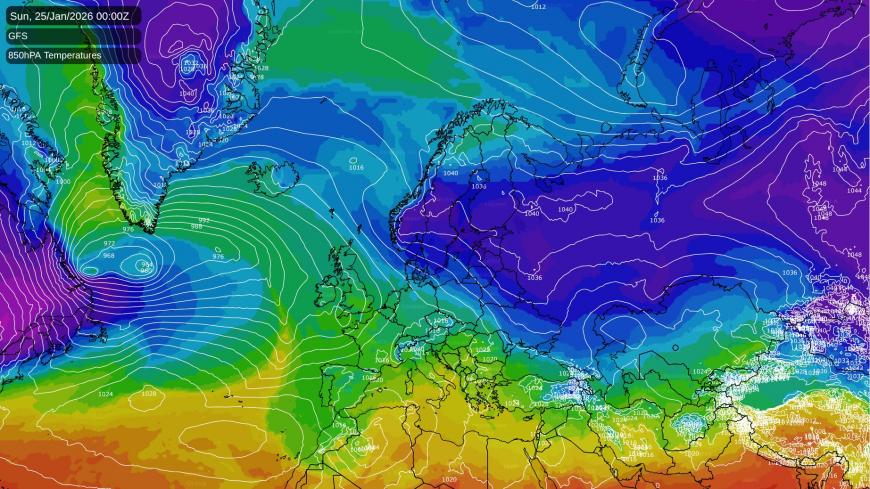
One of the recent milder options shown by the models (the GFS 06z this morning), as opposed to the colder ECMWF AI run shown above.
A fair number of runs are bringing that cold air all the way across to the British Isles. If it does get this far, it is likely to produce snowfalls, via snow showers over the North Sea, particularly into eastern counties, and/or frontal systems pushing into the cold air from the west. Thus, there is a significant possibility of a notable wintry spell in the last week of January, but not a certainty as things currently stand.
For us to get a notable easterly spell, we will need the lows coming in off the North Atlantic to start undercutting a developing blocking high over Scandinavia, heading into the southern half of Europe and propping up the easterly flow over Britain and sending a scoop of very cold air our way. It will also rely on the Scandinavian high throwing up a ridge to the north of Britain, towards Greenland and Iceland. If this does not happen, and the lows predominantly stay to the west of Britain, the Scandinavian blocking high is likely to end up ridging south into central and southern parts of Europe instead, leaving Britain in a southerly flow and keeping the pool of very cold air away to the east.
During the next few days, a substantial cold northerly outbreak is forecast for the east of Canada and North America, which will particularly affect the north-east of North America. This has potential to bring significant snow in some areas as well, especially around the Great Lakes.
Then in about a week's time, another very cold northerly is forecast to affect most of Canada and the northern United States, spreading widely across the north instead of just affecting the north-east. According to the latest model runs, temperatures of -20 to -25C may be quite widespread in the north-east of North America during the next few days, and in about a week's time, temperatures may drop below -30C in parts of the north of North America.
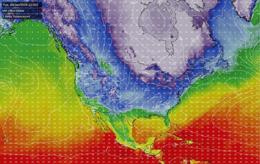
These regions are prone to especially cold blasts from the Arctic because there is no large expanse of sea to the north to modify these cold air mases, as happens in Britain when northerlies have to pass over part of the North Atlantic Ocean, subject to the North Atlantic Drift bringing a warm ocean current from the Gulf Stream, before they reach the British Isles.
It is especially this second cold air outbreak over Canada and North America that will happen at the same time as strengthening of the Scandinavian high. It is quite common in these setups for us to simultaneously see major cold weather over Canada and North America and over Europe, with unusually mild air being sent up towards Svalbard and/or Greenland via southerly winds.
Sometimes the cold air coming out of Canada and North America can power up the jet stream and help keep the Icelandic low in place, which hinders the chances of the Scandinavian high sending cold air all the way west to the British Isles. In other cases, snow has been known to fall and lie widely from frontal battleground events where the cold air from Canada comes across from the west
and we end up with two cold air masses - cold polar maritime westerlies and cold easterlies from eastern Europe - meeting over the British Isles. One famous example of this latter setup was on 5-7 February 1996, when some parts of Britain, particularly Cumbria and north and west Lancashire, had a big snowfall.
Loading recent activity...