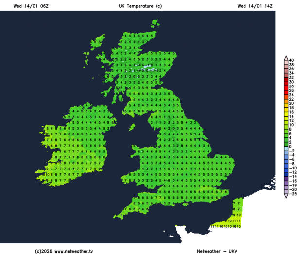
After a mild start to the week, Wednesday starts off with a widespread frost with some ice patches and freezing fog or mist in places too, thanks to a transitory ridge of high pressure which has built in overnight.
This means a fine and sunny morning and early afternoon for many, temperatures reaching 5-8C after the cold start, so not as mild as the last few days in the south.
However, the fine weather won’t last, with an occluded front bringing a band of showery rain and strengthening winds in from the west across the far west this afternoon, before moving across the north and west this evening, while a frontal wave moving northeast brings thicker cloud and some showers to southern England and East Anglia from late afternoon through the evening.
Tonight, a band of showery rain moving east will merge with showery rain spreading northeast across SE England and E Anglia, some wintriness over northern hills, before clearing England in the early hours, though showers, wintry over high ground, lingering across Scotland.
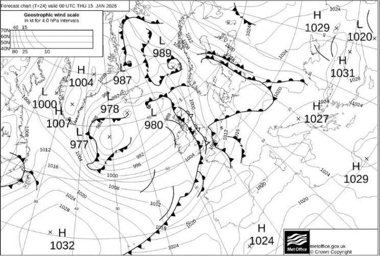
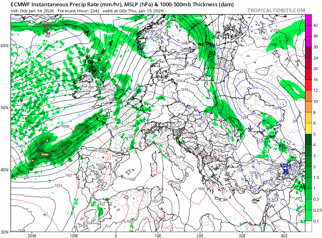
Then Thursday is looking rather wet for southern England, Midlands and much of eastern England, as frontal wave developing north of the Azores this morning runs northeast and forms a low off NW Spain early tomorrow. The low then becomes elongated as it moves northeast over the Bay of Biscay and is forecast to develop two centres strung SW-NE, as a shortwave trough moving in from the west becomes increasingly amplified as it engages the low and cyclonic vorticity along the forward side of the trough becomes more strung out.
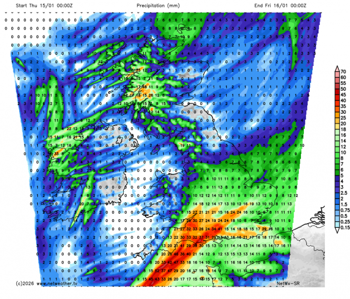
This means a spell of more prolonged rainfall spreading northeast across southern England, Midlands and eastern England arriving along the south coast around breakfast time and not clearing eastern England until late evening.
The Met Office have updated a yellow rain warning for tomorrow for S England - in force between 9am and 10pm on Thursday
An area of low pressure will migrate northeastwards across England on Thursday. Whilst the exact track is uncertain, rain will become persistent and heavy through the day, before clearing to the north through the evening and night. Accumulations of 20-30 mm are expected fairly widely, in some places falling in just a few hours, with the potential for 40-50 mm in a few isolated spots. Given the saturated ground, this may lead to some surface water flooding.
This low pressure system was forecast to deepen much more on previous model runs, particularly ECMWF, but it’s looking less developmental now with a shallower more strung out low, so rain rather than wind will be the issue. We’re not talking large rainfall totals by the end of tomorrow, widely 20-30mm possible across southern and eastern England, perhaps locally 40-50mm towards the south coast. But falling on saturated ground following recent rain, it may cause some localised flooding issues.
Elsewhere, looking mostly dry and bright or sunny on Thursday, though some showers around western coasts.
Friday sees an area of low pressure move in close to western Ireland, which will have showers in its circulation rather than any longer spells of rain. These showers affecting the island of Ireland, western and southern areas, though showers tending to become increasingly confined to the southwest later in the day. Scotland and northern England looking mostly dry and sunny, away from the far southwest of Scotland.
Then a drier and more settled weekend in prospect, as that low near Ireland sinks south over the Bay of Biscay allowing high pressure to build from the east.
Loading recent activity...