The weekend had been looking quiet and drier but a warm front from France will now move over more of England on Sunday. What had just threatened to wave over Kent and maybe East Anglia is now forecast to reach across England, perhaps to eastern Wales by lunchtime and up to the Pennines in the afternoon. That could leave a milder and brighter afternoon for southeastern Britain behind the front. We will likely see further changes in where this frontal band and wet weather ends up.
It has been cold and frosty in eastern Scotland and Northumberland on Friday morning. Parts of Yorkshire up to Middlesbrough started the day with a fog warning from the Met Office. Fog will also return for eastern England early on Saturday.
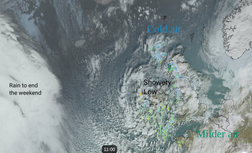
We have flimsy low pressure over the UK with bands of showers which interrupt the overall benign pattern. The unstable and moist Polar Maritime airmass and the low, continue to generate showers which rotate around it. Some of these showers could produce a sharp downpour, even hail today with dramatic anvil clouds against the winter’s sky. More well scattered showers will reach in from the southwest later this afternoon, heading towards Belfast and the Inner Hebrides.
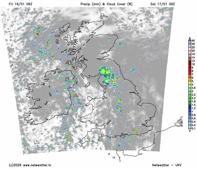
By the small hours of Saturday the UKV model has a small cluster of showers moving from Dorset, Bristol up to Cumbria but milder air reduces the risk of ice in the south.
Through the day pulses of showers march northwards over Britain and Ireland. Some areas will miss them and continue with a quiet, sometimes bright Saturday. The winds will be light. Wales and SW England could see a fine day, avoiding most of the showers and seeing more sunshine. Dublin, Belfast and eastern Northern Ireland seem to be plagued by showers flowing northwards on Saturday, so a more unsettled picture here.
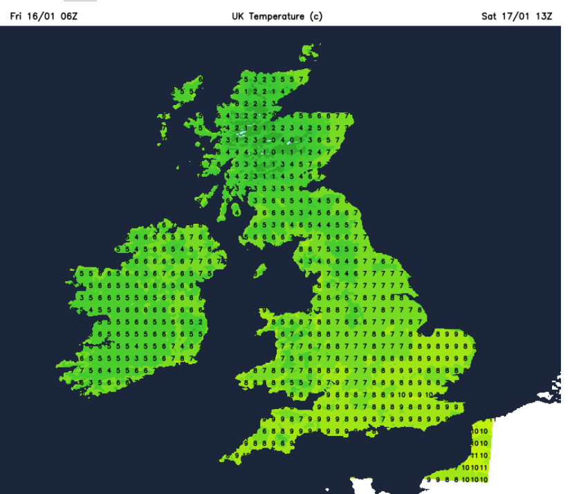
As Manchester United play Manchester City at lunchtime on Saturday it should be dry as the lines of showers stay along the spine of northern England. Temperatures will be around 8 or 9C which won’t be too bad (for January) with only light winds. London should reach 10C as northern Scotland stays around 5C.
The cluster of showers starting the day over Cumbria and the Pennines will swing northwards over mainland Scotland. More showers will surge northwards from the Isle of Wight to the Midlands and then to the Pennines. Western Britain should end Saturday drier and clearer with more cloud for eastern Britain and a scattering of showers for central and northeastern areas.
Western areas will be colder with clear skies on Saturday night. There will be frost and fog, with the risk of ice for areas that have seen showers. The feed of showers clipping County Down and Belfast will not give up until Sunday lunchtime.
There will be more cloud over England and eastern Scotland with a slight flow off the North Sea. Winds will be very light.
Sunday
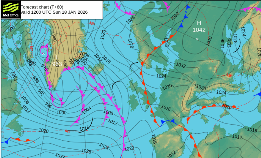
We remain in this quiet zone, a col, with a deep low pressure close to southern Greenland and a stable high pressure over western Russia and the Baltic States. This warm front manages to drift over SE England on Sunday. There is still uncertainty about where this band will end up. Will it reach across to Manchester and eastern Wales, how far north in England?
The occlusion front out in the Atlantic is being slowed by the high pressure over eastern Europe. Its high cloud will begin to encroach on County Fermanagh on Sunday afternoon as rain reaches western Ireland to end the weekend. Otherwise a fine day for Northern Ireland as the eastern showers finally clear away with temperatures around 6 or 7C.
Where the fog lingers it will feel cold. Western Wales, SW England, NW Scotland could all see sunshine away from the incoming occlusion off the Atlantic but also out of reach of the warm front from France. In the milder air behind the warm front temperatures could reach 9 to 11C.
This troublesome zone of rain; the Arpege model shows an early pulse of rain from Hampshire to Buckinghamshire to Yorkshire and the Humber in the afternoon. The ECMWF model is quite different with damp weather around the Bristol Channel early on, and a developing pulse moving from the West Midlands to northwest England (mostly inland) in the afternoon. This becomes heavier over SE then eastern Scotland during Sunday evening. The ECM has more showers over eastern Northern Ireland too during Sunday day. The GFS model has damp weather over central southern England in the morning which slips over Wales, the West Midlands into Merseyside.
This slack col zone isn’t helping the models on Sunday, with the frontal band drifting westwards and potentially making the second half of the weekend rather grey and damp for some.
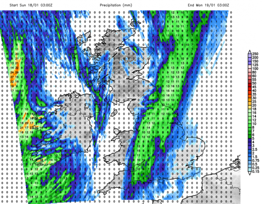
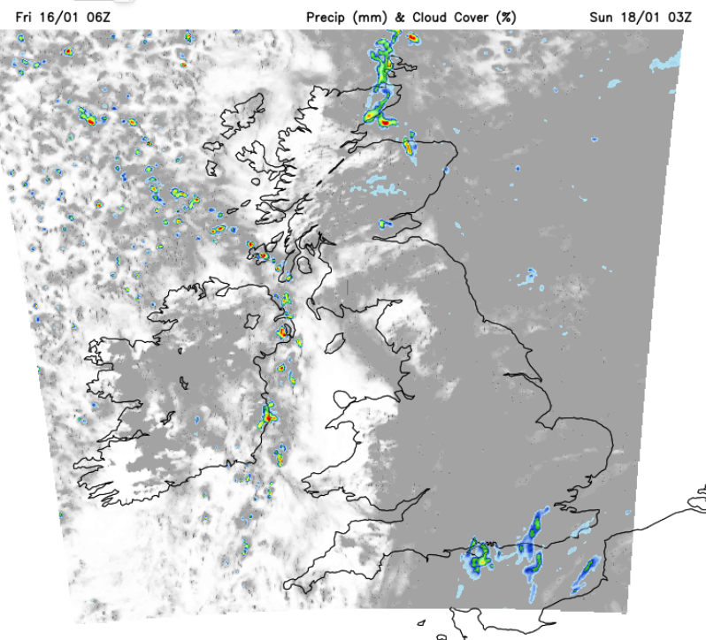
The UKV 24 hours rain totals map shows its forecast zone of wet weather with a drier day for the SE of Britain. This takes the rain band northwards away over the North Sea on Sunday evening but further showery outbreaks follow from the English Channel.
Monday
By Monday there will be pockets of sunshine but frost and fog. This ongoing showery zone stretches up through central England and east Wales. Also the western frontal band will bring showery outbreaks of rain over Ireland and into SW England with some hefty downpours. It is a mixed picture for Monday but Northern Ireland could also see heavy showers by the afternoon. The Atlantic seems to keep some influence for the start of next week over western parts of the UK with showery rain. Further east for Britain perhaps more settled.
Loading recent activity...