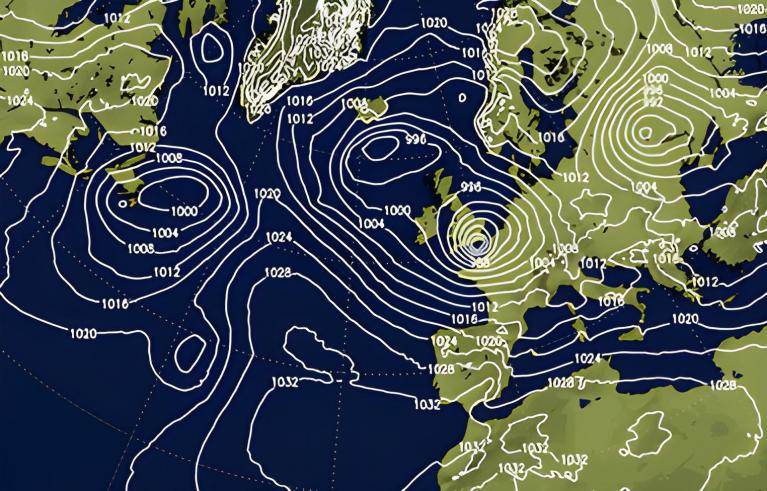
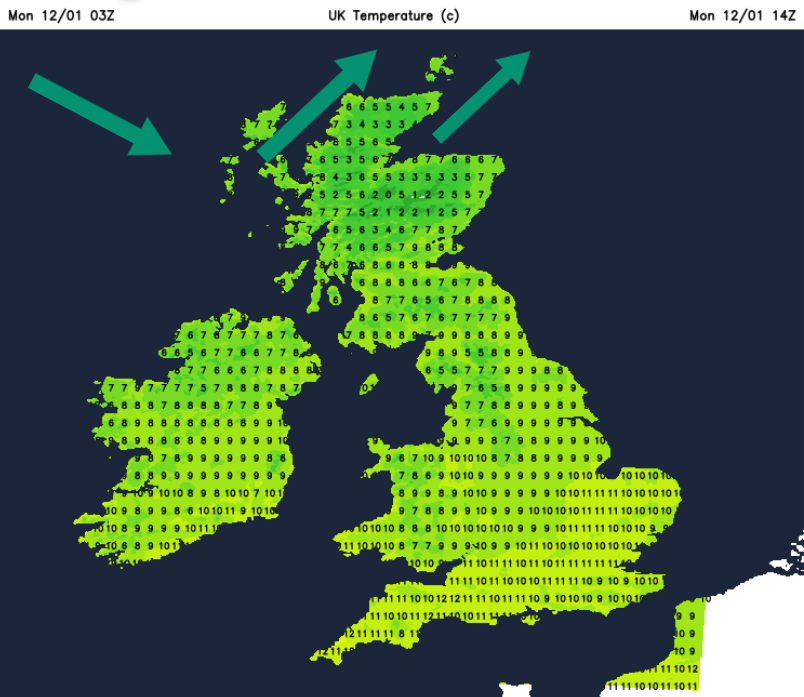
The far north of Scotland has been wet and windy overnight with Sunday’s low pressure heading past Shetland today. Following this is a brief milder airflow over the UK with southwesterly winds. It feels very different out there for Monday morning with temperatures round 7 to 10C by 9am.
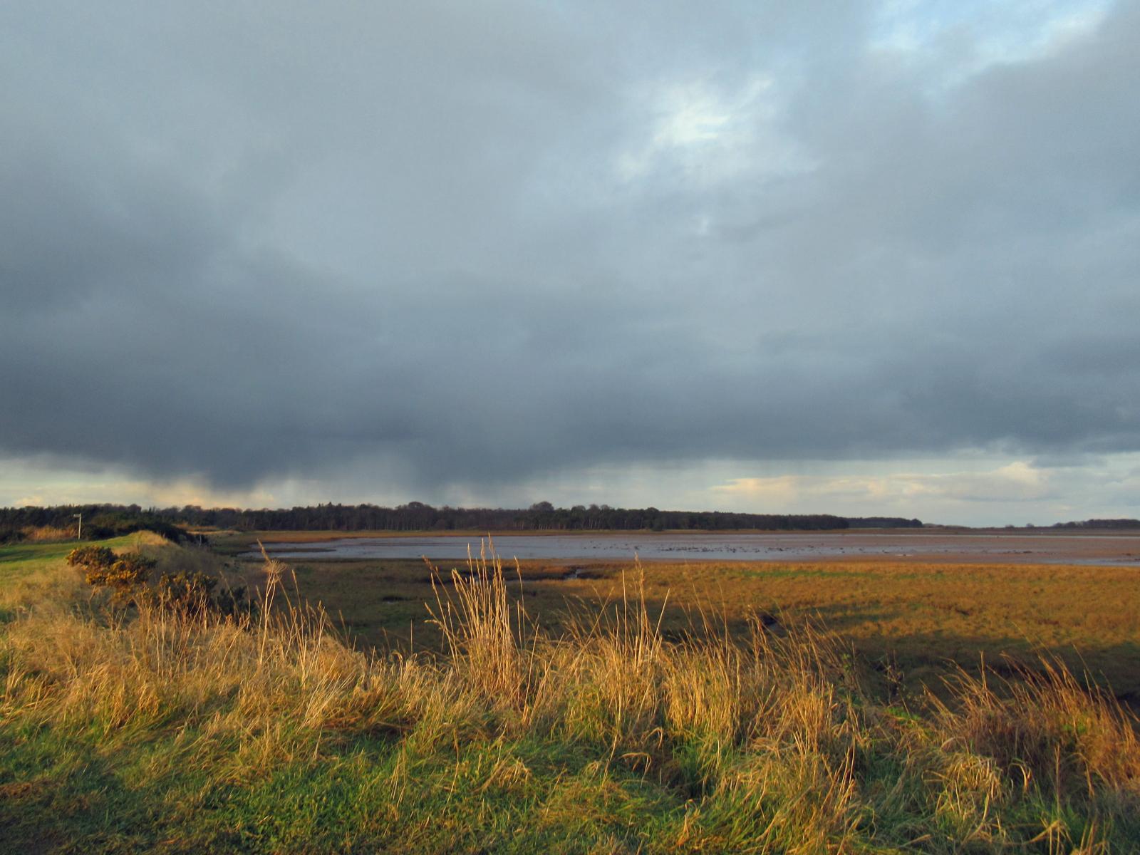
Last week brought further heavy snowfall in the far north and Storm Goretti to the south. Conditions in northern Scotland have been icy and wet but most roads are now clear, although often with huge side piles of cleared snow across Grampian and the Highlands.
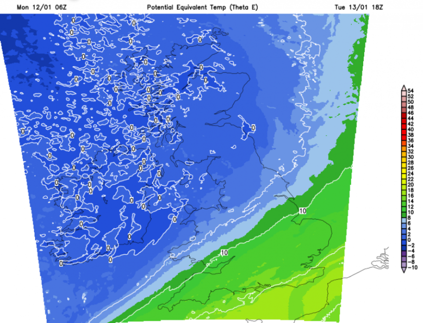
This combination of heavy rain and snow melt now brings the risk of flooding. Colder air will return by the middle of the week but there could be a rapid thaw before that.
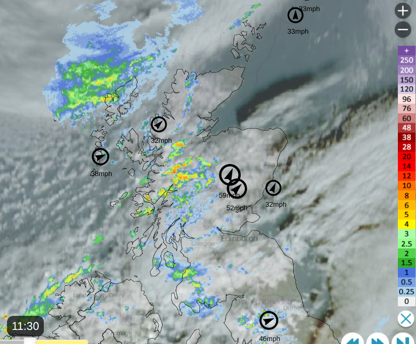
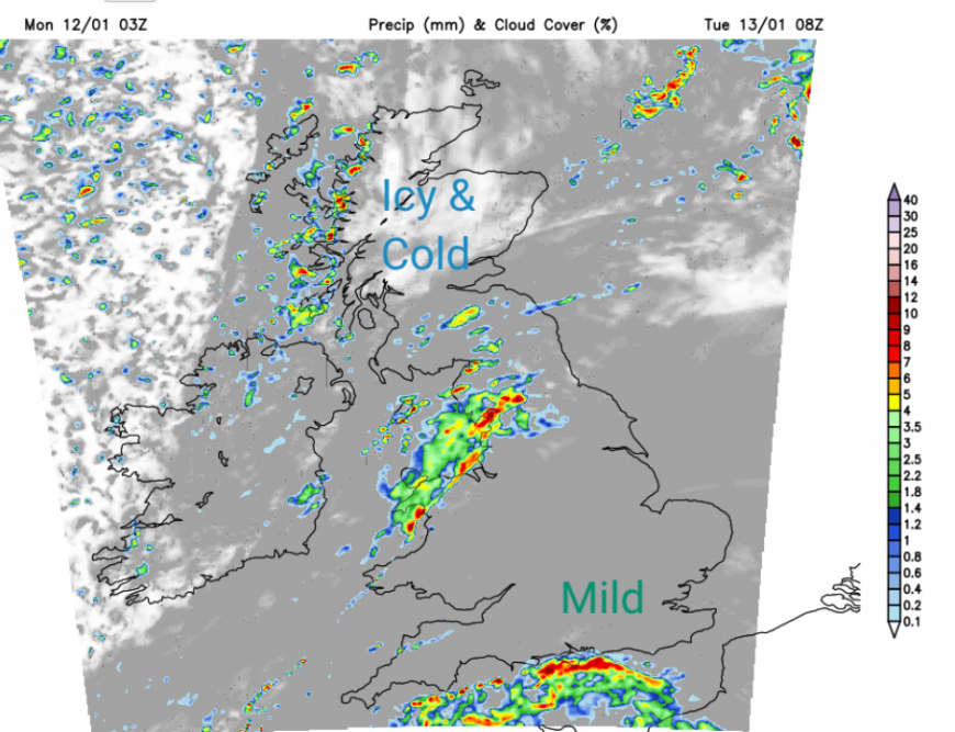
Netweather Radar showing rain showers and cloud cover with top ten windspeeds at 11:30 Monday 12th
There has already been some disruption in Scotland due to the rainfall from the northern low pressure and melting snow, which is expected to last into Tuesday. Northwestern parts of mainland Scotland have been highlighted as a concern after a wet end to the weekend with road closures or large areas of standing water.
Monday
There are rain showers arriving on this southwesterly flow but with more shelter and even sunshine for eastern Britain. A trailing front from the low in the far north is bringing rain to northern France and waving north across the Channel for a time today. This could brush the coast of Sussex and Kent this afternoon. It will feel milder, with temperatures in England and Wales around 9 to 11C. Scotland and Northern Ireland will be closer to 8 or 9C.
Clusters of showers will move by with lines developing through the night. There is an ice warning for Monday night over northern and northeastern Scotland as temperatures fall and the melting snow freezes.
“Ice formation may cause travel disruption through Monday night and Tuesday morning.” MO
Tuesday
The windy weather will have eased and there will be clear skies overnight but chilly sunshine to start Tuesday.
By Tuesday morning, there will be bands of showery rain giving a miserable start in places. Coming in off the Irish Sea, for western Scotland and from Cornwall over southern England. In between these zones, it will be cloudy in the morning but mild in the south. Cloudy and damp weather will linger over southeastern Britain, the remnants of fading weather fronts. It will be another mild day here but tempered by the dampness in the air.
Colder air will arrive from the far northwest with a late morning band of showers bringing fresh snow for the Scottish mountains. A scattering of wintry showers will continue into the evening for western Scotland as the cold air continues to flow in.
Midweek
Gradually drier and clearer weather will topple in from the west as pressure begins to rise. The frontal band over SE England will take its time overnight to clear from Kent but could leave fog for the Home Counties by Wednesday morning. Most of the UK will see a quiet, sunny but colder start with a widespread frost. Milder air will return over England on Thursday but overall there will be some nippy nights this week with further rain.
Loading recent activity...