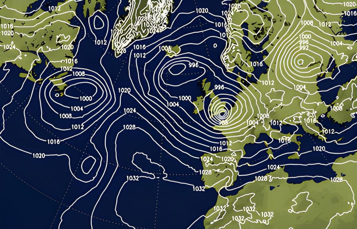
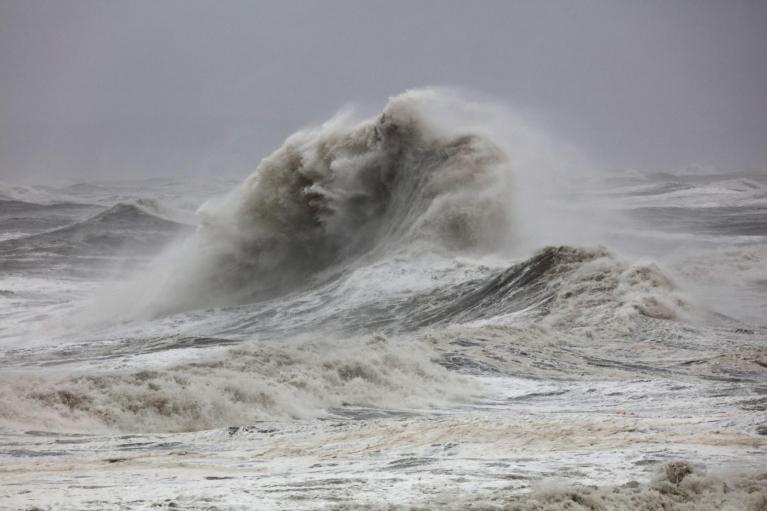
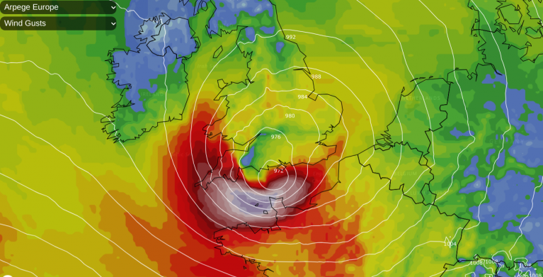
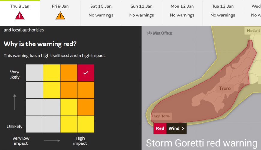
Prior to the arrival of Storm Goretti, the headlines often mainly focused on the potential for snow on the northern flank of the system, but the biggest overall impact came from exceptionally strong winds in Cornwall and parts of the English Channel, particularly Guernsey and the Isles of Scilly. The Met Office issued a rare red "danger to life" warning for Cornwall shortly prior to the event. At the time of writing, it is estimated that 25,000 homes in Cornwall are still without power. There have been a number of incidents where large trees have blown over and caused considerable damage to properties, as well as cases of roofs facing structural damage and in some cases being ripped off by the strong winds.
On the northern flank, snow especially affected the West Midlands and a large area of Wales, which has led to some power outages and disruption to transport, including some cancellation of train services. Snow lay in central Birmingham as the low passed through, for example. Some higher parts of Yorkshire were also affected by snow.
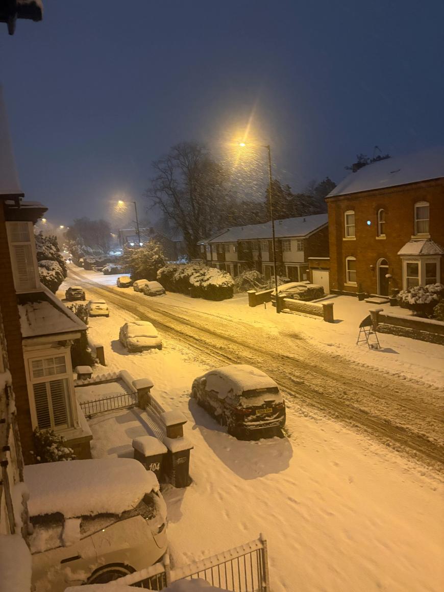
Snow in Birmingham uploaded to the Netweather community by BhamBoy
Generally to the east of high ground precipitation fell as rain or sleet, because temperatures were very marginal for snow, and an easterly and then a north-easterly wind picked up on the northern flank of the system. This brought onshore winds off a comparatively warm North Sea, which lifted the temperature up to 3 or 4C over much of East Anglia, Lincolnshire and the east of Yorkshire. As a result, these areas mainly had a lot of wet weather from the system.
There has been snow in these regions from southerly tracking lows running into polar maritime air in the past, such as on Boxing Day 2014, but these earlier instances that brought snow did not have as strong an easterly wind on the northern flank of the system, which reduced the warming effects of the North Sea and allowed evaporative cooling to take hold (where when winds are light and there is heavy precipitation, the snow line gets dragged down to much nearer the surface).
Largely unconnected to the system is the snow that is still affecting much of the northern half of Scotland, which fell mainly from snow showers earlier in the month.
The outlook for the coming week has the Scandinavian blocking high retreating into Siberia, allowing mild and changeable weather to establish over Britain, as low pressure systems keep sweeping in south-westerly winds and lows and frontal systems from the North Atlantic. These are expected to push into central Europe but then stall against the blocking high to the north-east. This will leave Britain with predominantly south-westerly and southerly winds, due to the low pressure to the north-west struggling to make inroads to the north of Britain, and the high pressure to the north-east.
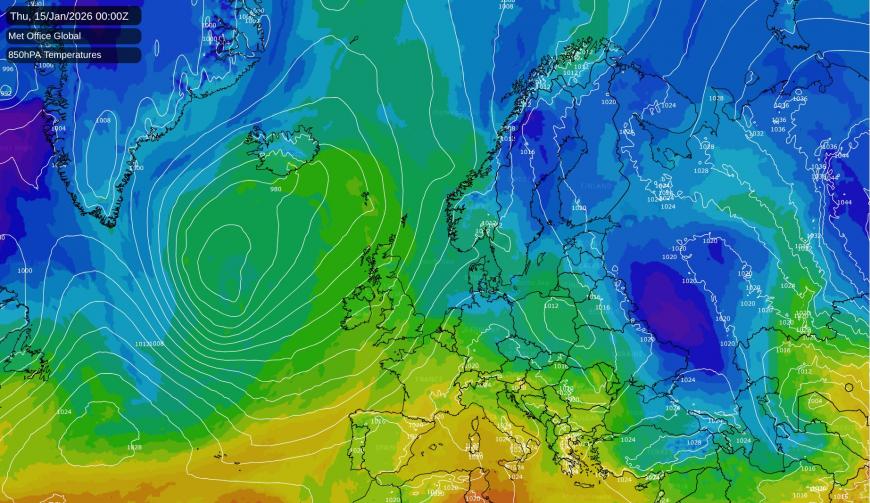
A scattering of forecast model runs have been sending the Siberian high westwards into Scandinavia and eventually bringing Britain a cold easterly flow, which would be likely to bring snowfalls, as there is currently a lot of cold air to tap into to the east. Due to this possibility, and the likelihood of high pressure staying close to Scandinavia for at least the next two weeks, it is not guaranteed to stay mild and changeable for the rest of January. However, an easterly currently looks like being just an outside chance during the next two weeks, with the North Atlantic lows looking likely to have too much strength.
2025 was the warmest year on record for the UK in records from 1884 and also for Central England (in the Central England Temperature series from 1659), but in contrast 2026 has got off to a cold start. The Central England Temperature for the first 8 days of January is running at 0.9C, 3.0C below the 1961-90 average, which is impressive, as the 1961-90 normal is more representative of the 20th century and is rather below recent averages.
It illustrates the fact that even in a warmer climate globally, individual regions can still have spells of below-average temperatures. The below-average temperatures have affected a large part of Europe as well, where there has been heavy snow in places and temperatures below -30C have been recorded. It is expected to remain very cold for much of Scandinavia and eastern Europe for another few days, but in the western half of Europe we can expect milder air to increasingly establish.
Loading recent activity...