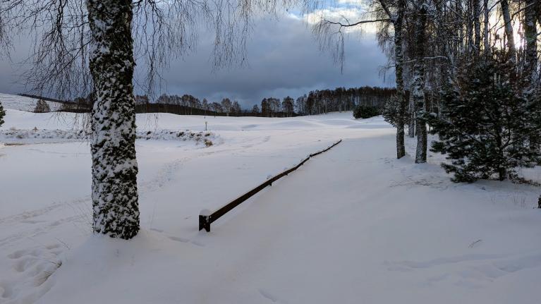
The cold spell looks set to continue over the next few days and if you haven’t seen any snow yet, you may see some flakes over the next few days, though any further significant snowfall will tend to be confined to northern Scotland, N. Ireland, western & eastern coastal areas - which will see further snow showers today and Monday.
However, we will see changes in wind direction from Tuesday, the cold northerly flow direct from the arctic will be cut-off to be replaced with a less cold but still chilly northwesterly flow. The blocking high pressure to the west and northwest weakens and sinks south to allow low pressure to drop southeast from Greenland towards the North Sea by mid-week. Tuesday and Wednesday look cloudier but still on the cold side, with outbreaks of rain, sleet and hill snow spreading southeast across all areas.
Blocking high pressure to the W and NW weakens and sinks south next week, allow less cold but unsettled conditions to roll in off the Atlantic from mid-week
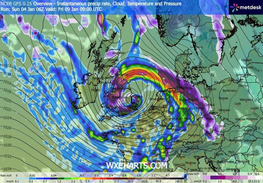
Potential for a low to deepen in the southwest approaches and cross the UK later in the week, but great deal of uncertainty over track. But a spell of wet and windy weather looks possible late Thursday and into Friday, perhaps with snow on the northern edge of the low, so potential for some disruptive weather.
Deep low on Friday? Could bring wet and windy weather with snow mixed in too
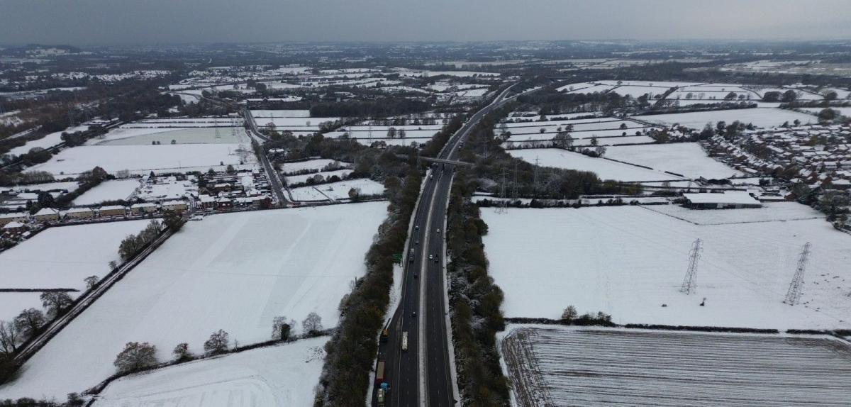
For now, a very cold and frosty start to Sunday, the south saw the lowest low-level temperatures, Benson in Oxfordshire got down to -9C overnight. At 8am: it was as low as -7C at Southampton and Bournemouth Airport, -6C at Northolt in NW London. With temperatures low to start the day, temperatures will struggle to get much above freezing today, despite mostly blue skies for many away from the far north and coastal areas.
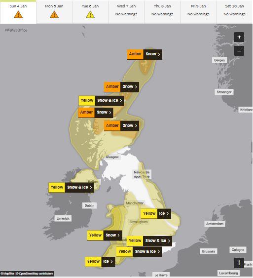
Plenty of Met Office snow and ice warnings in force for the next few days, Amber warnings for parts of northern Scotland
A subtle change in wind direction today, backing more to the northwest, means snow showers will penetrate further inland over Wales and southwest England, while generally steering clear of eastern England after they brought a fair bit of snow to Norfolk and coastal areas further north yesterday. Further frequent snow showers for Scotland and N. Ireland. Dry and sunny inland elsewhere.
Snow showers continuing for northern Scotland, north of N. Ireland and windward coasts elsewhere, while a cold front moving southeast will bring some patchy snow inland across Wales, Midlands and southern England overnight too. Otherwise dry, cold and frosty again.
An area of low pressure dropping south over the North Sea will bring snow showers back in along eastern coasts of England, snow showers in Northern Scotland and western coastal areas easing, though more organised area of rain, sleet and snow moving in from the northwest later in the evening across Scotland and NW England. Otherwise a dry, sunny and cold day.
Mix of rain, sleet and hill snow will spread off the Atlantic across parts at times through the rest of the week, temperatures recovering a little, but still on the chilly side.
Cloudier with outbreaks of rain, sleet and hill snow will spread erratically southeast across the UK on Tuesday and Wednesday, as an area of low pressure moves southeast across Scotland and on toward the North Sea. Another frontal system arrives in the west later on Wednesday, with a band of rain, perhaps preceded by hill snow in the north.
Thursday and Friday, uncertainty over the track of a deepening low that forms to the southwest of the UK. GFS and a few other models track quite a deep low northeast across England and Wales, which would bring wet and windy weather, perhaps some snow mixed on the back side of the low as it clears, more especially over hills. ECWMF has the low track further south. We will firm up on the track of this low over the next few days, as models come into agreement, but an early heads up for some possible disruptive weather later in the week from snow, heavy rain and strong winds.
Loading recent activity...