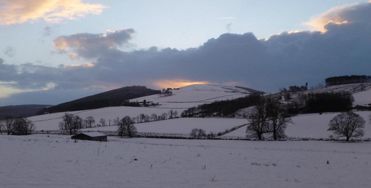
It will stay cold through the weekend and into next week, thanks to northerly winds feeding air direct from the arctic. The northerly wind will continue to blow in frequent snow showers across northern Scotland and along coastal areas of the east and west further south through the weekend and into the start of next week.
Increasingly cold air spread south through the weekend
Northern Scotland will see the most severe conditions, with Amber Snow Warnings in force here until midday on Saturday, for up to 40cm of snow, then yellow warning takes over for the rest of the weekend into Monday. While yellow warnings for snow and ice are in force for N. Ireland, Wales, parts of the Midlands, SW England and North Sea coasts of eastern England over the weekend and into Monday.
Various Met Office warnings for snow / ice in force over the weekend and Monday, here's Saturday's map
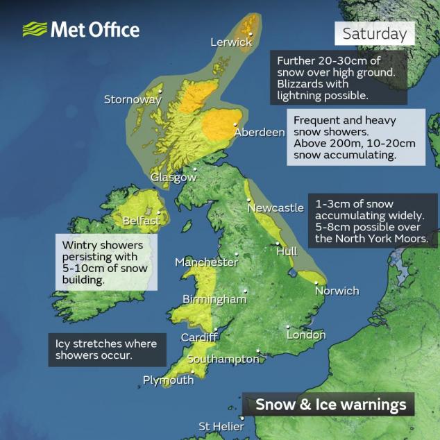
The warnings for snow and ice for the different parts of the UK are in force for different time periods, so please check the Met Office Warnings here
A blocking area of high pressure to the west and northwest of the UK extending north over Greenland and low pressure slow-moving over the Baltic Sea and Scandinavia will continue to feed a very cold arctic northerly down across the UK and the rest of NW Europe over the weekend and into the start of next week.
It will remain mostly dry and sunny inland across the UK, but the cold arctic air crossing the warmer sea will generate instability and support snow showers which will affect northern Scotland, Northern Ireland and coastal areas of the west and east exposed to the northerly wind. Most significant snowfall accumulations will be over northern Scotland, with 10-20cm likely at lower levels and up to 30-40cm falling over higher ground. Parts of Wales and N. Ireland, especially higher ground, could see 5-10cm by the end of Monday. The strong northerly wind will gusts to 40-50mph along coasts of the north and east too, causing drifting of lying snow and creating a harsh wind chill.
Everywhere will see hard overnight frosts tonight, Saturday and Sunday nights, temperatures falling well below freezing, temperatures could fall as low as -8 to -10C across in prone inland frost hollows in England and Wales, we could see lower than that in sheltered Glens in Scotland. Daytime temperatures will struggle to get above freezing away from the far west as a result over the weekend, 1-2C at best in the north and east, 2-4C at best in the far west. The wind chill will make it feel like it’s well below freezing.
2pm temperatures on Saturday and Sunday
Generally any sleet and snow will be confined to northern Scotland, N. Ireland, western and eastern coastal areas over the weekend and on Monday, commonly referred to as the ‘wishbone effect’ in cold northerly flows. However, Sunday night, like Thursday night, may see a more organised area of wintry showers, falling as snow inland, track southeast across N. Ireland, Wales, Midlands and parts of southern England - perhaps giving a covering in places.
Beyond Monday, the blocking high to the west and northwest weakens, with the arctic northerly weakening too, but with cold air still in situ over the UK and much of northern Europe. Uncertainty increases in the weather model forecast for Tuesday onwards, with the currently buckled jet stream, helping feed cold air down from the arctic, showing signs of trying to flatten out from the west, which will encourage low pressure systems to move in from the northwest and eventually west, bringing wetter weather and milder air later next week. But as the rain with these systems bumps into the cold air lingering over NW Europe, it may turn to snow. Where this occurs and when is very much up in the air at the moment. Partly as a result of the weather models not being able to resolve this far out the track and timing of these lows and where and when they may cross the UK. So snow risk could be just confined to the north of the UK or could affect the south too. We will give more detail on this potential over the next few days, when it becomes clearer.
But it does look like there will be attempts for low pressure systems moving in from the west and northwest, as the block breaks down, to bring in milder, wetter and windier conditions later next week, but a great deal of uncertainty on where and when for now.
Loading recent activity...