After the quiet, gloomy grey of Twixtmas, New Year will turn even colder with snow from the north. If you are heading out on New Year’s Eve, southern Britain looks cold but dry, with only light winds. For Hogmanay celebrations, it will feel bitterly cold if you are walking home, with brisk winds as wintry showers set in for the start of 2026.
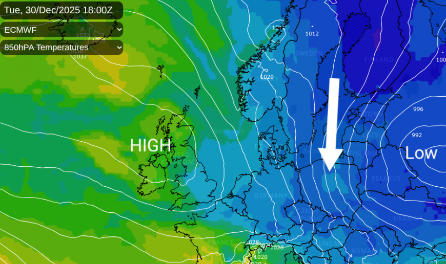
Looking at the temperature charts for the 30th, the cold air (indicated by deeper blues) has been steered southwards to Germany by a low-pressure system over western Russia anchored by our steady high pressure extending over the North Atlantic. Northern Poland has seen heavy snow and ice, with red and amber weather warnings on Tuesday in the cold northerly flow. Eastern Europe will be in the grip of perishing cold for the end of 2025.
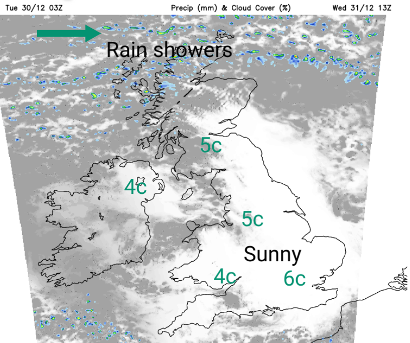
The showers over eastern Britain will fade tonight as the wind turns to a westerly. There will be frost in places. Many areas will become dry and sunny, quite a change after the cloudy blanket of the past week. There will be rain showers in the far north which will become heavier for Wednesday evening, as the westerly wind veers to the northwest and strenghtens over Scotland.
New Year’s Eve
Wales and most of England - Dry and cold. London 2C feels like -2C, frosty, dry but only very light winds. Cardiff by midnight, 2C feels like 0C on a calm, dry night
Far north of England, Scotland and Northern Ireland- a nippy westerly wind with clear spells then bands of rain showers from the north. By midnight, showers turning wintry with a cold NW wind.
Belfast dry, cold and breezy by midnight 5C feels like 0C. Leeds 31st 4c feels like 0C cold but dry and breezy
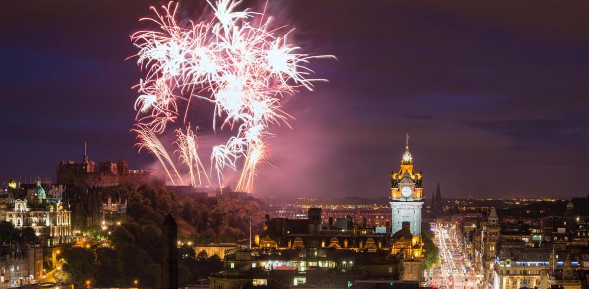
For Hogmanay, Edinburgh +4C feels like 0C in the wind with a chance of a sleety rain shower, Glasgow looks wet 6C but feels like 2C with the wind and rain, Aberdeen 4C feels like 0C in the wind with icy rain or sleet showers. Northwesterly gales for Orkney at the Bells.
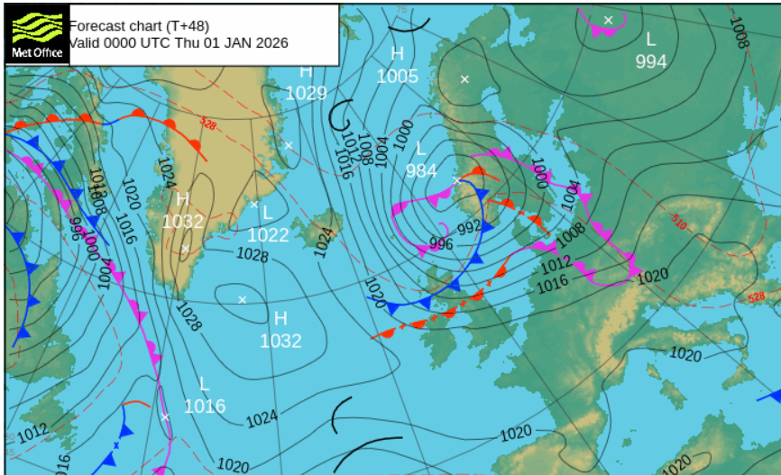
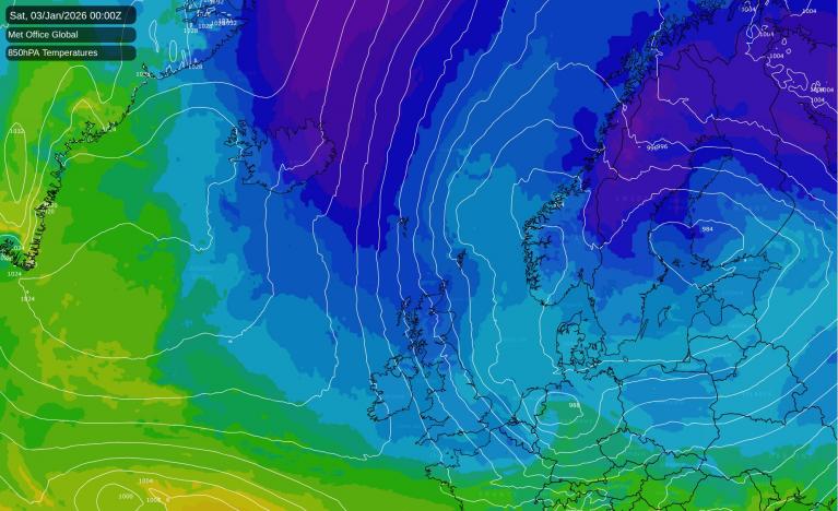
You might be thinking that it is cold enough already but a raw-feeling flow from the Arctic will develop for January 1st. A new low pressure will form in the Arctic Circle, near to Greenland, and will drift southeastwards towards Norway. A clue to the change of airmass can be found on the Met Office surface pressure charts. The red dashed lines show constant height or thickness lines. This is the vertical distance between the 1000mb (near the ground) and 500mb (middle of our atmosphere) pressure levels. Warm air is less dense and so the levels would be further apart; the thickness is greater. Cold air is denser and when the thickness is below 5280m that is a signal for UK snow. 5280m is shortened to 528 dam (decametres) and forecasters talk about the 528 line. It is a 'rule of thumb' not a guarantee of snow but that the air is cold enough for any precipitation to fall as snow.
That 528 line starts over Iceland on Wednesday, but by Friday 2nd it right down to southern England. Colder air is on its way.
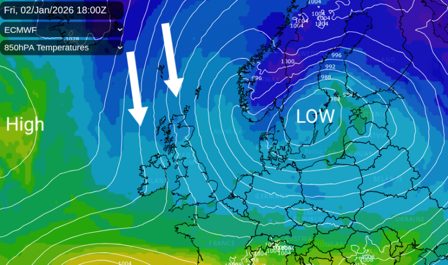
As the Arctic low begins to dominate over southern Scandinavia, the bitter cold in the east will edge away from Ukraine and the Baltic States, as Arctic cold air will sink down through Norway and the Norwegian Sea resulting in a colder weekend for the UK.
2026
January the first could be white from frost where the winds are light, but northern Scotland could see a covering of snow for First Footers as the feed of snow showers from the north strengthens.
There will be snow showers for the first few days of the new year, focused on the northern half of Scotland but reaching Northern Ireland and Wales in the NNW flow. As this flow veers to a northerly, some of the wintry showers will reach down North Sea coasts with a few bands of mixed showers working their way right down through Britain.
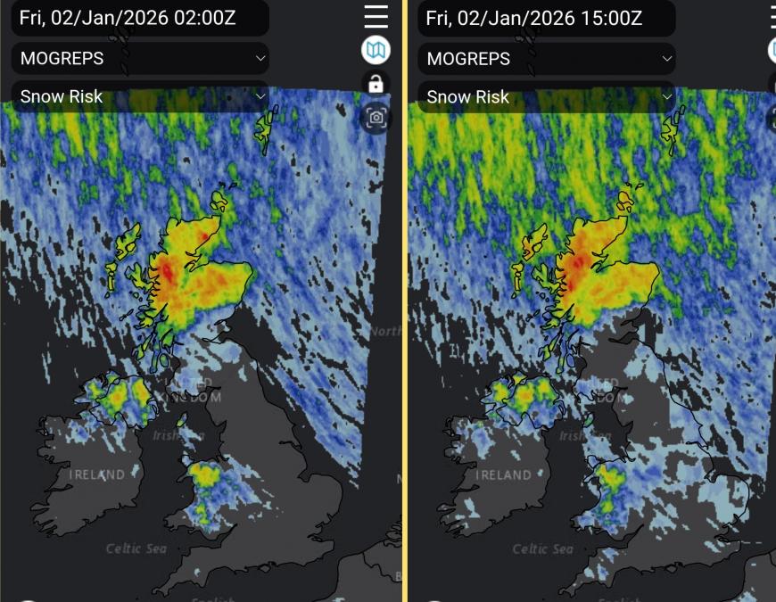
NW flow veering to a true northerly with wintry showers reaching eastern Britain during Friday
If you are in northern Scotland, do prepare for winter weather, lying snow and ice, and find the sledge. Elsewhere in the north, any snow showers will be scattered and dependent on the wind direction. For many in the south and through the central counties of England, it will stay dry and very cold.
By the weekend, Leeds +1C feels like -6C , London +3C feels like -2C, Cardiff +3C feels like -2C, Belfast +2C feels like -3C with snow , Edinburgh 0C feels like -6C dry, Aberdeen 0C feels like -8C in a fresh NW wind with frequent snow showers.
Loading recent activity...