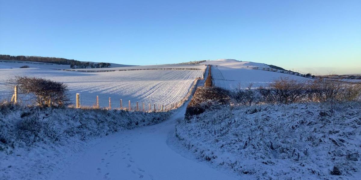
Happy New Year from the Netweather team. As we start 2026, it’s looking to remain cold for the next 5 days at least and perhaps through the whole of next week too. It’s been chilly since before Christmas, but it will turn colder still, as an increasingly cold arctic northerly flow develops over the next few days, bringing cold days and frosty nights, with a risk of snow and ice. The Met Office have issued Amber and Yellow Warnings for snow for the north and northeast of Scotland, while Yellow Warnings for snow and ice for N. Ireland and parts of Wales, Midlands and southern England have been issued for Friday morning.
The cold conditions linger into next week and with it the risk of snow showers towards coasts. However, there are signs that Atlantic systems approaching from the west may try and attempt to shift the cold air away from the middle of next week, but uncertainty over this outcome, it may stay cold for the north or all parts of the UK.
For now, a cold front is sweeping south this morning, a few rain showers along it across the west, but not much more than a band of cloud as the front clears the south coast this afternoon. Bright for a time ahead of the front in the far south, colder arctic air following the front, but mostly dry with sunny spells away from northern Scotland and the west, which will see showers, most frequent in the far north. Showers will fall as snow across Scotland, with a Met Office yellow warning for snow in force for snow and ice from 6am until midnight tomorrow, for accumulations of 10cm locally by tomorrow morning, over 20cm above 200m.
Temperatures reaching 3-6C this afternoon across Scotland, 6-8C across N. Ireland, England and Wales.
Tonight, northern Scotland will see further snow showers throughout the night, giving increasing accumulations. A band of patchy sleet and snow along a frontal wave sliding southeast will also move across Northern Ireland, then Wales, the Midlands and down towards southern England overnight, reaching SE England before dawn. A dusting or a few centimeters possible in places, so a risk of slippery surfaces to watch out for for those out first thing. Elsewhere mostly dry, cold and frosty overnight.
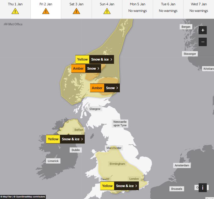
Patchy rain, sleet and snow will clear the far south first thing on Friday morning, then a mostly dry and sunny but cold day, away from northern Scotland - which will see frequent snow showers bringing further accumulations which will continue though the weekend too. The Met Office have issued Amber Warnings for snow for N & NE Scotland, which will come into force from noon tomorrow through to noon Saturday. 30-40cm possible over higher ground stated in the warning. But the snow showers carry on after the end of the warning into early next week, so could be more than that for high ground and coastal areas exposed to the northerly wind.

Northern Ireland, which has a yellow warning for snow and ice for Friday, Wales and SW England see some wintry showers too, falling as snow inland. Temperatures reaching 2-5C at best generally, perhaps 6-7C across the southwest. Quite a wind chill in the cold northerly wind, making it feel like it’s below freezing.
Both Saturday and Sunday will have a similar story of being rather cold everywhere in the brisk northerly wind. Further snow showers across northern Scotland, those Amber warnings in force until noon Saturday, then yellow warning for snow and ice through until midnight Sunday.
Also sleet and snow showers for northern facing coasts of N. Ireland, Wales, SW England and along the eastern coastline of England over the weekend. A yellow warning for snow and ice for Saturday along the North Sea coasts of England. Otherwise dry with winter sunshine. Temperatures reaching 0-2C at best during the day, though a little less cold in the far west. The wind chill will make it feel like it’s well below freezing though. A widespread hard frost overnight where skies stay clear.

Further sleet and snow showers across the north of Scotland and coastal areas of the east and west on Monday, especially the morning, otherwise dry and cold with plenty of winter sunshine, the northerly wind and showers easing into the afternoon, as a ridge of high pressure builds in from the west.
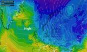
Uncertainty grows thereafter, with models for a few days now signalling an attempt of a breakdown of the cold arimass over the UK from the west, as the blocking high pressure ridge to the west and northwest, allowing the cold air to sweep south, weakens and allows a route for low pressure systems to move across the North Atlantic towards the UK. Where these lows track is uncertain, but on the northern and eastern flanks of these lows moving off the Atlantic there could be a spell of snow, while rain is likely on the southern side of the lows in the milder air. But it is likely to stay on the cold side next week in the north, with a risk of snow at times and overnight frost. Southern areas less certain, could turn less cold, with a mix of rain, sleet and hill snow at times.
Loading recent activity...