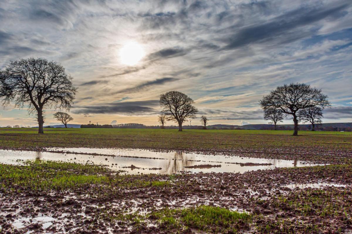
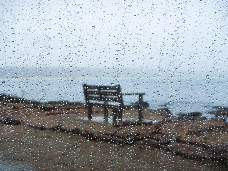
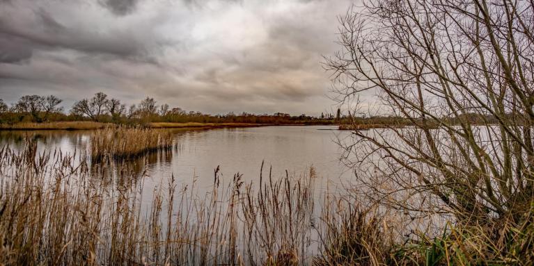
We face another week of wind and rain heading in from the west. There has already been plenty of wet weather this month, and it was a very wet weekend for parts of western Britain, particularly for Cumbria. Yellow rain warnings continue for parts of England and Wales but it is south Wales with the Amber warning on Monday.
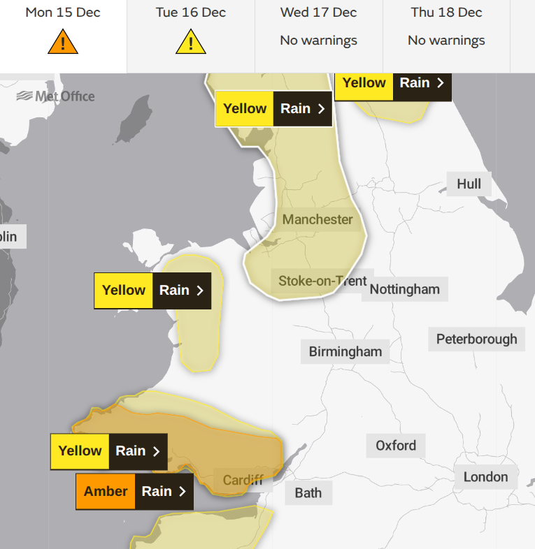
The Amber rain warning has a medium likelihood and a medium impact.
“Heavy rain is expected across parts of south and southwest Wales during Monday. 50-80 mm of rain is likely to fall quite widely with some places seeing close to 100 mm. Given the recent wet weather and saturated ground, the likelihood of impacts is higher…leading to travel disruption and flooding.” MO
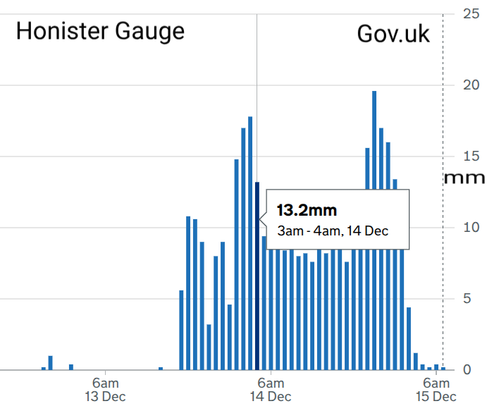
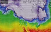
Over a month’s worth of rain fell in places, with the Lake District seeing over 200mm of rain with an amber warning on Sunday. The Honister Pass B5289 saw the UK's highest rainfall in 24 hours back in Storm Desmond 2015 and had a very wet weekend a bit over ten years later. For eastern and northeastern Britain, there has been more shelter with drier weather, albeit often windy.
A change for Christmas week
Although we have further bouts of heavy rain and strong winds through this week, Christmas week looks to bring a change. By Christmas Eve, we could see high pressure building over the UK. This would bring more settled conditions. Also less mild air, maybe turning colder but if you are looking for snow, at the moment it just looks drier and steadier.
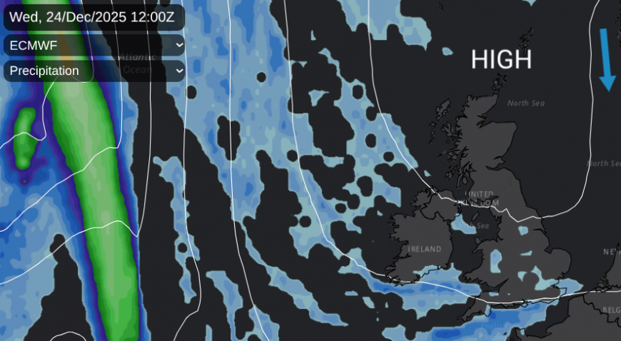
The air circulates around a high pressure clockwise, it is an anticyclone. If we do develop a colder high, there could be a flow southwards down the North Sea but you might look for an Atlantic weather front that manages to nudge in from the northwest. If this came up against colder air, especially later on Christmas Day it might produce a bit of wet snow,espeacilly over the Scottish Highlands. At the moment, it is not looking like a winter wonderland with a blanket of white snow. We would love that at Netweather, but for now its just looking more settled next week.
More rain this week
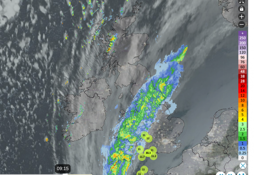
Back to the rain of this week. The problem has been a frontal boundary between high pressure over mainland Europe and the active Atlantic. The same frontal rain band which brought the wet weather at the weekend is still with us and it is rather stuck. Monday has been wet for Yorkshire, the Peak District and Yorkshire Dales, Merseyside and much of Wales in Cornwall and the Moors of Devon. Either side of this band is drier, brighter weather. Still mild for southeast England at 9 or 10C but colder to the northwest of the band, at 4 or 5C. And there are blustery showers coming into the Western Isles and NW Highlands.
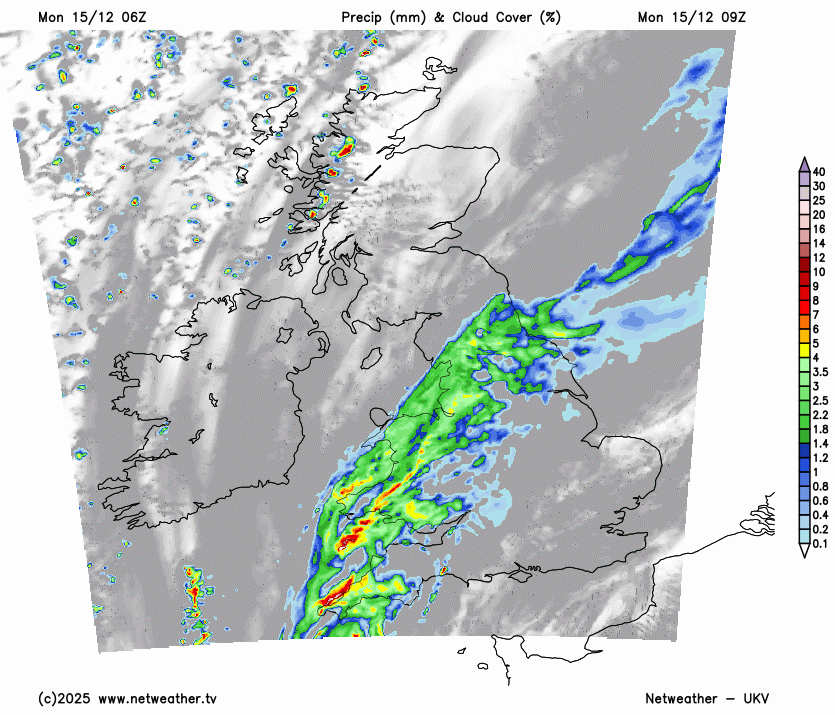
This conveyor of rain will continue today, focused on southern Wales, where the air lifts and cools over the hills, depositing more rain. The amber warning runs into Monday evening for south Wales. Heavier rain on the UKV Model heads for the Bristol Channel region through this afternoon and across the West Country. The rainband will become more patchy later on Monday and will move away from Wales. There will be overnight rain for central southern England, the Midlands up to North Yorkshire.
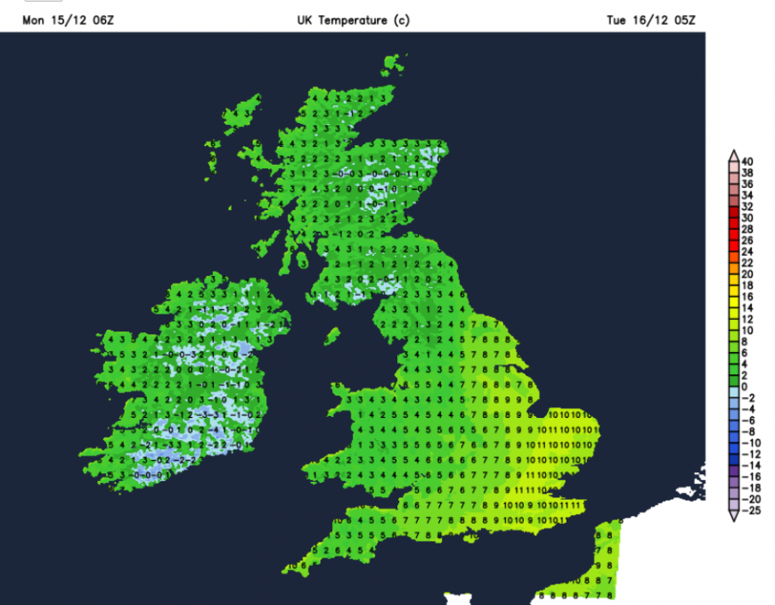
This leaves a cold and frosty Monday night in the north and west, but still mild to the southeast of the frontal divide. Quite a stark temperature difference across Britain by Tuesday morning. There could be some early fog for northwest Britain after all the wet weather and as temperatures fall to around freezing. Although there will be the dregs of the front over London and the Home Counties, into East Anglia on Tuesday, much of the UK will see a fine Tuesday, with sunshine but colder air. And a cold first part of the night later on Tuesday with fog forming in southern Britain as temperatures fall.
The environment agencies’ outlook for the next five days highlights the river flooding risk for Cumbria and other weather-warned areas on Monday
“Ongoing local river flooding is expected for parts of the North of England until Wednesday and the River Severn from today until Thursday. Further heavy and persistent rainfall on Thursday means that local inland flooding will be possible for the North West and South West of England.”
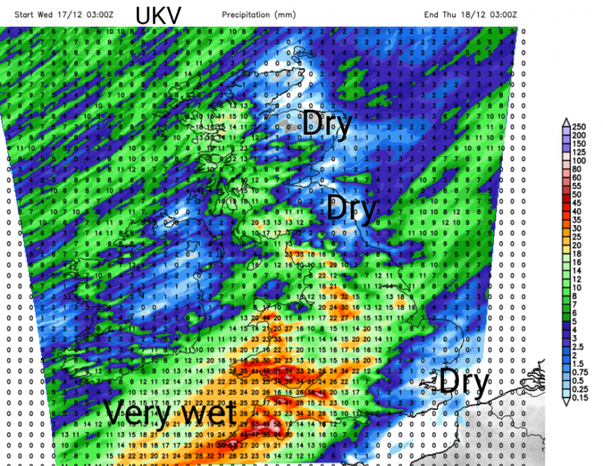
After the quieter lull on Tuesday, the Atlantic starts again with more wet and windy weather arriving from the west for Wednesday and Thursday.
Loading recent activity...