This week will see bouts of wet and windy weather as Atlantic low pressures bring rain and heavy showers. The high pressure from last week is now away over the Black Sea and low pressure moved over the UK on Sunday. This brought heavy rain to Northern Ireland on Sunday, with torrents of water flowing off the Mourne Mountains into flood-prone towns of County Down. This surface water flooding saw streets full of water with debris, including stones and rubble. Although there will be more wet weather for Northern Ireland this week, it won’t be anything like the torrents of the past weekend.
For Monday, it is southern Britain where the threat of heavy, even thundery showers. The Netweather Convective forecast
“strongest instability (and deep convection/lightning) most likely towards southern coastal areas of Wales and England – where relatively warm Sea Surface Temperatures, beneath cold air aloft, will cause more buoyancy of unstable air, given weak surface heating in sunny spells now. Lightning more isolated inland. Hail and gusty winds will accompany stronger convection”
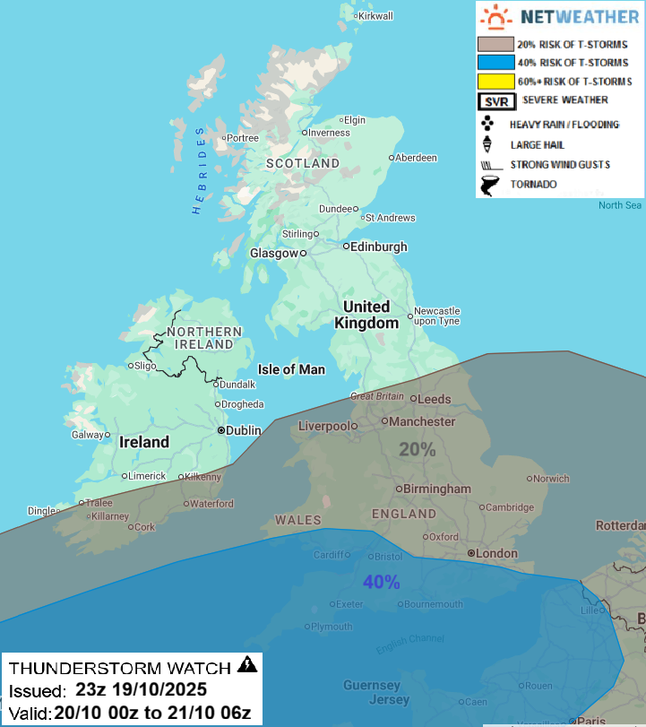
These downpours could cause some tricky conditions on the roads with surface water and spray, also poor visibility at times. This evening, the showers over England and Wales will fade, taking their time over Wales into Monday night.
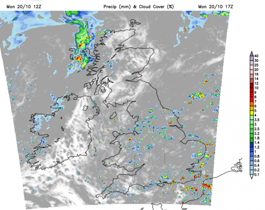
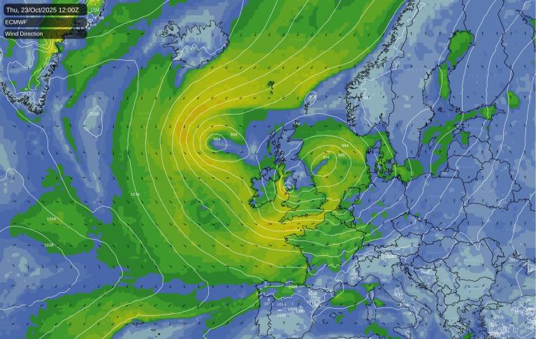
The winds will be light and western Scotland will see more rain as occlusions curl into the far northwest but also reaching County Down for a time tonight before clearing eastwards. The low centre over southern Britain will move eastwards towards Denmark but a stubborn low centre will emerge to the north of Scotland. The occluded bands will move over northern Britain with more showers and bands of rain for northern parts of the UK as England could see more sunny spells in the morning. Northern Ireland will brighten up but there will be a rash of showers for Tuesday afternoon. Tuesday will be breezy and so will feel colder as cool air tucks around from the northwest. The low pressure in the north will dominate and it will become windy for Scotland through the day with gales and rough seas along the north coast.
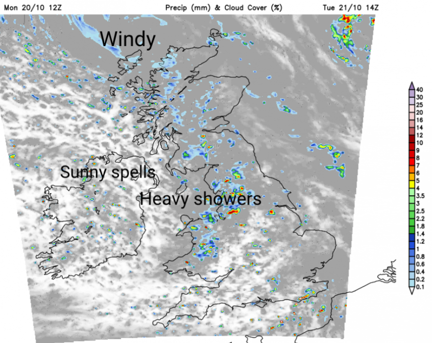
Although the strong winds and scattered showers will continue in the far north of Scotland, elsewhere Wednesday should become a better day. With fewer showers and more sunshine, there will be light winds for many. England, Wales and Northern Ireland will be around 12 to 15C. More showers will arrive over Ireland later on Wednesday linked to a new occlusion. Scotland will feel colder, especially in the north. What will need watching is the waving frontal band to the southwest. This is the start of developing low which could bring rain through the English Channel on Wednesday and into the night.
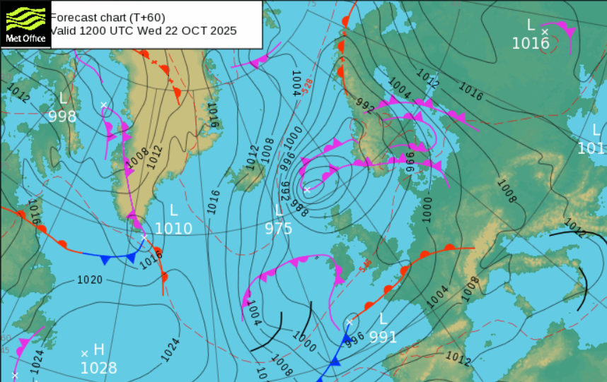
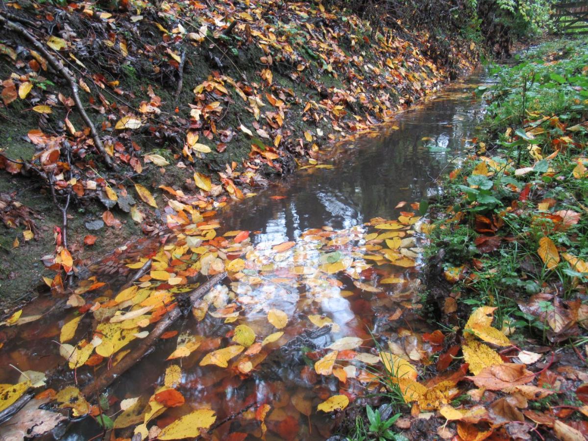
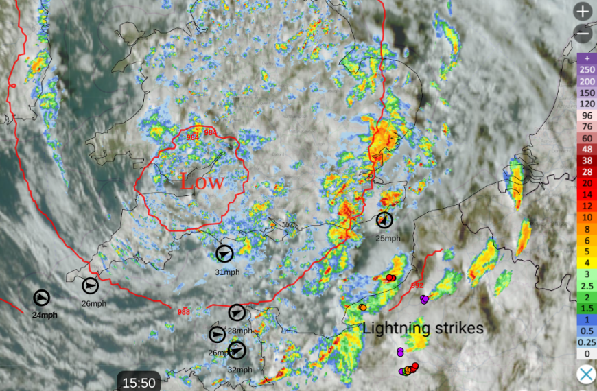
The next storm name on the list is Bram, following Storm Amy. There are no signs yet that we will have a named storm this week. There is a lot of uncertainty in the forecast as two low centres move around each other in the middle of the week. The most recent runs of the model have pulled back slightly from developing the low over southern Britain by Thursday, which had hinted at wind disruption for eastern England. This could now be offshore in the North Sea. And yet there could be heavy rain over southern and eastern England during Wednesday night and early on Thursday. At this time of year, it can be the falling leaves blocking the drains which cause problems with surface water flooding. The low close to Scotland will continue to lurk and rotate with a feed of showers and the risk of gales. Thursday will be windy. Do keep an eye on the forecast as confidence is low at the moment.
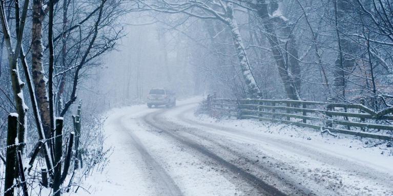
The end of the week looks colder, into the weekend as the flow changes to a northerly. Even with snow for the Scottish mountains.
Ongoing drought
Parts of Britain will be very grateful for any rain. More areas went into official drought this month, in Yorkshire and East Sussex.
17th October- Environment Agency issues further six drought permits to Yorkshire Water to allow them to conserve water in reservoirs to secure public drinking water supplies.
Claire Barrow, Environment Agency (EA) Yorkshire Drought Manager, said: “Although we expect to see more wet weather over the autumn and winter it will take significant rain over several months to refill rivers and reservoirs, without which water supplies will continue to decline.”
10th October- EA moves to drought status for the area supplied by South East Water in Sussex.
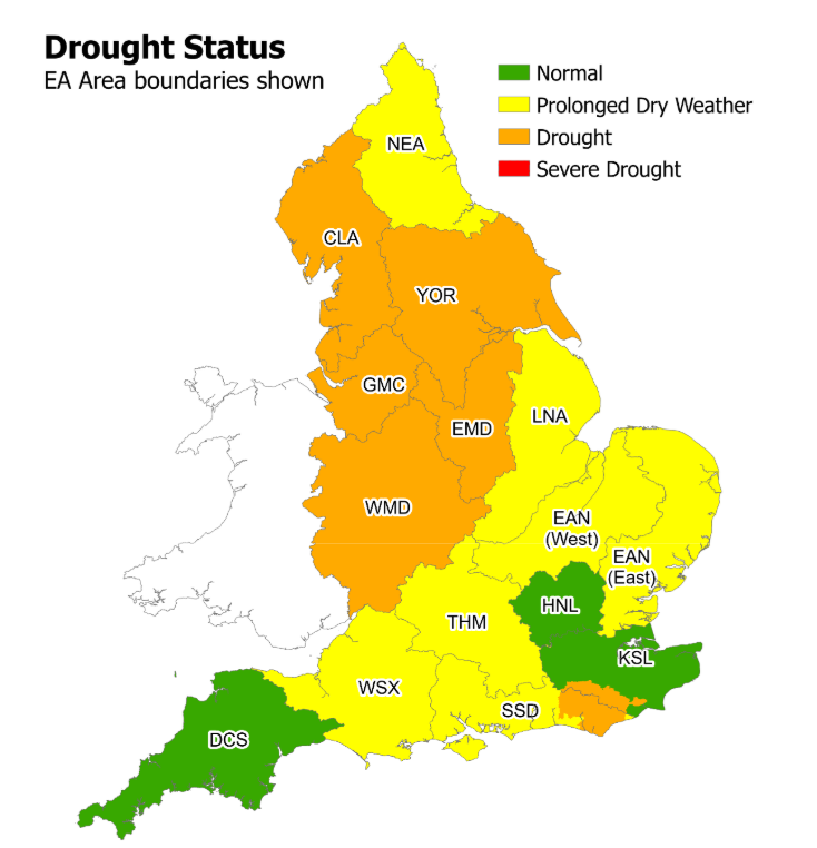
Experts have warned it will take a wet autumn and winter to reverse the impacts of several continuous months of below average rainfall. It can take a long time with sustained rainfall to fully replenish groundwaters, reservoirs and rivers; and the environment can take even longer to recover.
Richard O’Callaghan, Area Environment Manager at the EA said: “we must be sensible about water use all the time, not just some of the time. A few bursts of recent rainfall do not undo several dry months of cumulative impact.”
Three areas in NE Scotland remain at Significant Water Scarcity with other Moderate Scarcity in the Grampian region.
The National Drought Group - which includes the Met Office, government, regulators, water companies, the National Farmers’ Union, Canal & River Trust, anglers, and conservation experts – continues to monitor the situation and will next meet on 30 October.
Loading recent activity...