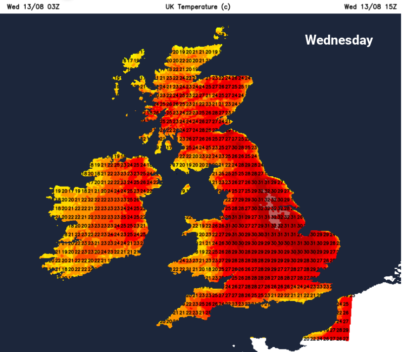
The heat continues on Wednesday. There is some cloud about this morning, bringing some relief perhaps, with a dampness in the air. However, Northern Ireland, southern Scotland, down through northern England, inland Wales, the Midlands across to East Anglia have clear sunshine and the temperatures are already responding, passing 20C by 8am in places.
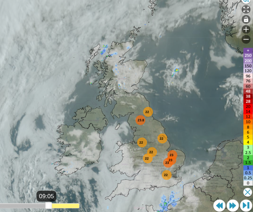
Netweather Radar with top ten temperatures, showing cloud in SW and Irish Sea. A few showers over northern Scotland
Today could see temperatures reach 33 to perhaps 35C with the focus for the heat for eastern England. Even Scotland could get near to 30C somewhere today as some head back to school. These high temperatures require the sunshine to do its work once more, as the intense heat from Europe continues to spill northwards, giving us the warm, close nights that can make it difficult to sleep.
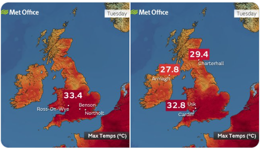
Ross-on-Wye, Benson and Northolt reached 33.4C on Tuesday, Yeovil 33.2C and Cardiff 32.8C as a scattering of locations reached official heatwave conditions with three days above their threshold temperature. These vary from 25 to 28C across the UK.
The UK has seen temperatures up to 40.3C, back in the summer heatwave of 2022. We are beginning to have more humidity, which makes the air feel more uncomfortable. Southwestern Britain has seen a cloudy start. There will be medium-level cloud over southeastern England and East Anglia this evening and overnight with a few big raindrops. There is the risk of heavy showers, even thunderstorms, for a few northern areas today, particularly for Scotland. However, within those risk areas, the storms won’t affect everyone. It’s a risk, not a certainty, for much of the UK. Wednesday will be another warm or hot day with a lot of fine weather.
Summer thunderstorms aren’t even that useful for water supplies as the sudden downpours can’t usually soak into the ground. There is usually just a lot of runoff water, the risk of flash flooding and then conditions return to how they were. The drought conditions need long-term seasonal rainfall.
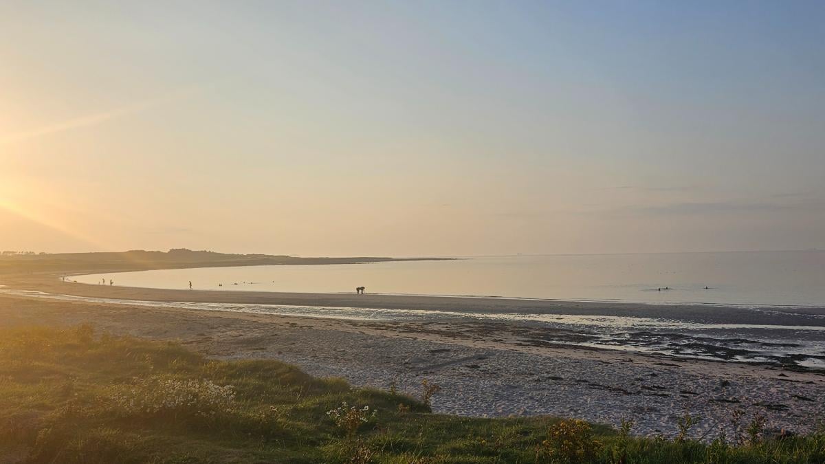
The breeze is from the south and coastal areas will feel a bit more comfortable as temperatures inland rise into the high 20s and the 30sC.
Scotland might see isolated thunderstorms by day but there could be a few developing over western Ireland tonight, which move over Northern Ireland and into SW Scotland. Again, most areas will miss these.
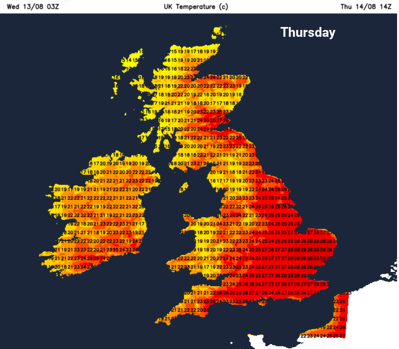
The hot air and heat will be edging eastwards as a more westerly breeze picks up and allows more comfortable conditions to creep in from Ireland. Northeastern Scotland keeps the risk of heavy thundery showers on Thursday as Wales and other western parts of Britain see more cloud and just a few showers.

Temperatures are more likely to be in the 20s Celsius on Thursday, still very warm for eastern and southeastern Britain but not as oppressive as midweek. By Thursday evening, there could be isolated thundery showers for northeastern Britain, something to just watch out for and keep an eye on the Netweather Radar.
By Friday, with a light flow from the north or northeast, some areas will feel quite different with more cloud, especially on exposed coasts but the southern half of the UK continues to feel very warm or hot. Temperatures in southern England could still reach 29 to 31C.
Loading recent activity...