Despite a week of cooler north-westerly winds, July 2025 is still shaping up to be considerably warmer than average in most parts of the country, especially in England and in the north and east of Scotland, though with less marked positive anomalies elsewhere. The mean maximum temperature for this month has been around 26C in London, compared with a 1991-2020 long-term normal of about 23.5C, and it has been around 23C in Manchester, compared with a long-term normal of about 20.5C. Remarkably, in the Central England Temperature series it is looking set to be at least as warm overall as July 2022, which saw that record smashing 40 degree heatwave on the 19th. However, it looks highly unlikely to be as hot as the Julys of 1983, 2006 and 2018.
As expected, this spell of north-westerlies has been cloudier than we saw earlier in the month, with just occasional sunny days. Sunshine, which had been running above average in most parts of the country around mid-July, is now looking set to come out below average in most regions, despite the spell of hot and sunny weather in the second week. Rainfall has also been raised above the long-term normal in most parts of England, although western Scotland is potentially looking at a considerably drier than average July.
The generally north-westerly type is looking set to persist for the rest of July, but especially with high sea surface temperatures to the west of Britain, temperatures will probably be no lower than average for the time of year, meaning that July is still looking set to be a very warm month overall. It looks set to be quite dry except in north-west Scotland, though with some light rain or showers around from time to time, and quite cloudy.
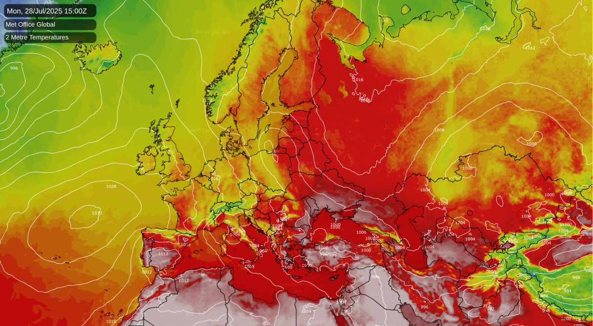
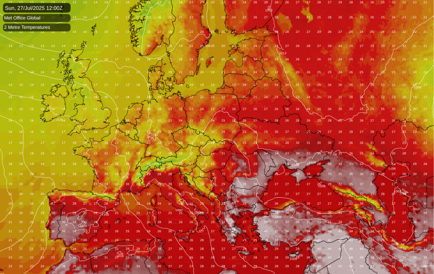
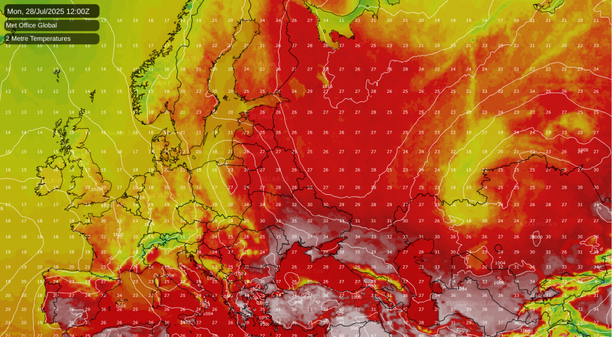
There is an exceptional heatwave ongoing in south-eastern Europe, where parts of Greece and Turkey have exceeded 40C, and locally reached 44C. Temperatures in the low to mid-40s Celsius are again forecast over a wide area of south-east Europe today, but through Sunday and Monday the heat will push away eastwards, with cooler north to north-westerlies spreading in off the North Atlantic.
On the eastern flank of the persistent low pressure over western Scandinavia, which has been contributing to the recent cooler north-westerlies in central and western Europe, it has often been hot in Finland, and exceptionally so to the north of the Arctic Circle, with temperatures widely reaching between 25 and 30C. Unlike in south-eastern Europe, this heatwave in north-eastern Scandinavia, especially northern Finland, is forecast to persist for another week, with persistent high pressure over Russia and low pressure over western Scandinavia maintaining a persistent southerly or south-easterly flow over much of Finland.
Parts of Spain and Portugal will also be hot at times, but for the rest of central and western Europe, a persistent north-westerly airflow will prevent substantial heat from developing during the coming week, with temperatures generally near or below normal over the region. Most of France, except the far east, is expected to be predominantly dry, with the Azores High close by to the west, but there will be frequent showers and longer spells of rain in the more central parts of Europe, including Germany and around the Alps.
There are signs that as we head through early August, ridges of high pressure branching off from the main Azores High may start to push further north and east, bringing warmer/hotter and sunnier conditions to western Europe, including the British Isles. However, confidence in this is currently relatively low, as this shift looks unlikely to happen until around 10 days’ time. Longer range outputs from the GFS model indicate that, from there, it won’t take much to get some of that hot weather in Spain and Portugal spreading back northwards through western Europe, should one of those ridges of high pressure head eastwards into central Europe. Again, though, this is a long way off, and substantial heat through Britain and France looks unlikely for at least another 10 days.
Despite a relatively cool and changeable weather regime during the next 10 days, it also looks set to be drier than average during the next 10 days, not just in the majority of Britain but also France. This morning’s 00Z GFS run suggested less than 5mm of rain over a large area of England in the next 10 days. However, in this type of pattern there is potential for the odd low to track further south and bring more widespread rain, and so for example this morning’s ECMWF run has more substantial rain across Britain in about 7 to 10 days’ time. But both models runs are agreed that some areas of France, particularly central western France, could end up completely dry during the next 10 days.
Loading recent activity...