
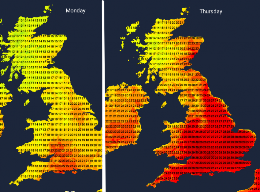
The heatwave conditions are returning this week. For England and Wales, it will feel hotter by Wednesday and that heat and humidity will only grow as we head to the weekend. The warmer conditions will reach northwards into eastern Scotland. By Friday, much of the UK will be hotting up. For southern Britain, temperatures will be moving into the low 30s on Friday and stay there for the weekend, into the start of next week, with the likelihood of some Tropical Nights, (when the overnight minimums stay at or above 20C, adding to the heat stress for some people).
So it’s going to be hot and sunny, it’s July, it’s summer. And you may love the heat, enjoy being in humidity and sunshine and not be facing a commute on the London Underground or a long car journey. For other people, the prospect of high heat and humidity will cause concerns or should flag changes in behaviour so that they are not adversely impacted by the ‘severe weather conditions’. Severe weather can be torrential rain, heavy snow, gales or fog which may impact your daily life or have wider impacts for communities, health providers or on the transport network.
Heatwaves also do this, and there are specific alerts (Heat-Health Alerts) which “are aimed at professionals within the health and social care sector, those who have a role in responding to hot weather”. For yourself, if you are on medication, now might be the time to research how it needs to be stored in times of higher temperatures to remain effective and if you need to take extra care as the heat sets in.
“Extreme heat not only affects us but can also place strains on water and energy utilities, road and rail transport and the health and fire services.” Met Office
Back in July 2022, the UK, England, Wales and Scotland's highest temperature records were broken. The highest UK temperature ever recorded was 40.3C in Lincolnshire and the UK saw its first red Extreme Heat warning issued (a relatively new type of Met Office warning).
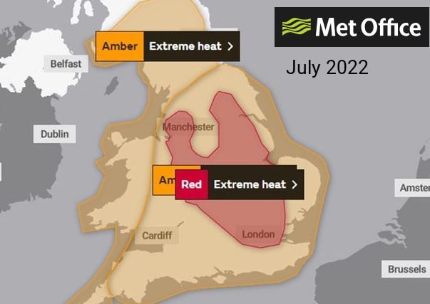
The red and amber Extreme Heat warnings from the UK Met Office in the record-breaking summer of 2022
The impacts of heatwaves are not just adverse health effects, which can be very serious. Working practices may need to be adjusted. Heat-sensitive systems and equipment may fail, leading to power cuts and the loss of other essential services. Delays on the roads are likely, leading to frustration and exposure. There were issues on the railways in the previous heatwave episode at the end of June as the sun beat down on steel rails and metal overhead wires. Network Rail does paint some of the rails white in the spring, ready for the summer heat.
More people, especially children, visit beaches, rivers and lakes, which brings a risk of water safety incidents. It is already summer holiday time in Scotland and Northern Ireland. These upcoming situations, conditions and scenarios can be highlighted so that people can make informed decisions, perhaps adapt plans and hopefully lessen any strain on the emergency services.
The main advice in the previous two UK summer 2025 heatwaves has been to “Keep out of the sun as much as possible at the hottest time of the day (between 11am and 3pm)”, to slow down and to drink plenty of fluids, particularly water. In France last week, as their heatwave continued, people were advised not to go out between 11am and 9pm.
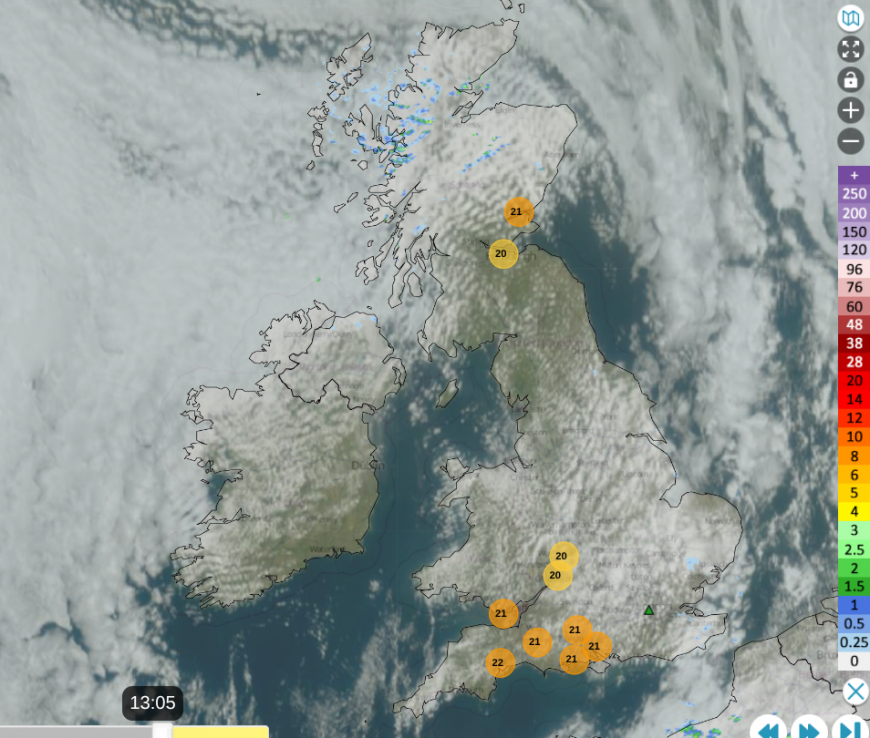
There have been amber and red extreme heat warnings this month across mainland Europe, as our relief arrived in early July from an Atlantic weather front. This has brought fresher conditions, and some welcome rain through the weekend.
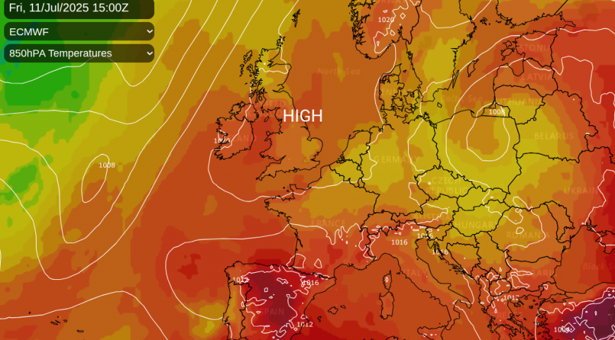
High pressure will build in from the Azores and settle our weather down. There will be weather fronts grazing northwestern parts over the next few days with a bit of rain but the overall theme is towards dry, sunny weather with very light winds. Under this steady setup, the land and so the air at the surface with heat up, day by day. Air pollution levels will rise too.
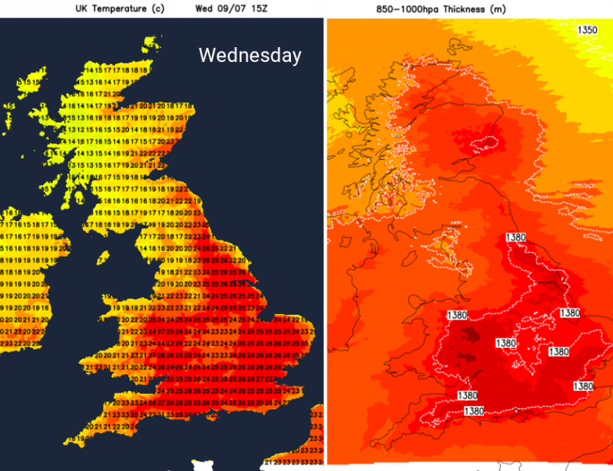
By Wednesday, central and eastern Scotland will be in the low 20sC, Belfast 22C. For England and Wales, it will be the low to mid 20sC with some spots reaching 27 or 28C. As the heat continues to build, it is expected that some parts of England will see Tropical Nights, and without a time for the body to cool down and recover, never mind the lack of sleep, this ongoing stress can cause health problems.
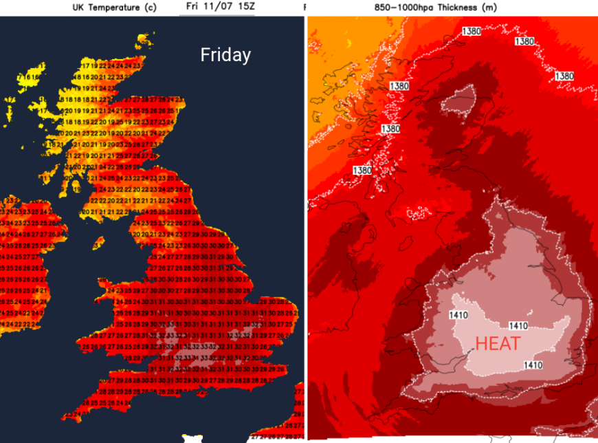
By Friday, parts of Scotland and Northern Ireland could reach 25C, which is the heatwave threshold temperature (three consecutive days are needed). Temperatures inland for England and Wales will be moving up to the high 20sC and into the low 30sC. The heat, humidity and discomfort by night will only increase over the weekend, lasting into the start of next week. Prepare now if you have anything outstanding from the earlier heatwaves.
Loading recent activity...