For weeks, it was dry and sunny, but we have seen a dramatic change at the end of May, with welcome and much needed rain. There are signs that the temperatures will lift at the very end of the month, up into the 20s Celsius. There will be more rain and showers in the next few days, but the Met Office has announced that there has already been enough sunshine for this to be the sunniest spring on record.
“The UK has already recorded its sunniest spring on record, according to provisional Met Office figures. The UK has recorded 630 hours of sunshine from 1 March until 27 May, beating its previous sunniest spring in 2020 by 4 hours, in a series which dates back to 1910.”
Last week it was announced that both Scotland and Northern Ireland had seen their sunniest spring on record. Spring being the three months of March, April and May for statistical purposes. The full May and spring data will be released on Monday 2nd June by the UK Met Office. After the long dry spell, we will have to see how the rain at the end of the month has affected the overall rainfall figures. Also, how the shift away from the sunny high pressure has impacted the mean temperatures.
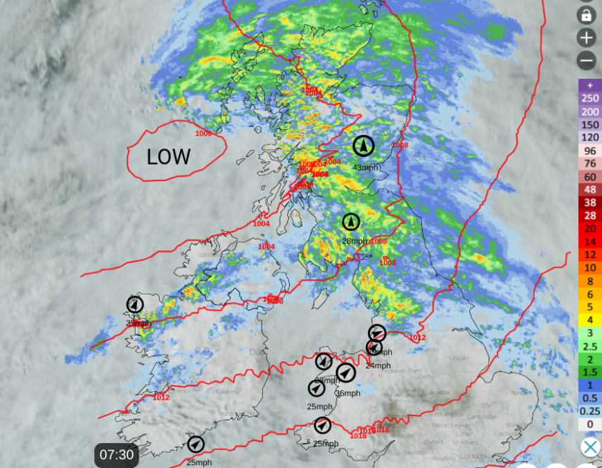
We have three more low pressures affecting the UK this week. One crossing the UK today that is bringing a wet and windy start to the day but it is mild out there with a lot of cloud. The warm front rain is clearing away into the North Sea, quickly away from eastern England with breaks appearing in the cloud. Cumbria and Dumfries & Galloway are seeing a soggy start to the day and the trailing cold front will bring further outbreaks of rain to parts of Scotland with showers over Northern Ireland. To the north of the frontal band, the winds will be light. For much of the UK, it will be a blustery day, with fresh west/SW winds for exposed parts. The wind will help break up the cloud cover and as the sunny spells appear, it will feel warm and more humid.
Temperatures in Scotland will be around 17 to 19C even up to 21C in the east, to the lee of high ground. Away from any showers, Northern Ireland will reach 18 or 19C today. Coastal parts of Wales will be around 16C but Cardiff should reach 19C with brighter skies this afternoon. Central, eastern and southern England will be around 20 to 22C today and northern England 16C for the coast of Lancashire and up to 20C for Tyne & Wear.
The low moves on tonight but leaves trailing weather fronts with distinct bands of rain. One over northern mainland Scotland with heavy bursts and another waving over the Irish Sea, into western Wales and northwest England and the Pennines. Southern Britain stays dry and mild.
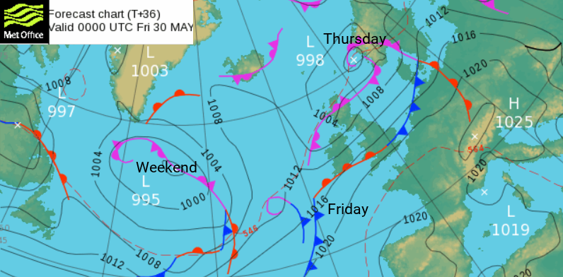
Friday
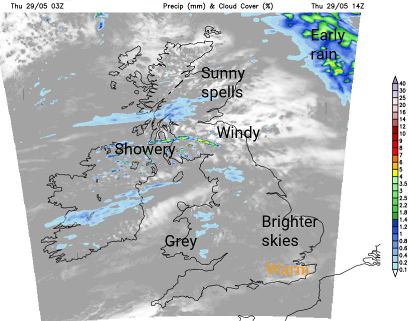
The waving frontal band in the south will continue to feed more cloud and patchy rain to western Wales. Here there will be grey skies and a damp day. There is some uncertainty about which other areas will stay grey, such as northwestern England, the West Midlands with damp weather for windward hills.
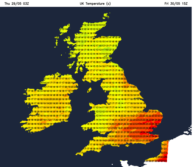
To the southeast of the cloud band will be warm and muggy air. Temperatures could rise to 24 perhaps 25C in London and the Home Counties. Across the UK, where the sunshine appears it will feel warm with temperatures of 18C to 21C
It will still be blustery for southern Scotland and northern England on Friday morning but elsewhere the winds will be easing to a light westerly by the afternoon. The lingering frontal bands will allow a scattering of sharp showers for southern Scotland and Northern Ireland, with a cluster around the Forth by Friday evening.
The warm, humid air will last into Saturday but Sunday will feel much fresher. Will it be hot?
Loading recent activity...