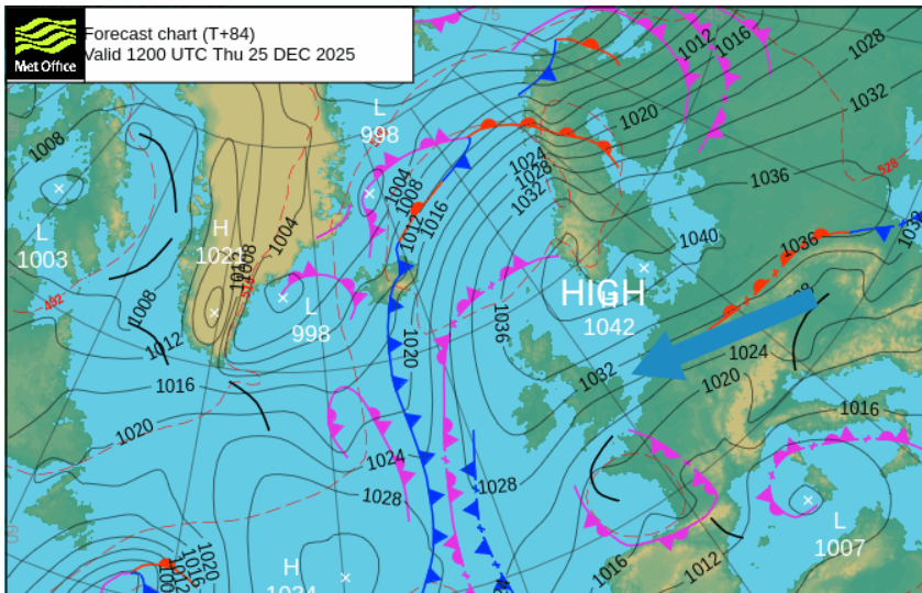
The run-up to Christmas looks settled and cold. This will be good news for those travelling this week. An absence of heavy rain, flooding and high winds should keep things moving on the rail and ferry network, and not add issues to the already busy roads. If you are packing to go away in the UK, take a woolly hat. It will feel cold in the developing brisk easterly wind. This wind will stop radiation fog from forming, although at times the skies will be grey and gloomy as a layer of cloud flows in off the North Sea. High pressure closer to Scotland will be steering the easterly flow over southern Britain, but the winds will be much lighter in the north with a frost.
If you are looking for snow (those on the Netweather community forum are always on the lookout for snow), it is all looking a bit disappointing. We do have the cold air, which is a strong signal for Christmas. It looks very dry; the UKV model doesn’t have any precipitation forecast for Christmas Day. There is a thickening band of cloud, which might bring a tiny bit of something northwards in the English Channel. Perhaps some rain to Plymouth, at a stretch, sleety over Dartmoor, but we are scraping about here. For those interested in the odds of a White Christmas, it’s not looking that encouraging, just dry.

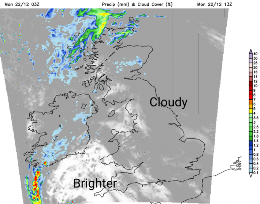
It is a mild and damp start on Monday. Frontal rain has been working its way northwards overnight, and as you can see on the radar, that is over Northern Ireland and Scotland before 9am. There is mild air from the southeast as a low centred off Cornwall remains in place. The rain will move over northern Scotland, leaving a better day for much of the UK. It will be mostly cloudy with patchy rain taking its time to clear from Northern Ireland. The cloud will be thicker over much of England, with murky conditions over the hills. For western Wales, SW England, and Cumbria, there should be bright spells at times. Temperatures today will be around 9 to 11C which is mild for December.
It won’t be especially cold overnight. There will be clear skies for northern Scotland with temperatures in rural spots down to 3C, but mostly staying at 6 to 8C.
The low pressure to the southwest will throw a few showery bands over SW Britain during Monday night, and these will still be around for Devon and Cornwall on Tuesday morning. It will be a rather grey and gloomy day for most, with the best chance of brighter breaks for western Wales and NW Scotland. The thicker cloud off the North Sea will bring a gloomy, damp day with temperatures closer to average at 7C.
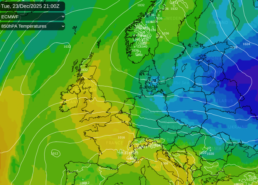
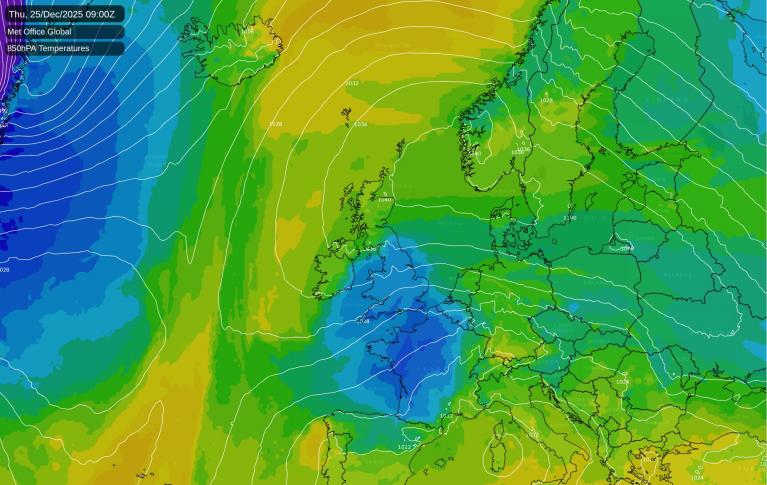
Across in Europe, there is a mass of cold air moving south from Finland and western Russia into Kazakhstan. With high pressure centred over southern Scandinavia on Tuesday, the flow around the bottom of the high pulls some of that cold air across mainland Europe. Although the source of the coldest air does get cut off, some of it will reach right across to England on Christmas Eve. Add on the brisk easterly wind, there will be significant wind chill as Santa starts his deliveries.
The colder air begins to arrive on Tuesday night across the North Sea as a new frontal band brings rain to the far north of Scotland with colder, clearer air from the northwest.
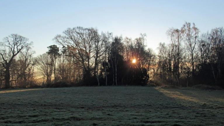
As the colder air reaches the UK, there will be more sunshine as the cloud breaks up. Don’t underestimate the cold as the easterly wind picks up for southern England. It might look nicer through the window, but it will be chilly. Air temperatures will be around 6C by day, down to 2 or 3C by night, but the wind chill for the southern half of the UK will slash the feels-like values. In the lighter winds, Northern Ireland, Scotland and northern England could all see a frosty-white Christmas morning but little sign of snow.
See what Santa has to say about the Christmas Day forecast.
Loading recent activity...