One of the main meteorological talking points during the past week has been the impacts of Hurricane Milton in Florida. The impacts have been compounded by this storm following shortly after Hurricane Helene, which hit the region in late September.
The hurricane hit Florida late on Wednesday and during Thursday as a Category 3 storm, producing tornadoes and extreme rainfall totals as well as severe winds, and the death toll at the time of writing is estimated to be at least 17. There is a widespread trail of devastation, and large scale efforts are currently underway to help residents, including sending out well over a million meal deliveries per day and attempting to restore power as quickly as possible. There are widespread power outages in the region, and there is also a fuel shortage at petrol stations.
As recently discussed by Nick Finnis, it looks unlikely that ex-hurricane Milton will head far enough across the North Atlantic to affect Britain, as it is looking set to dissipate rapidly over the next few days.
Temperatures during October so far have been running near to slightly below average, and Britain is currently experiencing below-average temperatures following a northerly outbreak on Thursday and Friday. Today we can expect bands of rain to push south-eastwards through the country, followed by drier weather and a further drop in temperature, bringing a widespread frost to Scotland.
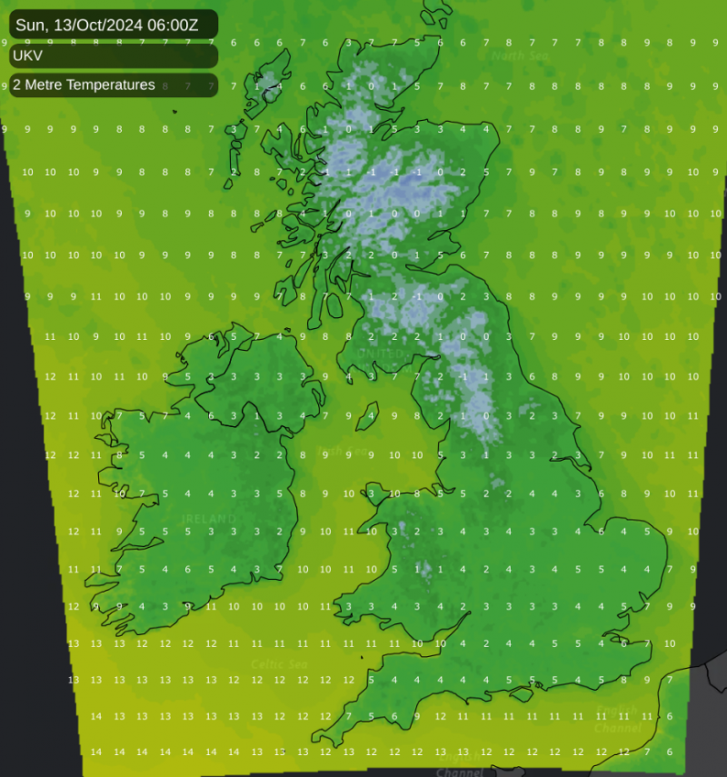
A ground frost will be quite widespread elsewhere, too, but with temperatures away from Scotland likely to remain above freezing except in prone frost hollows. Sunday looks set to be cool and sunny for most of us, but with cloud increasing in western areas during the afternoon and evening.
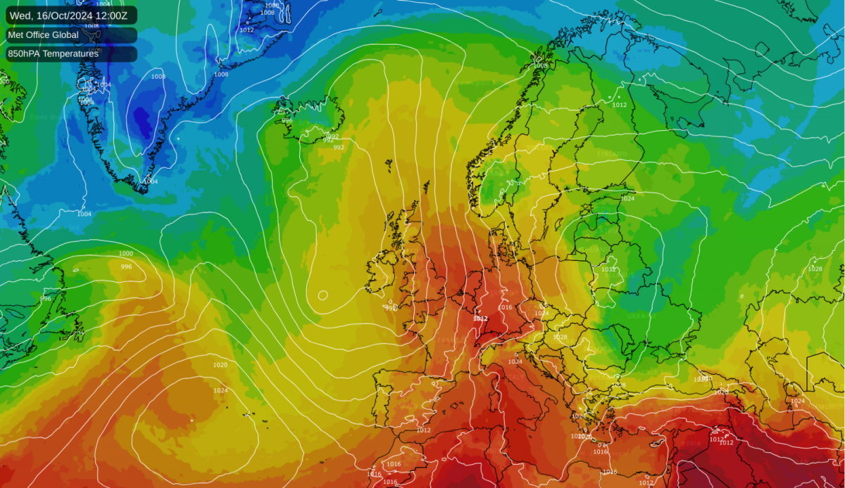
However, a marked change of weather pattern is forecast to set in next week, as temperatures are set to increase substantially, reaching well above average values for the time of year, due to a period of mainly southerly winds, pulling air masses all the way up from the Mediterranean. The warmth will peak on Wednesday and Thursday with many areas, especially in southern and eastern England, forecast to reach the low 20s Celsius on one or two of the days, which is not record-breaking for the time of year, but somewhat above the mid-October long-term average.
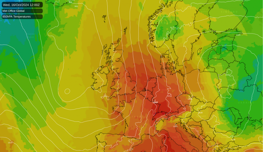
One or two of the nights has potential to be more exceptionally warm. There is potential for parts of England and Wales to see overnight minima of 14 to 16C overnight Wednesday/Thursday, which is close to what these regions would normally expect to see as a daytime maximum around mid-October.
After a quiet day tomorrow, the weather will turn more unsettled again, and there is potential for the southerly winds to bring some thunderstorms, particularly through Tuesday and Wednesday, mainly for southern Britain, especially south-west England. While thundery activity tends to decline somewhat as we head through the autumn, it is possible to get widespread thundery activity in October in this kind of setup, as was demonstrated several times during mid to late October 2022. However, it does not look likely that thunderstorms will feature substantially in Scotland or Northern Ireland, with any lightning activity associated with the systems tending to dissipate as they move northwards and north-eastwards across the land mass.
A generally south-westerly type is forecast to persist for much of the rest of October, which means that the weather will generally be warm and changeable, with the majority of the wind and rain especially affecting north-western Britain, and more frequent drier, quieter weather towards the south-east. There are signs that high pressure may build northwards during the last week of October, bringing drier, more settled weather especially to the southern half of Britain.
If this more settled weather materialises, it will probably remain warmer than average in Scotland for most of the time, with south-westerly winds likely to persist on the north-western flank of the areas of high pressure. However, temperatures may well fall closer to normal in most parts of England and Wales, especially in the south, with increased potential for cold nights and for fog patches to form overnight. Overall, despite a relatively cold first half, it looks likely that October as a whole will end up warmer than average, due to a likelihood of frequent southerly and south-westerly winds in the second half.
Loading recent activity...