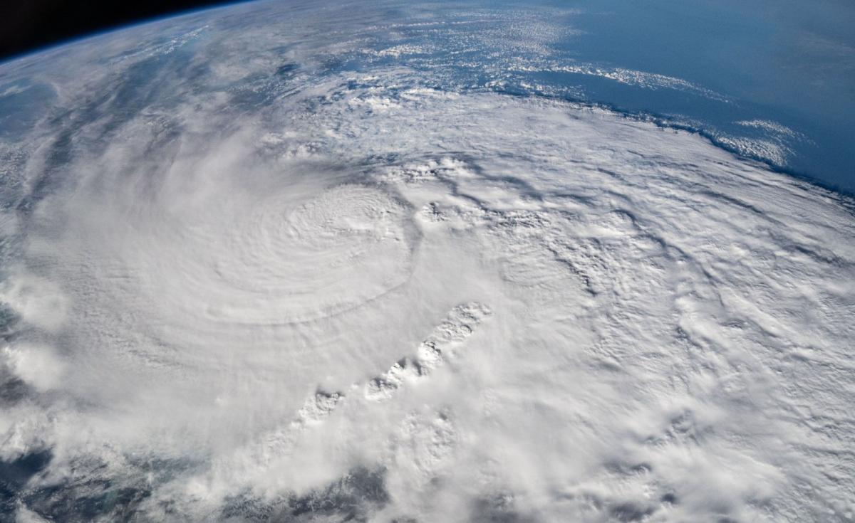
Hurricane Milton, which made landfall across the central west coast of Florida on early Thursday (UK time) as a dangerous category 3 storm, carved a path of destruction across large areas of central and southern parts of the state. At least 16 people have been confirmed as dead and the death toll may rise as rescuers work through debris and floodwater left from the hurricane.
Well before Milton made landfall, supercell thunderstorms in the outer bands of the hurricane’s circulation formed and outbreak of strong tornadoes across southern Florida which killed 4 people, destroyed homes and other properties and downed power lines.
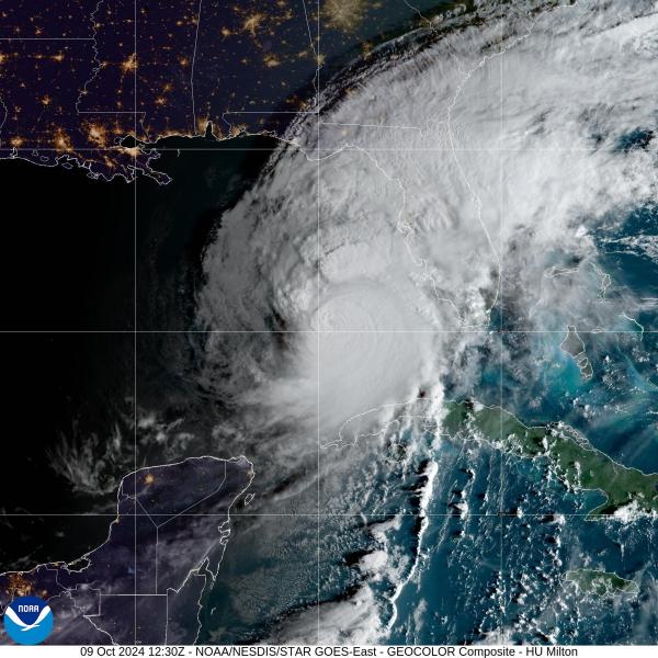
The strong winds downed trees, damaged homes, downed power lines and more. While flash-flooding from extremely heavy rainfall also flooded homes, businesses and closed many highways, hampering rescue efforts.
The storm surge wasn’t as bad as predicted for Tampa Bay and St Petersburg. However, this area of the central west coast of Florida saw significant rainfall which caused flash-flooding. Milton dropped more than 18 inches (1.5 feet) of rain on St. Petersburg, representing a more than a 1-in-1000 year rainfall event for the area.
Milton is no longer looking at the National Hurricane Center’s Atlantic Atlantic Tropical Cyclones and Disturbances map,. There is the remnants of ex-Hurricane Milton in the form of post tropical cyclone or area of low pressure over the northwest Atlantic though, bringing an area of heavy rain and gusty winds, but this low looks to weaken then dissipate as it heads further east over the next few days.
However, Tropical Storm Leslie, currently over the mid sub-tropical North Atlantic with sustained winds of 60mph, looks to track north then gets picked up by the jet stream on Saturday, where it will then carried east. Leslie will then become a post tropical storm / area of low pressure over the weekend, which will track east-northeast past the Azores and likely on towards Iberia early next week.
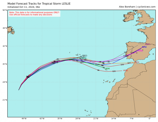
The remnants of ex-tropical storm Leslie do look to inject tropical moisture, warmth and energy into the strengthening cyclonic southerly flow that looks to develop across western Europe, including the UK, ahead of an amplifying upper trough moving east over the North Atlantic early next week.
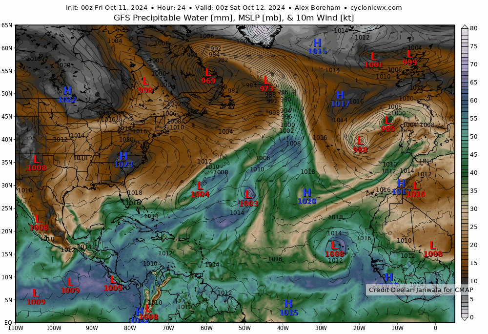
This injection of warm and moist air combined with increasing lift ahead of the upper trough approaching from the west may mean some heavy showers or longer spells of heavy rain spreading north across parts of the UK from Tuesday afternoon. Given the origin of the airmass, some the rain could be heavy and persistent enough to bring some flooding, especially if areas of low pressure or waves develop along the ‘baroclinic’ zone - where waving fronts, separating warm/humid air to the east and colder air to the west, produce pulses of heavy rain. More detail on this later in the weekend, when it becomes clearer where heaviest rain might move through.
Top image of Hurricane Milton from the ISS courtesy of the Earth Science and Remote Sensing Unit, NASA Johnson Space Center.
Loading recent activity...