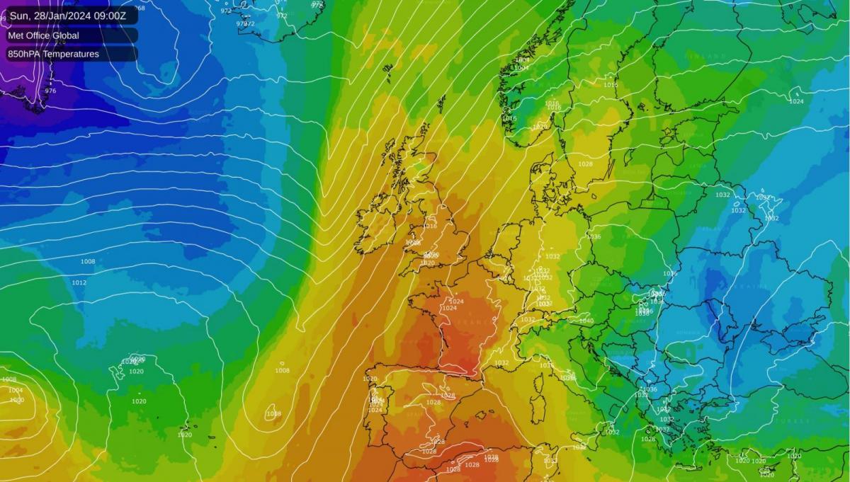
A bulge in the Jet Stream, caused by an anticyclone ridging strongly northward from central Europe and troughs to the west of Ireland, has created a synoptic situation more akin to a summer heatwave rather than a Sunday in mid-winter. As a result, we currently see particularly mild air being drawn up from Iberia, where there has been record heat recently. This air also contains pockets of Saharan dust, so don't be surprised if you're unlucky enough to see a 'dusting' of sand on your car, either today or tomorrow.
Despite the mildness, parts of eastern England saw a touch of frost first thing, but it will end up as a very mild, dry day. Cloud amounts will vary, but there will be some winter sunshine for most. The exceptions are Northern Ireland and West Scotland, where, after a dry start for many, Atlantic fronts approaching from the west will bring outbreaks of rain throughout the day, some of it heavy.
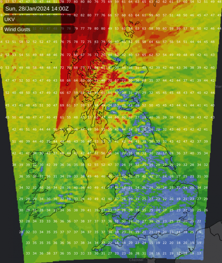
A southerly wind will be fresh or strong over Scotland and Northern Ireland, where gales in the north and west could give gusts in excess of 60mph.
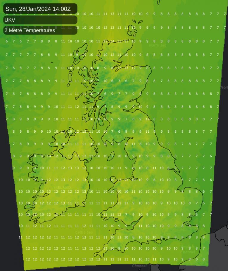
However, it will become very mild everywhere, with maximum temperatures of 10 to 13°C, but as high as 14 or perhaps 15°C towards the north-facing coasts of Wales and the Moray Firth.
After dark, both Scotland and Northern Ireland will be wet for a while, but this will move away overnight, leaving clearing skies and much lighter breezes. It will be chillier, with a slight frost mostly in rural glens where temperatures may fall close to freezing. By morning, it will be the turn of northern England and the north and west of Wales to become wet, while the remainder of England and Wales stays dry in a southerly breeze with a mix of cloud and clear intervals. Although it may turn a little chilly again over eastern England, it will mostly be a mild, frost-free night, with lowest temperatures of 3 to 5°C in the east and 7 to 10°C further west.
The new working week sees Scotland and Northern Ireland, apart from the odd shower in the far northwest, mostly fine and dry with sunny spells. Top temperatures here will be about 5 to 7°C. Across Northern England and Wales, a now slow-moving front will bring outbreaks of rain, some heavy and perhaps wintry over the highest hills towards the Scottish border. To the south of that, it continues to be very mild and mostly dry, although a few showers may move in from the west later.
After dark, a shallow depression will bring further bursts of rain across central parts, with showers spreading from west to east across southern areas. Over Scotland and Northern Ireland, it will stay mainly dry with clear spells, but it will be cold enough for a frost in places overnight.
Loading recent activity...