With another long weekend coming up, there are plenty of events and activities taking place. Ranging from celebratory tea parties and Big Lunches to the main event, the Coronation ceremony and procession in London. There will be a televised Coronation concert on Sunday from Windsor Castle and the extra Bank Holiday on Monday.
People might be getting away abroad, planning a longer walk, bike ride or camping trip here in the UK, hoping that the weather would be getting warmer in May. Or a night out, a party, hoping for a BBQ during a few days off or just getting stuck into the traditional Bank Holiday past time of good old DIY.
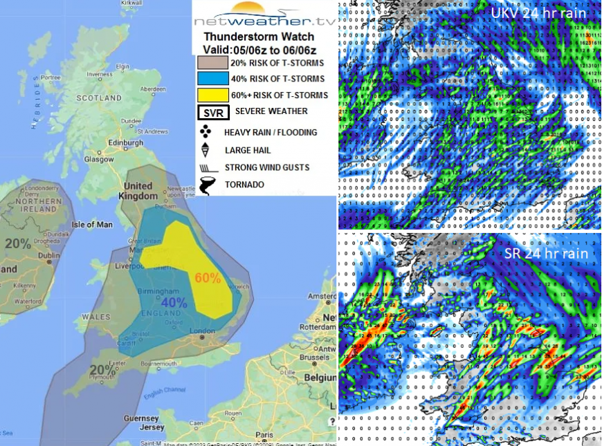
There is rain in the forecast and temperatures varying from 9C to maybe 21C. The easterly wind does finally give up. For those living along the east coast of Britain, that will be a welcome change. It has been cold and cloudy, so the gradual shift to a southerly, then westerly flow will make quite a difference. Grampian will take its time to lose the cooler air. Bands of rain move across the UK, and there will be hefty showers during the weekend, even the risk of thunderstorms. In between, there will be brighter skies with occasional sunny spells, but it does all keep swapping about.
Friday sees a weak front up through northern Britain with cloud and rain followed by bright spells, a rash of showers and the risk of thunderstorms. Along the murky frontal band there will be a chilly easterly wind for northern Scotland. Further south it will feel warmer with very light winds and temperatures in the high teens where the sun breaks through.
"Surface heating of moist flow in sunny spells developing across England and Wales beneath cold mid-levels will create steep lapse rates which is modelled to generate 600-1000 j/kg CAPE early afternoon...This instability will support the development of heavy showers and thunderstorms from later morning and through the afternoon into early evening." Convective forecast
The weather will be quieter overnight as the front in the north edges towards Shetland. A lot of cloud remains as the next weather system approaches Britain from the southwest. This small low will bring rain for the Coronation Day. Differences in the model forecast are shown below.
There is a warm front and a cold front to move through with rain reaching London around 9am. There does look to be a period of grey, damp weather through the Procession and Ceremony with outbreaks of rain. It will feel cool with a light south to south-easterly breeze, around 13C.
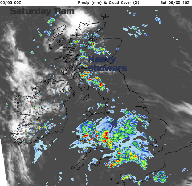
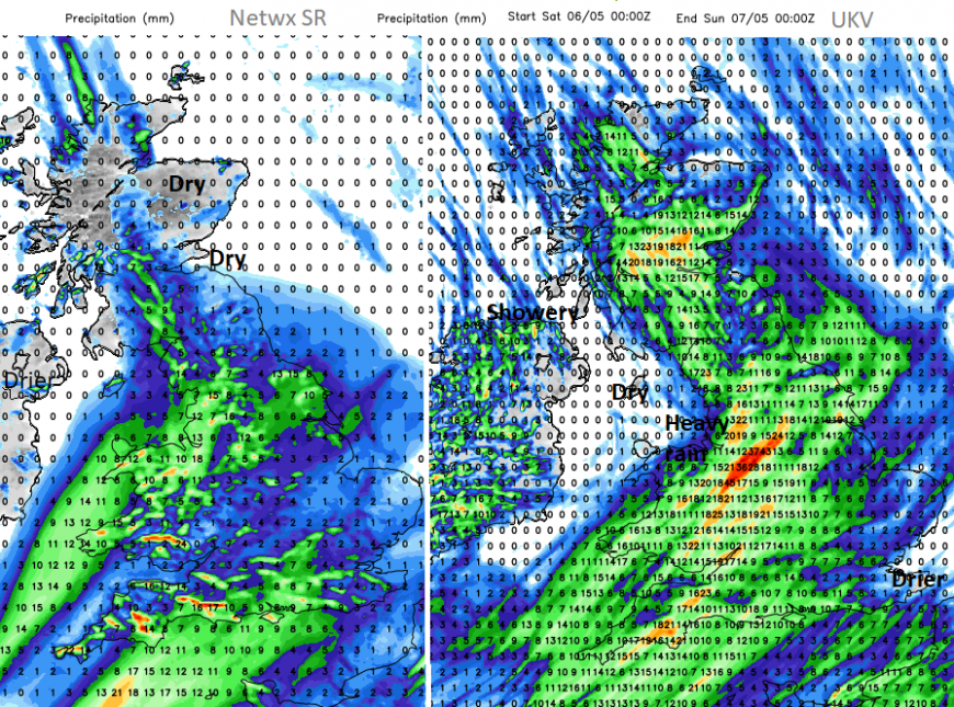
The bulk of the rain edges northwards over Wales and more of southern and central England. It will be more patchy for Kent and Cambridgeshire. To the north, there will be showers breaking out where sunny breaks appear in the cloud cover around the middle of the day and these will affect parts of Scotland and Northern Ireland into the afternoon. After the heavier area of rain over southwestern Britain in the morning, another arm of heavier frontal rain looks to push up through the West Country, eastern Wales and the West Midlands. There is some uncertainty around the timing and reach of the front over northern England during Saturday afternoon. Behind it, there will still be a lot of cloud but where brighter gaps appear, the temperatures will leap up into the high teens.
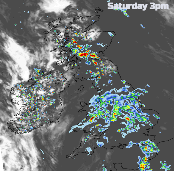
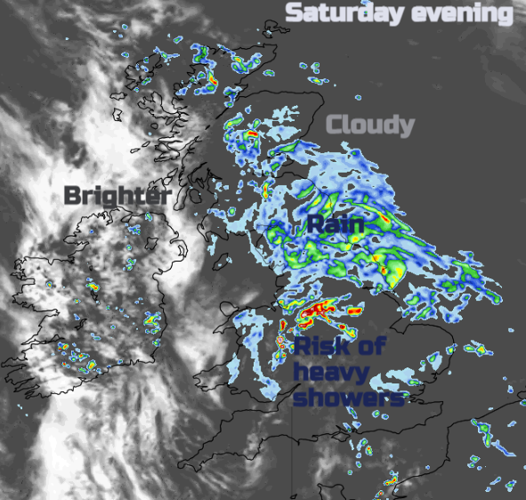
By the evening there will still be a band of frontal rain over a central swathe of England. The heavy showers over Scotland will be drifting northwards and over southeast England there is the risk of a few hefty showers but most areas should be drier but cloudy. Weather forecasts and apps maybe showing a row of showers (the cloud, sun and dot of rain combination) but that is a risk of showers in the area, the potential, not that you will see rain every hour.
Sunday should be a drier day for many, although still with a lot of cloud across the UK and showery rain still over eastern Britain in the morning. This is pivoting away across the North Sea but might take a few hours to clear. Then brighter breaks appear, and a scattering of showers pop up. As the afternoon goes on, these are more likely for Scotland and eastern England as the next Atlantic weather system edges in. There will be a light westerly breeze with temperatures between
The frontal rain sweeps into Ireland and then Wales overnight with a freshening southerly wind. Currently, timings show the main area of rain over Britain on Monday morning, taking its time during the day and followed by showery outbreaks. This looks to be a very unsettled day, with temperatures varying from 14 to 18C but possibly up to 21C in any sunnier times. Have a good weekend if you do have some time off.
Loading recent activity...