Mild and unsettled conditions have dominated over the last few weeks and, although milder weather has become confined to the south these last few days, a change is on the way for Christmas Eve that will bring much colder conditions from the north for all of the UK. Although it will turn briefly milder for all parts on Boxing Day, it will turn colder again from the north on Sunday and these colder conditions look to stay with us right up to New Year’s Day and possibly continuing into early January. There is also a continued signal from model guidance of a Sudden Stratospheric Warming occurring in early January – which could allow high latitude blocking weather patterns establishing later in January that could bring a prolonged cold weather pattern for the UK.
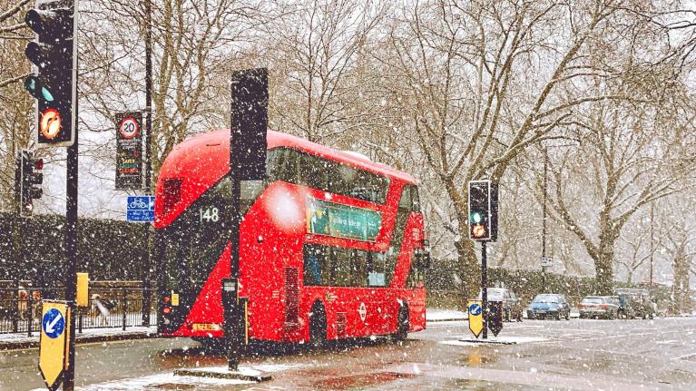
A change in weather pattern is underway that will usher in colder conditions for Christmas Eve and into Christmas Day. What’s happening is a southwesterly jet stream running across southern UK over the last few days, bringing mild and wet weather across southern Britain, with flooding issues in the west midweek, will be replaced by a northerly jet stream as the jet stream buckles upstream over the Atlantic. This will help pull down a cold northerly flow from the Arctic at the surface for Christmas Eve, which will be a mostly cold, dry and sunny day.
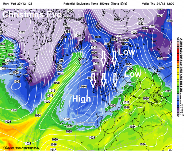
A widespread frost Christmas Eve night for many, leading to a frosty start for many on Christmas Day. Cloudier, breezier and mild start across northern and western Scotland though, with patchy drizzle in the west, and these cloudier skies and less cold condtitions gradually spreading southeast across parts through Christmas Day – with rain arriving in the far northwest, though southern-most counties perhaps staying bright and cold.
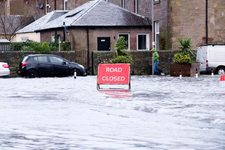
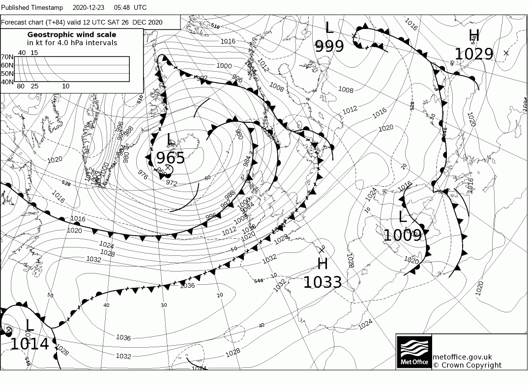
It looks to turn briefly milder, very windy and unsettled on Boxing Day. A deep low pressure system, which has its origins over eastern U.S.A., loops over Greenland today, carried by the buckled jet stream, before heading southeast over Iceland then toward the Northern Isles on Saturday – bringing cloudy skies, milder air and outbreaks of rain spreading southeast across most parts by the end of the day. Gales developing across England and Wales, with a Met Office yellow warning for wind in force. Heavy squally rain along a cold front sweeping south and snow over the Highlands of Scotland will be additional hazards.
Tight isobars on Saturday will bring gales for England and Wales, along with heavy rain spreading southeast.
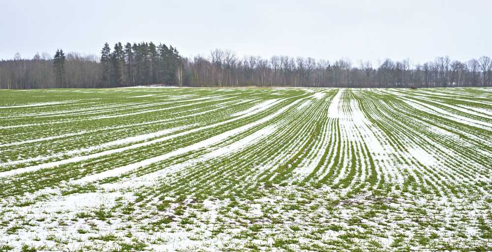
The deep low arriving close to northern Scotland late Saturday looks to drop south on Sunday and Monday - pulling down colder polar air with it. So after heavy overnight rain clears the south Sunday morning, there will be a mix of sunshine and showers on Sunday, showers wintry in nature in the colder air, particularly over hills in the north and west. Further wintry showers or longer spells of rain/sleet or snow circulating around low pressure over the UK on Monday with some sunny spells in between.
Low pressure + cold air next week will create a forecasting headache, with a chance of snow but marginality and positions of fronts and troughs in the low circulation making it tricky to forecast too far out.
However, a great deal of uncertainty over the positioning of the upper low in relation to the UK early next week - which will determine where surface features will be, the 00z EC had the core of the upper vortex close to the NE, while the 00z GFS had the upper vortex centred over the SW. Secondary surface lows likely to form on the N and W side of this vortex, so it's position important to what the sensible weather will be. EC runs a secondary low south down the west then swings it SE across the south around the vortex on Monday, bringing potential for disruptive snow, even in the south. Because the GFS has different position of the upper vortex, it doesn't have this feature - instead has showers around coasts, but rain/sleet and snow getting inland across the north where it has a surface low.
With low pressure staying close by through the rest of next week, it will stay unsettled. But slack conditions at the surface, with low pressure filling and isobars widening - winds will fall light, allowing for boundary layer to keep cold - with help of short daylight hours and long frosty nights. So there will be scope for snow to fall at times, particularly over higher ground of the north and west, but also to lower levels too at times and not just in the north. The detail of where and when it may snow remains highly elusive for now, with no run to run consistency from models.
Looking further ahead through early January, there is no clear signal as yet, colder than average conditions may persists with the negative North Atlantic Oscillation (NAO) persisting, or, we could return to less cold conditions with a positive NAO. But there are signals for blocked weather patterns to return or persist through January and perhaps into February, thanks to increasing signals from EC, GFS and GloSea5 models of a Sudden Stratospheric Warming in early January.
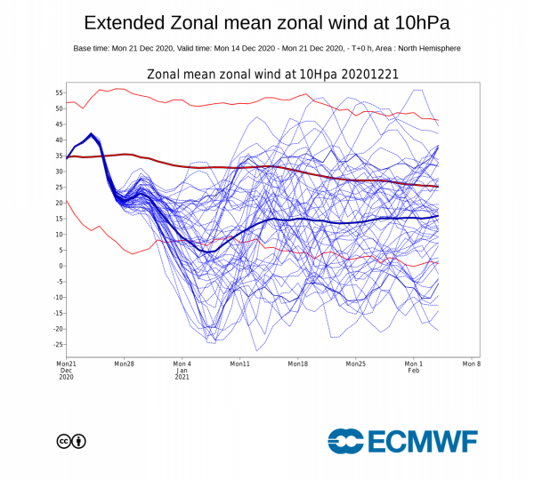
GFS operational runs and increasing GFS ensemble members have been going for a reversal of zonal winds at 10 hPa (65’N) for the past week, with the latest extend EC zonal mean zonal winds at 10 hPa also jumping on board with a reversal. The GloSea5 daily run yesterday also bringing a SSW in early January.
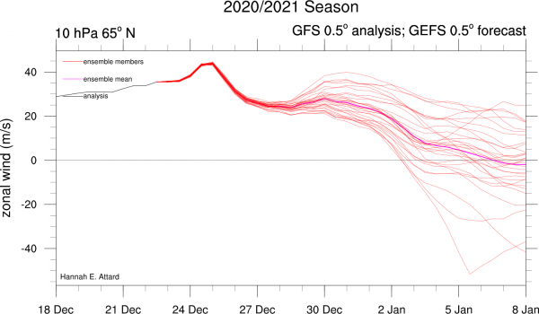
If a split or displacement in the Stratospheric Polar Vortex (SPV) from a SSW were to happen, there’s no knowing from the current standpoint how the troposphere (where our weather happens) will respond. With a split, it depends where the two ‘daughter’ stratospheric vortices end up, the same with a displaced vortex on where it will displace. Also whether these stratospheric vortices couple with the troposphere. Yesterday’s extended EPS for 10 hPa and this morning’s 06z GFS operational suggest the SPV, that normally sits over the pole, displaced towards NE Europe, if this were to couple to the troposphere it could portend to deep cold affecting northern Europe, including the UK. But if the vortex is displaced to N America or eastern Asia, then cold wintry weather may not occur for the UK.
So, in a nutshell, a SSW seems increasingly possible in early January, however, if it does indeed occur, there is no guarantee that it will lead to prolonged cold wintry weather in the UK. There was a SSW on the 1st of January 2019, but it had little impact on the UK weather for rest of that winter, the easterly winds propagating down through the stratosphere following the wind reversal at 10 hPa on 1st January did drip down into the troposphere, but seemingly not strong enough to disrupt the upper patterns this side of the northern hemisphere to bring high latitude blocking. However, a SSW in late 2018 was implicated in triggering the early March 2018 ‘Beast From The East’ – which saw unusually cold conditions for early March sweep in from the east with some disruptive snowfall.
Loading recent activity...