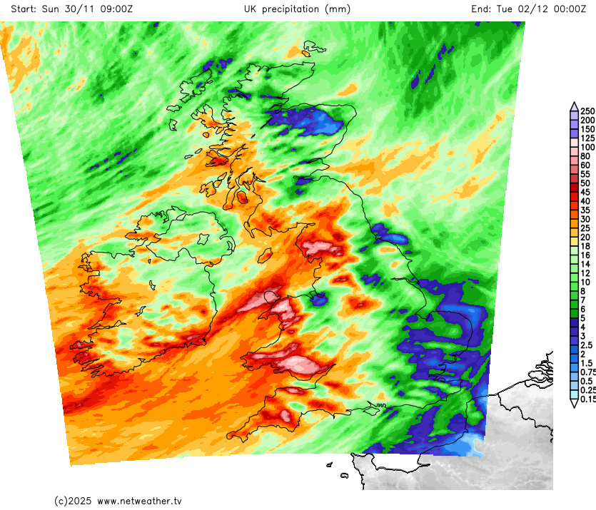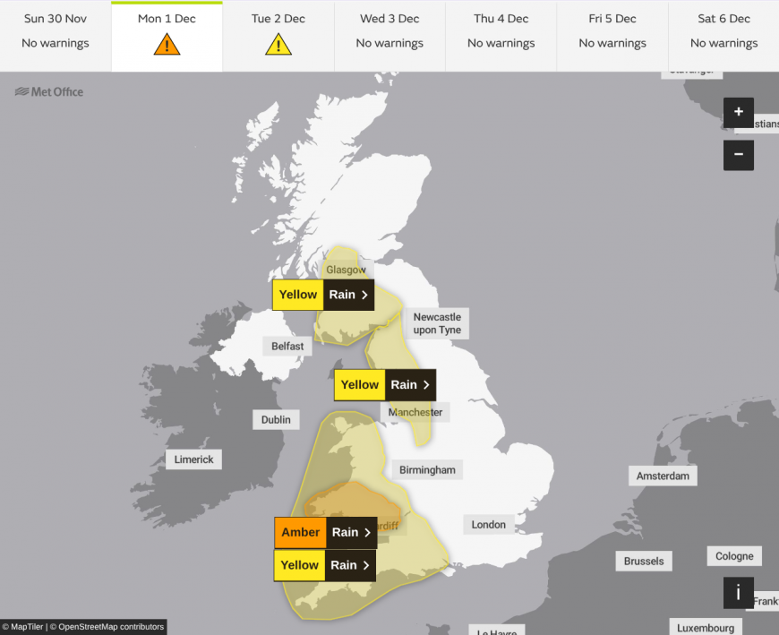
An Atlantic weather system will bring 100-120mm of rain to Welsh high ground on Monday, with the Met Office issuing an Amber warning, amid concerns over already-saturated ground and potential danger to life from fast-flowing floodwater.
The first day of meteorological winter looks set to bring a significant and potentially dangerous rainfall event across the United Kingdom. Whilst much of England and Wales falls under Yellow warnings for rain, the main concern is South Wales, where a moisture-laden frontal system meeting the steep terrain of Bannau Brycheiniog (the Brecon Beacons) is forecast to produce exceptional rainfall totals.

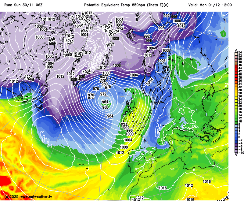
The weather pattern driving this event is a classic Atlantic setup. A deep area of low pressure, forecast to intensify to around 960 mb, will sit southwest of Iceland by midnight on Sunday. The low then tracks slowly northeastwards through Monday, dragging an active frontal system across the British Isles.
The heaviest rainfall over Wales will result from a process meteorologists call a Warm Conveyor Belt. In simple terms, this is a stream of mild, moisture-laden air drawn northwards from the subtropical Atlantic, rising as it travels and releasing its moisture as rain. When this already-wet airflow hits the Welsh mountains, it is forced to rise further, cooling and wringing out yet more rainfall in a process known as orographic enhancement. The upshot is that rainfall totals on west-facing slopes can be three to four times higher than in nearby lowland areas.

For South Wales, this means 60-80mm widely across the warning area, with peaks of 100-120mm possible over the highest ground. To put that in context, it represents around 60% of the typical December monthly rainfall falling in a single day. The Amber warning, valid from late Sunday evening through Monday night, carries explicit danger-to-life messaging from Natural Resources Wales, who note that rivers including the Taff, Usk and Wye are already running high following a succession of autumn storms.
These pre-existing conditions are crucial to understanding the flood risk. November has seen a quite regular parade of Atlantic systems, including Storm Claudia, which deposited over 80mm at Tafalog in mid-November, and Storm Bert, which flooded 680 properties across England and caused severe flooding in Pontypridd and Cwmtillery. The ground across the warning areas is essentially saturated, meaning virtually none of Monday's rainfall will soak in. Instead, it will run straight off the surface into rivers, causing levels to rise rapidly.
Yellow warnings extend to other parts of England and Wales and southwest Scotland. The Cumbrian Fells face similarly high totals of 100-120mm, whilst Dartmoor and Exmoor expect 60-80mm.

Behind the cold front, conditions will turn brighter but showery from the west during Monday afternoon, though a second burst of heavy rain may affect Cumbria during the evening. Temperatures will be mild for December, with southern and central England reaching 12-13°C against a seasonal average of 8°C, thanks to the warm air ahead of the front.
For those in the Amber warning area, the message is clear: avoid floodwater, prepare for travel disruption, and keep an eye on the latest updates. This may not be a named storm, but the combination of intense rainfall falling on already-sodden ground creates a genuine flood risk that should be taken seriously.
Loading recent activity...