#TheBeastfromtheEast
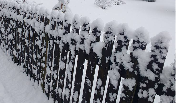
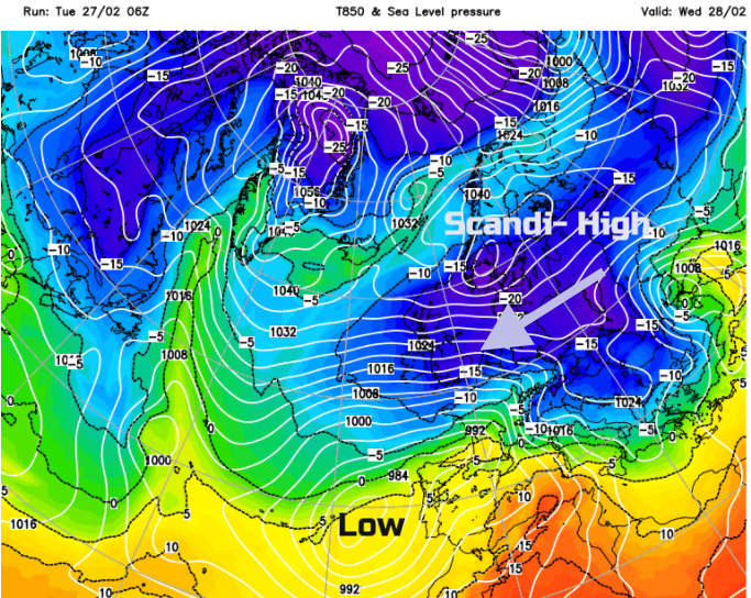
It’s not necessarily snow in your backyard, I’m afraid. It is deep, intense cold air bringing the threat of snow across the North Sea. Think of it as a mass of dry, bitterly cold air which originated over the snow fields of Siberia and northern Europe. When high pressure develops over Scandinavia (a Scandi-High) the flow around this anti-cyclone pulls south and then eastwards across the continent before reaching the North Sea. This air has little moisture in it, which explains the absence of frost deposits, the white rime we usually associate with cold mornings. As the cold, dry air moves over the North Sea, it sucks up some moisture in its lowest levels and shower clouds begin to form. Depending on the fetch (the length of water travelled) the showers can grow and when they reach land (the east coast of Britain) they dump their snow. This is sea effect snow.
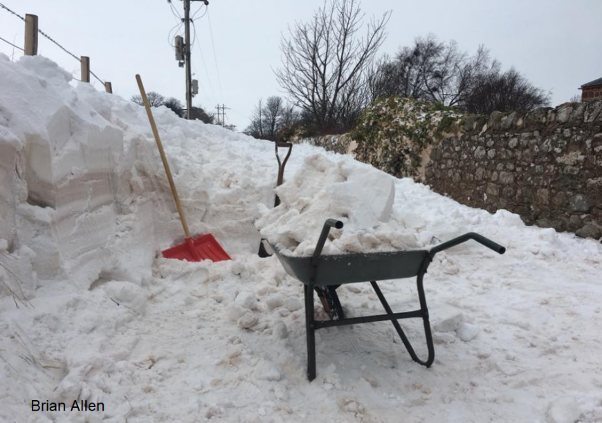
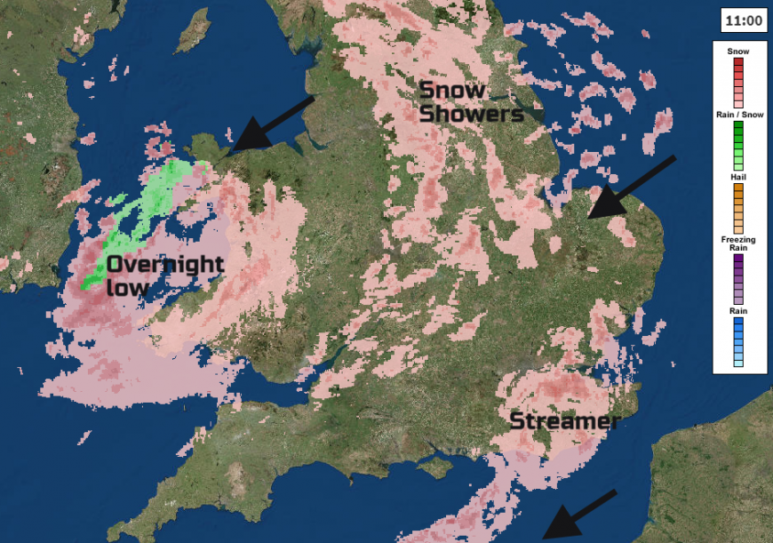
High pressures don’t move very fast, they often stagnate. If the Scandi-high remains, then the bitter cold air just keeps on coming. It can get even colder, and more frequent and heavy, even thundery, showers are set off. These pile into the UK often lining up, in so-called Streamers, where a narrow corridor can receive large snowfall totals with hardly any snow either side.
The Beast from the East is this process, this setup. It doesn’t happen properly that often, with snow lovers keeping an eye out for the signs over several years. With recent progress in identifying links from European cold winter to SSW (Sudden Stratospheric Warming) and how it affects the Polar Vortex (high-level winds which circulate the earth), there has been more of a build-up to this particular episode.
It’s about intense cold- daytime temperatures barely above freezing, significant wind chill making it feel much colder. Frost, ice and deep winter conditions.
Also, a setup for snow. This can be snow showers off the North Sea, or more significant features caught up in the flow which bring more widespread snow cover. Both can push right across the UK if the winds are strong enough. Sometimes, the high then extends over the UK as well and we are stuck in still air with snow cover. This is when the air temperatures sink, with days, even weeks of freezing air, little solar radiation early in the year and fog. Each day the temperatures struggle, and record minimums can result.
March 2018
The UK is now sitting in a bitterly cold easterly airflow. The coldest air, (not often seen over the UK) will be across us Wednesday/ Thursday. We could see the March day records broken, so the top temperature recorded all day being the lowest number. Bone-chillingly cold. The snow showers have been piling in from the North Sea, lines forming over Kent and Essex and through the English Channel. A low pressure moved over northern England into Wales during Monday night, bringing several cms to some areas. 8 to 10cms in Norfolk, Northumberland and North Yorkshire.
More warnings through Weds 27th/Thursday as the flow veers from NE to true easterly and other areas get snow showers streaming in. Later in the week, low pressures from the south cause the easterly flow to judder but the cold air holds on. A lot of uncertainty about how the forecast will pan out but the likelihood of snow continues as frontal bands come up against this very cold air.
Plenty more chat and discussion on the Netweather community forum
Loading recent activity...