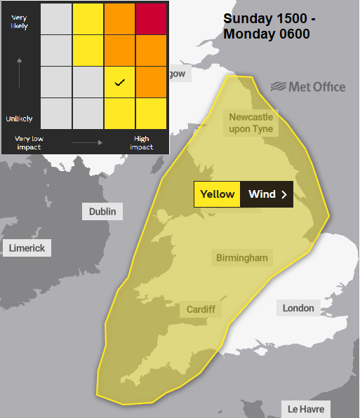
The UK Met Office has named Storm Freya and issued a yellow wind warning for Sunday pm overnight into early Monday. This warning is expected to be upgraded to an Amber warning. There will be a spell of strong winds, high gusts, gales with heavy rain and even hill snow.
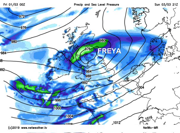
There will be two areas of low pressure affecting the UK. The first one brings strong winds to Ireland by Saturday morning and then across the Irish Sea which could affect Irish Sea ferry services and the west coast of Scotland. It becomes windy for Wales especially the coasts and hills with a blustery afternoon across the UK. this is just the preamble, from another low pressure away to the NW. Storm Freya will only just be developing out in the Atlantic. During Saturday night there will be severe SW gales for the Western Isles as the first low moves past with gusts over 60mph and gales still over northern Scotland to start Sunday.
Storm Freya
There is a lot of uncertainty about the developments on Sunday. How the low in the north clears away and how the trailing waving weather front changes and the new low pressure forms. This all affects when the strongest winds and rain arrive and how much of the UK they will affect. It will be worth checking back with the forecast and not taking the symbols and timings on a weather app. at face value.
There could be strong winds and high gusts from Sunday morning right through into Monday afternoon (through the English Channel). Northern Scotland will escape Storm Freya, with northern and western counties of Northern Ireland look to be out of reach too. The Met Office warning period runs from Sunday afternoon until around dawn on Monday. It does look like the worst of the high gusts and gales will be away from the east coast of Britain, out into the North Sea, before most people are on the move for Monday morning. That is the current forecast.
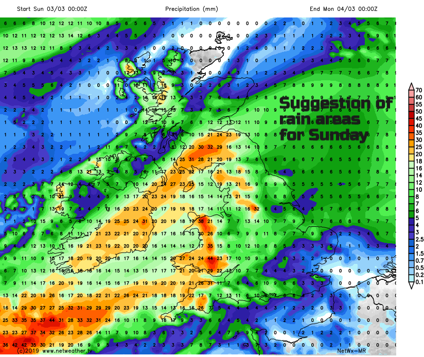
Conditions will be quite horrible with the wind and rain and a startling change from the recent spell of warm, dry and sunny weather. With colder air to the NW, ready for next week, there could even be snow over the hills, even to lowers levels on Sunday night for northern Britain..
Gusts of wind will widely reach 50 to 60mph but with the potential for 70 to 80mph gusts. The temporary, sudden busts of higher wind above the sustained mean wind speed. It is these gusts that can caused accidents and danger with vehicles swerving and lorries toppling (although it will be a quieter part of the week) In the strong winds there maybe objects flying about, damage to power cables, disruption to travel (worth bearing in mind if you are travelling to any sporting events this weekend) and also for ferry services. Seas will be rough with large waves around the coasts.
After Freya, the next name on the list is Gareth. More discussion on the Netweather Forum.
Any thoughts on the Name our Storm idea?
Loading recent activity...