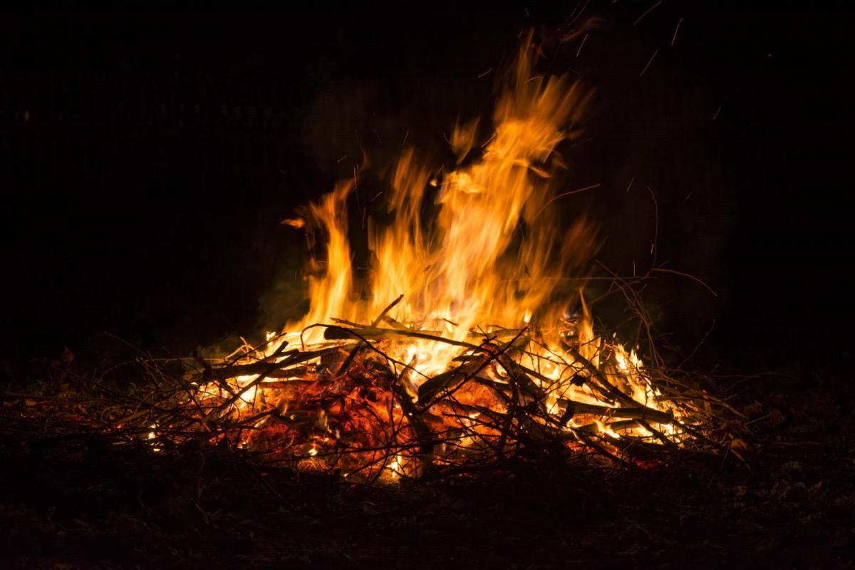
After the cold Arctic chill last weekend, the end of this week had included stormy weather in the forecast. With the 5th of November being on a Monday this year, the firework displays are littered from Friday, right through the weekend. High winds and rain are most unwelcome at these events, with calm, cold and misty conditions lending more to the traditional bonfire atmosphere.

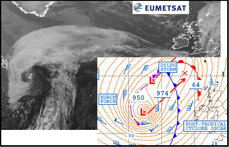
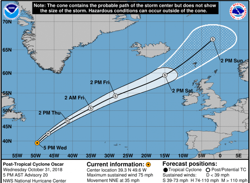
And yet, spinning in from the Atlantic is a large area of low pressure with tropical origins and leftover energy. What once was Hurricane Oscar has been caught up in the cooler, westerly flow and is heading past the UK this weekend. Now post-tropical cyclone Oscar, the low pressure will impact the UK Friday evening and through Saturday. However, this wet and windy even stormy weather isn't for everyone.
1. 
Winds
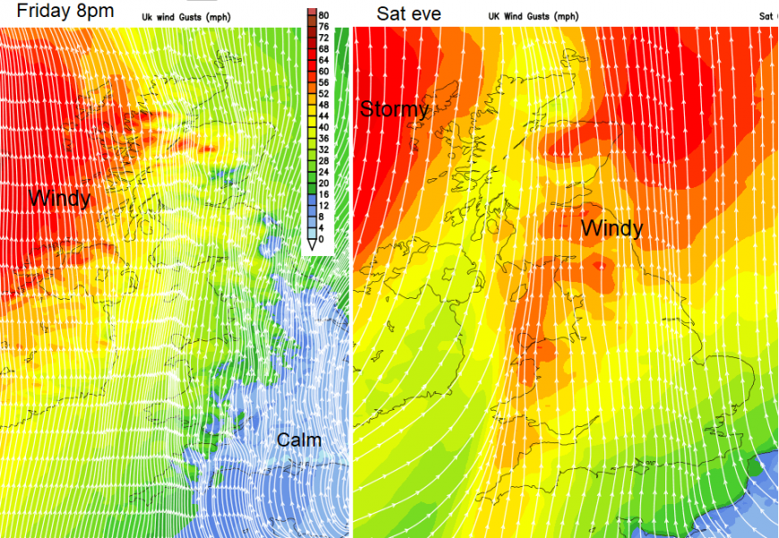
Strong southerly winds and gales will pick up during Friday evening and Saturday evening, mainly for Northern Ireland and Scotland. Friday looks calm over much of England and inland Wales. Everywhere will be more blustery by Saturday as the low heads closer to NW Scotland. Wind gusts of 50 to 70mph and gales for northern Britain, Irish Sea coasts and northern counties of Ireland.
2. 
Rain
Light and patchy rain will move over Northern Ireland during Friday evening west to east, so hopefully not reaching Belfast until 9pm ish. The Western Isles will also become damp on Friday evening but for much of the UK, it looks dry. For SE Britain, dry and clear with light winds becoming chilly. Gradually more cloud as you head NW with more of a breeze picking up too.
3.
Saturday evening will be milder than Friday, but worth being sheltered from the wind.
4..png?w=595)
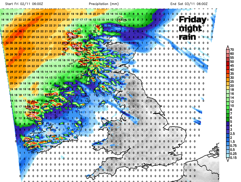
More rain will push in from the NW during Saturday with totals from the Met Office: 30-50mm is expected quite widely, especially on high ground with 60-80mm possible in a few areas. Localised flooding is possible for parts of Scotland.
By Saturday evening, a cold front from the low will be across the UK bringing rain. Ahead of this still fine but blustery, behind it showery and windy with gales for the far NW.
5.
Large swell and waves
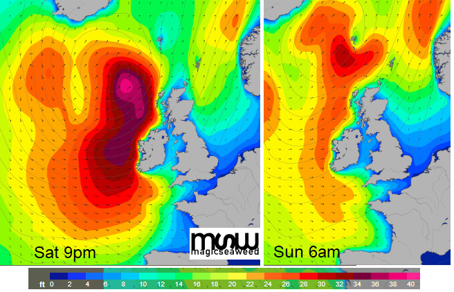
As this deep low pushes nearby, there will be a massive swell from the Atlantic. Sea surface temps are around 11 to 14C now, rather cool for water activities. Coastguards will soon be warning people about being near the coasts as the seas become rough and winds wild.
6.
By Sunday the low pressure will be away from the north of Scotland, but still blustery here. Elsewhere, lighter winds, cool in the north, mild further south around 10 or 11C but there could be some rain.
To check your location and display date or time have a look at the seven-day forecast.
Post or extratropical hurricanes - A guide
Loading recent activity...