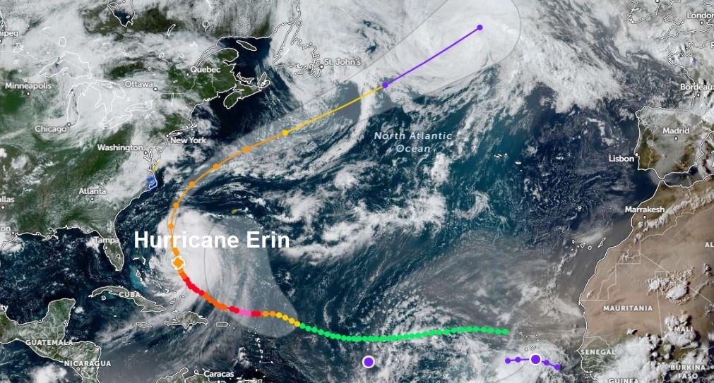
Hurricane Erin, which rapidly strengthened from category one last Friday to category five strength on Saturday, as it moved west just north of the Caribbean, was the first Category 5 hurricane in August since Dean in 2007. It reached peak intensity on Saturday - with maximum sustained winds of 160mph north of the Leeward Islands.
Erin, now category two strength, with maximum sustained winds of 100mph, has now turned north in track on the western side of the subtropical high over the North Atlantic.
Erin will continue north today, then more towards the northeast on Thursday, halfway between the U.S. eastern seaboard and Bermuda. Erin remains a large and dangerous hurricane even though winds are not as intense as they were over this past weekend. Erin looks to strengthen again over the next 36 hours, perhaps briefly reaching category three strength and a Major Hurricane again on Thursday. Erin will bring life-threatening surf and rip currents to the coasts of eastern U.S., Bahamas and Atlantic Canada over the next few days.
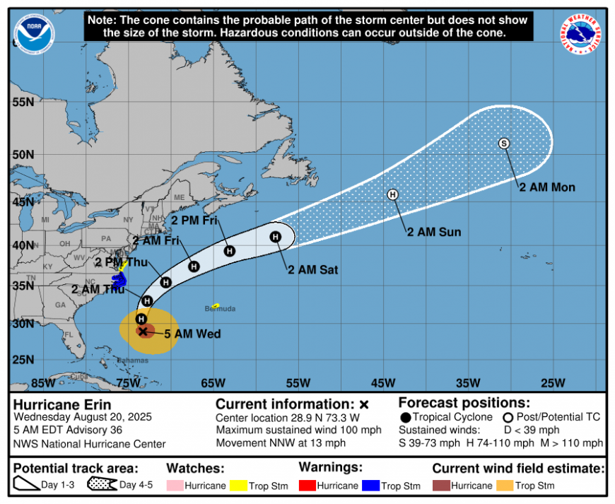
Erin isn't forecast to hit the U.S. directly, but will pass just over 200 miles offshore of North Carolina on Thursday, where dangerous life threatening rip currents & high waves of 15-20 ft (4-6m) are forecast along the Outer Banks, causing coastal flooding. Winds gusting in excess of 50mph too. Mandatory evacuation orders are in place for communities in the Outer Banks of North Carolina, while swimming at most U.S. east coast beaches will remain dangerous over the next few days due to life-threatening rip currents.
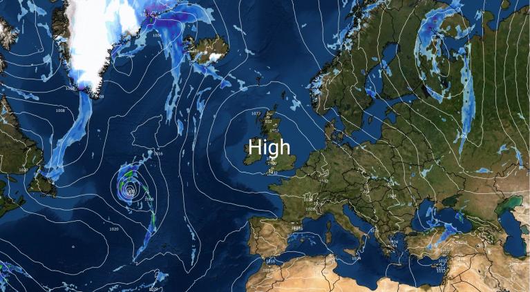
Erin will continue northeast over the NW Atlantic this weekend but transitioning into an extratropical low, as it gets picked up by the jet stream coming out of eastern Canada. As the tropical warmth wrapped up in Erin bumps into the colder air north of the jet stream, the large temperature contrast will result in producing a core off very strong jet stream winds east of Canada. This cranking up of the jet stream pushing east over the Atlantic towards Europe next week, heralding a change to more unsettled conditions for western Europe, including the UK and Ireland, though the timing of this change is uncertain for now. Fortunately it looks like the change will be delayed until after the Bank Holiday Weekend.
The strong jet stream will then carry a deep area of low pressure, containing the remnants of Erin, across the North Atlantic towards Europe next week. However, there is a lot of uncertainty between models on its track as it moves into the Northeast Atlantic.
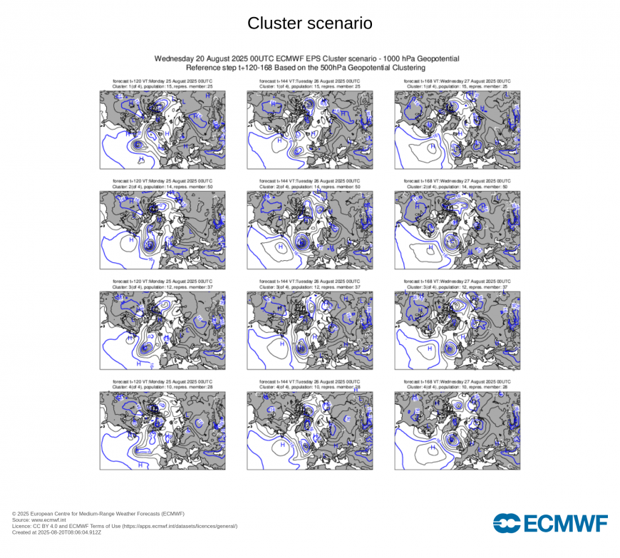
From the overnight model runs, the 00z ECMWF high resolution run tracks the low southeast into the Bay of Biscay then east into France by Friday week, while 00z GFS operational run takes the low toward Iceland.
A look at the 00z EPS clusters doesn't paint any clearer picture, though it appears the EC high resolution idea of taking the low over Bay of Biscay then France doesn't have the greatest representation, nor does the GFS idea of taking the low up to Iceland. The EPS mean track from the west over UK the middle ground for now, so perhaps this may be the best idea, but by no means the most likely solution.
Wherever the remnants of ex-Hurricane Erin end up, it will have already significantly strengthened the jet stream across the NW Atlantic then downstream towards western Europe, so an unsettled and windy end to summer looks likely.
Loading recent activity...