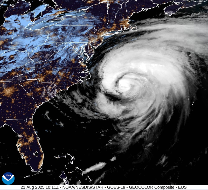
As in the first episode of Outer Banks (the series), when fictional Hurricane Agatha ravages the barrier islands off the coast of North Carolina, the Outer Banks are feeling the impacts of Hurricane Erin due to storm surge flooding and tropical storm conditions. This is not the time for surfing. Most eastern seaboard beaches have warnings not to go swimming at this time, even cautioning against being on the beach at all.
“Hurricane Erin will bring threats of coastal flooding, beach erosion, and dangerous surf conditions,” said Governor Josh Stein. “North Carolinians along the coast should get prepared now, ensure their emergency kit is ready, and listen to local emergency guidelines and alerts in the event they need to evacuate.”
North America
There is a high risk of life-threatening rip currents for the east-central Florida coast, but inland for Disney World, Orlando Erin is not making an impact. It is hot and humid at this time of year with a risk of thunderstorms each day. There will be fine weather in between, but temperatures are into the 90s Fahrenheit, around 33C.
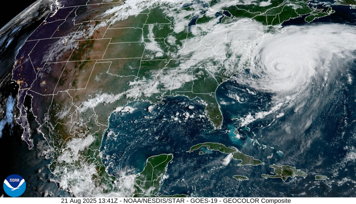
This massive hurricane is away offshore in the western Atlantic, but it is still growing and covers a huge area. There is a Tropical Storm warning for the Outer Banks and the Virginia coastline on Thursday, with concerns along the mid-Atlantic and southern New England coasts until early Friday. Bermuda has a Tropical Storm watch in place with rough seas but the airport remains open at 11Z on Thursday.
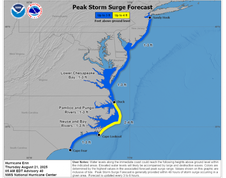
Thanks to Erin’s large swell, there are rough ocean conditions with large waves and dangerous rip currents, along with the dangerous storm surge, causing flooding if combined with high tides
“A Storm Surge Warning means there is a danger of life-threatening inundation, from rising water moving inland from the coastline, in the indicated locations…This is a life-threatening situation… Promptly follow evacuation and other instructions from local officials.” NHC
The weather in New York looks fine, sunny and warm for Friday and Saturday, although with the risk of showers by Sunday. Temperatures are around 29C.
Around New York, Newark and Long Island, there are flooding and overtopping concerns for waterfront properties and beach/dune erosion along shorelines. This is expected to cause travel disruption with road closures and flooding of basements and car parks. For those travelling with a hire car, watch what the locals are doing, not the tourists.
Elsewhere in the US, “Hazardous, record heat will continue across the Western U.S. through the weekend” NHC. Los Angeles, CA is warning of an “extended period of heat and fire” as temperatures near 100F (nearly 38C).
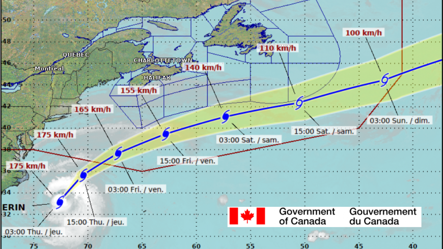
The Atlantic Canadian coast will also be affected as Erin continues her path northwards before turning across the North Atlantic.
The Canadian Hurricane Centre is closely monitoring the progress of Hurricane Erin. “Erin is expected to remain far offshore of Nova Scotia and Newfoundland Friday and Saturday. The most likely impacts will be dangerous surf along Atlantic coastlines of Nova Scotia and Newfoundland”. There will be some gusty winds and rough seas with rip currents.
Europe
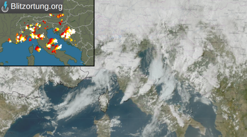
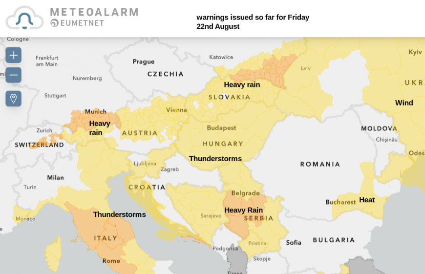
The Italian Met Service (part of the military) issued a warning midweek of Cyclone Lukas. A system forecast to bring heavy rain and thunderstorms with frequent lightning, hailstorms and gusts before it cleared eastwards. This low pressure will move from Austria to Hungary and onwards. There are many countries with warnings for thunderstorms and heavy rain on Friday. The high risk of thunderstorms over central Europe will move towards the Black Sea over Romania (and Ukraine) by Friday evening, bringing the risk of flash flooding and possible power outages.
High pressure over the UK will also keep settled weather over France, Portugal and Spain to start the weekend. For Friday evening and Saturday morning, there is a risk of showers for NE Spain, including Barcelona and Mallorca. Much of mainland Spain will have a fine Saturday but an approaching Atlantic weather system could bring rain to northwestern Galicia in an area that has seen terrible fires recently. The showery weather looks to extend along the northern provinces of Spain on Sunday, with some heavy downpours in the north and east of Spain through Sunday night.
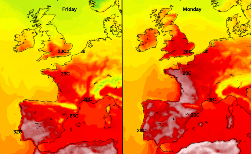
Temperatures in Spain have passed 45C this month. Currently, they are more widely in the high 20sC and low 30sC. Malaga will be at 28 and then 31C this weekend, an overall increase for western Europe as heat begins to build again in NW Africa.
Paris will see several days of fine weather and sunshine with temperatures rising through the 20sC, so feeling warm. The weekend will be warmer in the south but not the intense searing heatwave of previous weeks.
Loading recent activity...