Late season Tropical Depression 19 is forecast to head towards NW Europe by Friday. Always foxes the models a bit to add a smaller scale tropical disturbance into the mix. Other windy bits too.
Love this. There was a similar statement for Ophelia when she popped up.
This does mean 'no threat to US mainland'. The circle changing from black circle to white circle shows a cyclone undergoing extra tropical transition and becoming a post-tropical storm. Hurricane Ophelia managed to hold herself together on her bizarre journey, until quite close to Ireland in October.
This Tropical Depression 19 is at the tail end of the Atlantic season, which ends on the 30th November. You may have missed TS Phillipe, which skipped over Florida at the end of October. If this one needs a name. it would be Rina.
The National Hurricane Centre (NHC)had begun packing up for the winter, never the most solid of plans if you remember Hurricane Alex, a January anomaly? NHC issued a prelim. summary of 2017 cyclones in the Atlantic.
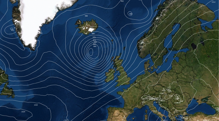
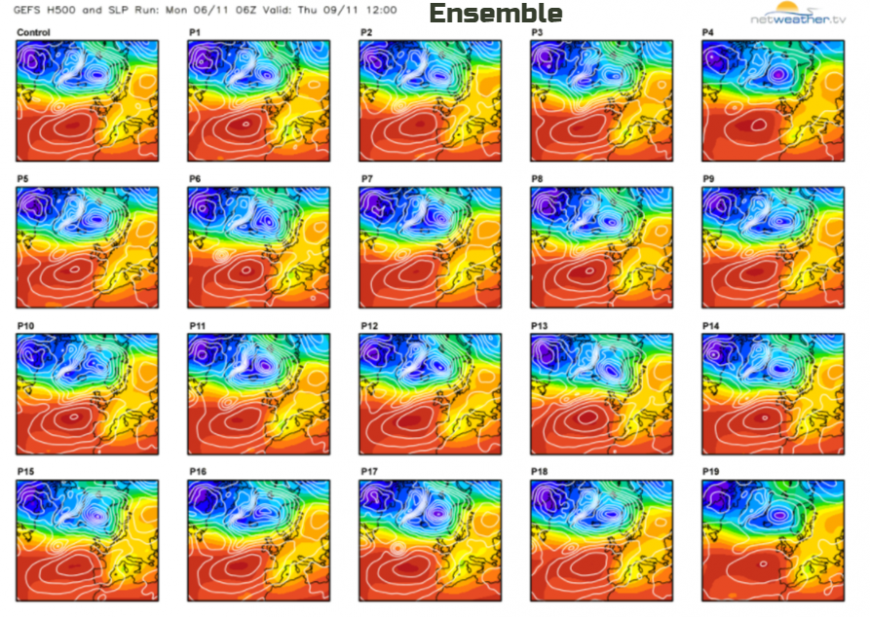
Now we have TD 19, a Tropical Depression in the mid-Atlantic which is forecast to strengthen to Tropical Storm Rina and then head north,northeast and get caught up in flow heading near to northern Scotland and the Faroes. This will not be a repeat of Ophelia, conditions are very different but looking at the postage stamp ensembles key features are the Azores High, anchoring and settling much of the eastern Atlantic near Europe. Away to the north is a low pressure near the Arctic circle and a cold NW flow in-between the two. It looks like the remnants of TD19 will just merge into weather systems heading towards Scotland, most likely scenario but not the only option. The latest run just showed an open wave feature, bringing rain but not too severe winds. The previous run had hinted at gales, even severe gales. However, it is still a few days off and this low pressure could keep its form and still head near to northern Britain as a deep low. Worth keeping an eye on this week.
There will be other spells of windy weather this week too.
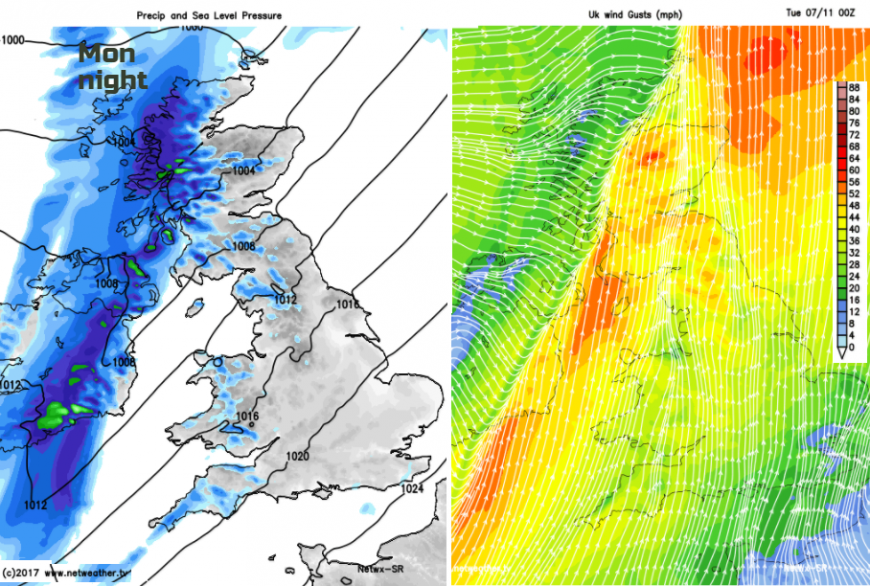
Monday will turn blustery as the cold front slowly moves SE wards, with gusts around 60mph for exposed coasts and hills.
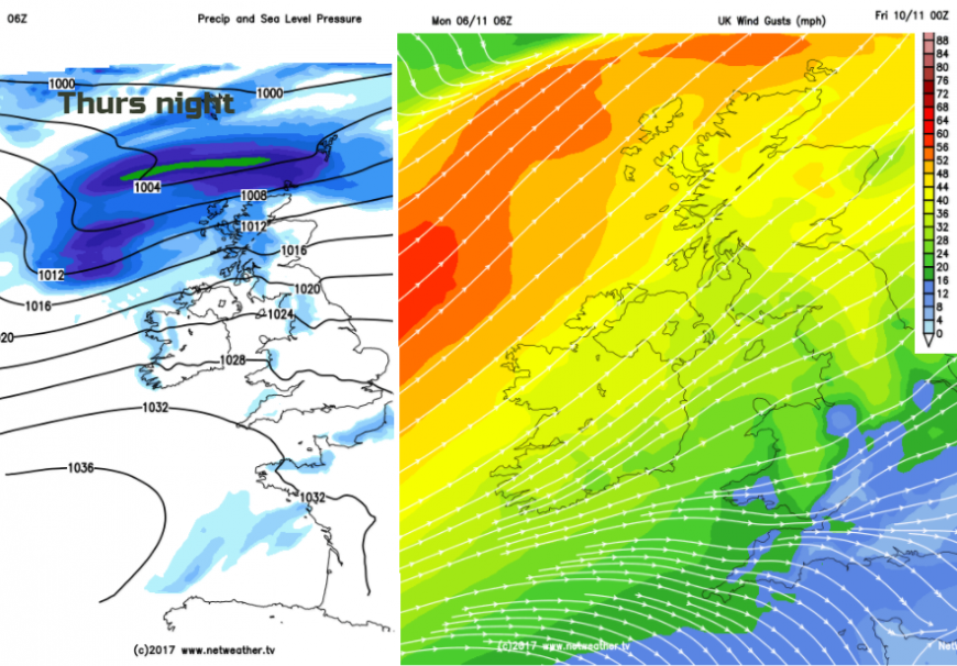
Then depending on how TD19 develops, fades or keeps on going we could see a spell of strong winds, gales, even severe gales later Thursday into Friday, with the far north looking most prone. Once that clears, we will be in much colder air for the weekend, so expect a frost and wrap up against the wind chill by Saturday.
Loading recent activity...