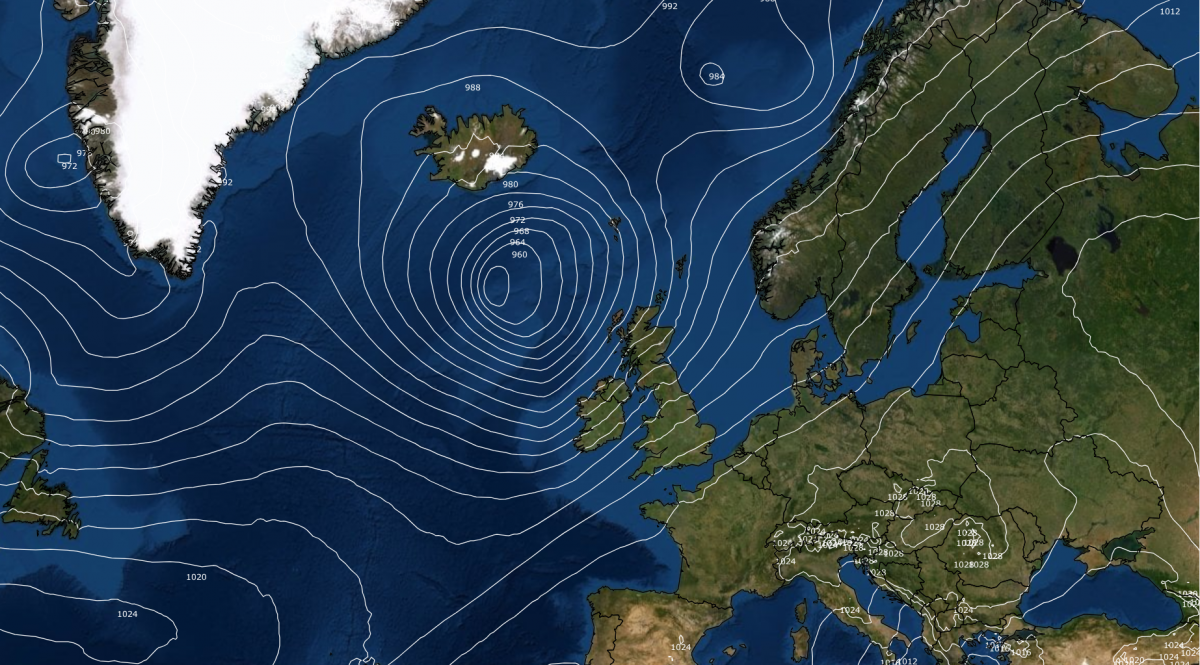
Ex-hurricane Gabrielle, which was a major source of uncertainty over Britain’s weather this weekend leading up to this weekend, is looking set to miss the British Isles, but it did make it all the way across to the Azores before transitioning into an extratropical cyclone. This is unusual, and according to the BBC, the last time it happened in the Azores was with Hurricane Gordon in August 2012. The associated damage over the Azores has been relatively minor compared with the impacts of many other hurricanes around the world, but Serra de Santa Barbera measured wind gusts of 115 mph, trees fell and there was structural damage to buildings.
The depression has now fully transitioned into an extratropical cyclone and will head eastwards through Portugal today and through Spain tomorrow, and is forecast to bring some heavy rain to northern Portugal and parts of western Spain, potentially with up to 50mm of rain near the west coast of Portugal. Strong winds are forecast over Portugal initially, possibly gusting to 50 to 60mph in exposed locations, but the depression will quickly fill and associated winds will ease as it pushes eastwards through Portugal and into Spain.

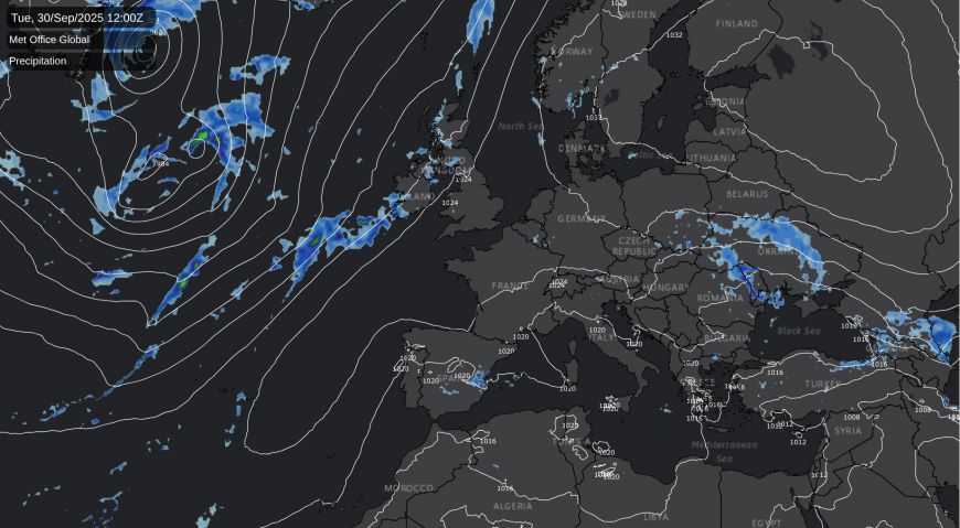
Although ex-hurricane Gabrielle will not directly affect Britain’s weather during this weekend, we are seeing a much shallower depression push in from the west over the weekend, which will bring a band of rain from west to east during the weekend. Some western areas will see a fair amount of rain on Saturday, but as the rain band spreads into eastern counties of England and Scotland, rainfall amounts will reduce substantially.
For most of the country, this will be a short-lived blip, as high pressure is forecast to build back in afterwards as we head into next week. However, there will be some change in the pattern, as highest pressure will tend to be centred over the south-east of Britain, rather than the north-east. This will allow windier and more changeable weather, with some bands of rain, to head into north-western Britain, particularly north-west Scotland. But it will stay predominantly dry over most of England and Wales, especially the south and east of England, with light winds. Cloud amounts are likely to be variable, so some days may have a fair amount of sunshine while others may be predominantly cloudy.
With winds becoming southerly or south-westerly, it will warm up, and in England, when the sun gets out, daytime temperatures will widely reach the high teens Celsius and may nudge 20C in some places. This will be noticeable, because the past week or so has seen a rare (for 2025 so far) spell of substantially below-average temperatures. September 2025 as a whole is looking likely to produce a mean temperature close to the 1991-2020 average thanks to this colder spell, although it will still be warmer than the twentieth century average and earlier 30-year periods such as 1961-1990.
Almost exactly a week after Hurricane Gabrielle, Hurricane Humberto will be entering the North Atlantic next week, and it has potential to affect the British Isles next weekend. It looks more likely to have an impact on Britain’s weather than Gabrielle did, because with high pressure to the south-east and the jet stream running to the north of Britain, the default path for Humberto will tend to be to the north-west of Scotland, rather than towards Spain and Portugal. It should transition into an extratropical cyclone before it reaches the British Isles, as it will lose the fuelling effects of tropical seas as it heads north of the tropics, but its tropical origins will mean that it has potential to produce gale force winds around the British Isles, particularly for north-western Britain.
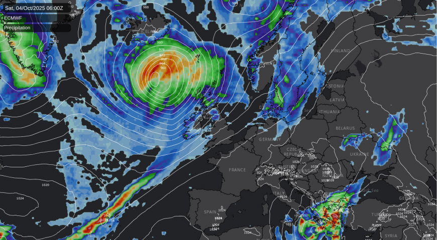
The longer range forecast models are suggesting that Humberto could potentially trigger another shift in the weather pattern, towards a more unsettled westerly type with low pressure systems tracking close to the north of Britain, but it looks likely that high pressure will continue to be close to the south and south-east, which means that we could just end up with a relatively minor shift, and just a more unsettled version of the northwest-southeast split that is forecast for most of next week. Temperatures look likely to trend closer to the long-term average in the long run as winds turn more westerly, but in the shorter term, next week looks like being on the warm side for the time of year.
Loading recent activity...