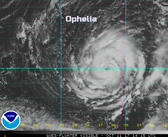
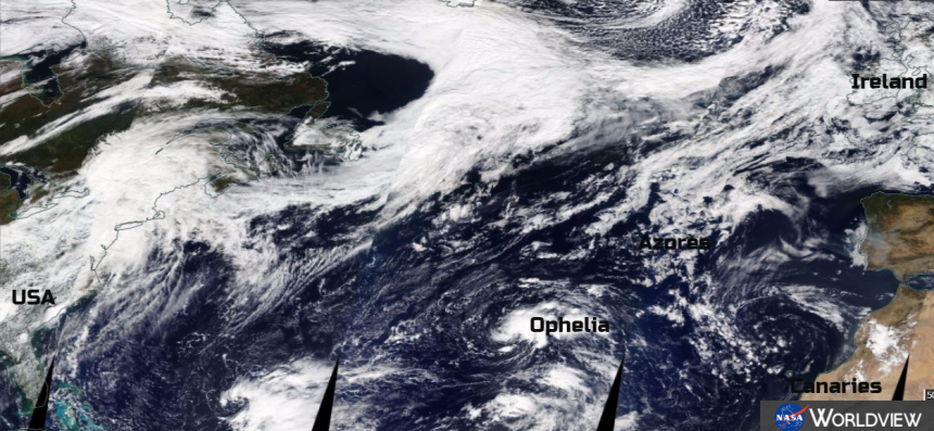
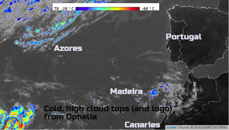
Ophelia is now a Hurricane. Forecast to head NE, closer to western Europe, with the possibility of affecting Portugal, Spain, Britain or Ireland. Out in the Atlantic Madeira and more likely the Azores will be watching its progress very carefully.
Current issues
Map projection. It is really quite tricky to visualise where Ophelia is and the variations of where she may head.
All sorts of sources are already screaming “a hurricane is coming!”
Ophelia really is in quite an unusual, although not unheard of, position
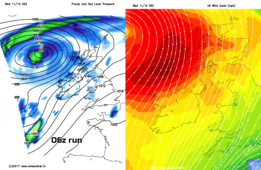
The night of Oct 15th into 16th 1987 was the night of the Great Storm and some forecast charts show a deep low close to the UK by Monday, the remnants of Ophelia. Exciting!
The IPCM Portuguese Institute for Sea and Atmosphere, only look ahead a few days for warnings, so nothing showing just yet for the Azores. The spread of possible tracks is huge. Most head between the far eastern island of the Azores and Madeira. Then the tracks vary from heading off east to Portugal, (the NHC seems to be fond of this) to clipping Galicia, NW Spain or heading northwards towards the UK. Many tracks stay out at sea, maybe brushing western Ireland, or just losing power slowly out in the Atlantic.
Look at all those solutions, all the lines, the western ones, eastern ones, some that do a loop the loop. This is where we can not take a deterministic solution and say this low pressure will be here, at this time. However, it is a valid part of the forecast to introduce the idea that there could be a deep area of low pressure bringing very wet, very windy weather but that the confidence of details is very low at this point.
At some point in its journey north, the SSTs (sea surface temperatures) will fall enough that this cyclone won't get its energy from warm seas. It becomes extra- tropical or post tropical. A change from a warm core, the important convective bit for a real hurricane, to our usual baroclinic low pressure sustained by a temperature gradient in the air masses.
The NHC track is showing this happening on Sunday, well out at sea from Portugal. Usually, this transition takes place off the eastern seaboard of the US or as remnants of Caribbean hurricanes head across the Atlantic west to east. Ophelia's path is shorter to NW or W.Europe.
Tropical air usually means heavy rain, and there is still the risk of gales and violent gusts. A cat1 hurricane has sustained winds of 74-95mph. Force 12, hurricane force winds are 73mph plus and do get mentioned in the Shipping forecasts with Phenomenal Seas. Remember gusts are sudden temporary bursts of stronger winds. A gust of 80mph is different to sustained mean winds in Hurricane Maria, for example.
We have to wait and see, the models are varying greatly. Here are two runs from the Netweather MR model, both for the end of Monday 16th.
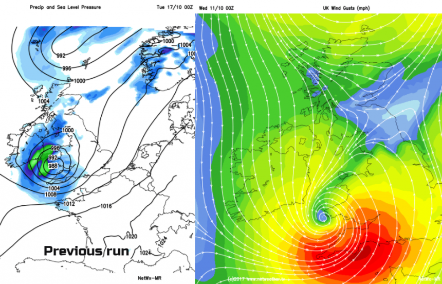
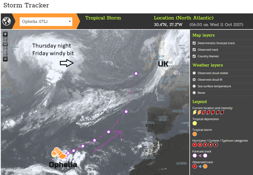
You can see the great changes from just one run. You can keep an eye on Ophelia's progress with the Met Office Storm Tracker which includes all the cyclones around the world. Also plenty of chat and discussion in the Netweather community forum. Heading to the west of Ireland, out at sea looks to be most likely.
From NHC , National Hurricane Centre US.
The cyclone is expected to be within a low shear environment and over marginally warm sea surface temperatures during the next 2 to 3 days. These conditions favour strengthening and the NHC forecast now calls for Ophelia to become a hurricane in about 24 hours. Extratropical transition is likely to start around day 4 and be complete by day 5, with the associated baroclinic dynamics expected to keep Ophelia a strong cyclone over the northeastern Atlantic.
Hurricane Vince 2006- Azores to the far south of Portugal/Spain
Hurricane Gordon 2012 - Azores
Loading recent activity...