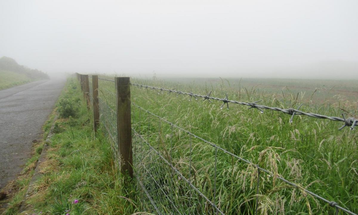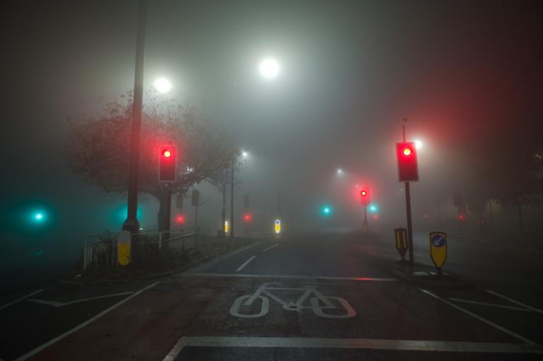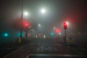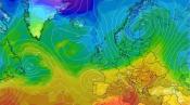



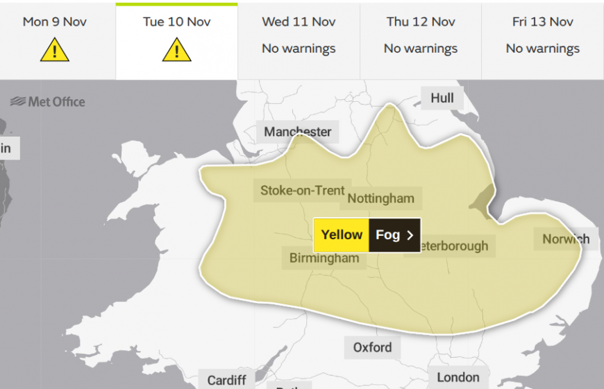
Did your week start with dense fog? A Met Office warning stated "Fog leading to difficult travel conditions and possible delays" for Monday morning commuters. Netweather's Nick Finnis had to adjust his plans south of London as the conditions worsened last night. There will be fog again tonight and for Tuesday morning, but not for everyone affected today.
On cool, clear and calm autumn nights, radiation fog forms if there is enough moisture in the air. Fog is just cloud on the ground. Lower visibility can be due to haze from dry particles or due to mist, fog or dense fog from water particles, depending on how poor the conditions become. In mist, the visibility is above 1000m, it is fog if the visibility is below 1km. For aviation, fog is defined as below 180 m, and dense fog as below 100 m, which is hazardous on the roads too. Freezing fog is more dangerous as ice deposits can cover vehicle windscreens.
We need moist air and low temperatures for fog to form, but not enough wind that conditions near the surface will stir and alter. By day, the sun (solar radiation) can also cause overturning and stirring. Cloud condensation nuclei (CCN) are important as they help the water vapour condense out, forming the fog droplets. Near the coast, these can be sea salt giving us coastal fog, pollution or fertilisers used in agriculture on the fields, and, at this time of year, the air is full of smoke and other particles.
Bonfire Night and Diwali both involve fireworks, and bonfires send smoke and burnt aerosol particles into the air. There are more CCNs in November due to these celebrations, but atmospheric conditions would produce fog without them too.
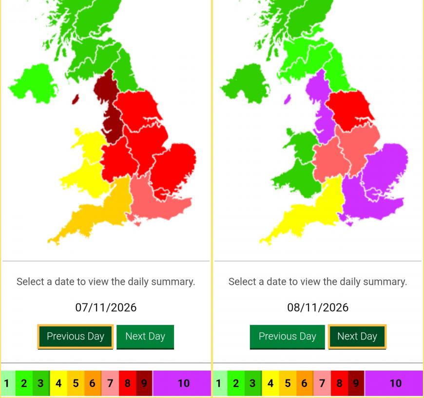
DEFRA air quality for the weekend following Bonfire Night
UK air quality networks routinely show a sharp spike in PM2.5 particles in early November. This year the 5th fell on a Thursday, so we’ve had many days of fireworks and a weekend with bonfires. Pollution monitoring stations are often placed in towns, and concentrations can leap up in the evenings, especially when smoke becomes trapped in the stable layer of air near the surface overnight.
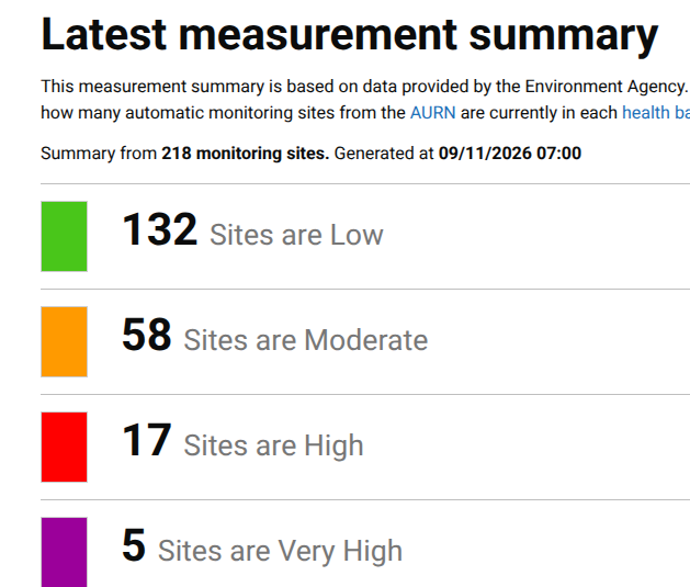
DEFRA air pollution levels early on Monday 9th November
There have been some high and very high levels of particulates recorded this weekend in the East Midlands, Merseyside and in East Anglia.
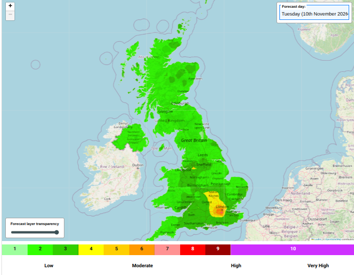
Forecast air pollution for Tuesday 10th Nov DEFRA
Monday started with widespread fog for England, Wales and Northern Ireland with high pressure nearby and light winds with mostly clear skies overnight. Overnight fog will reform, from East Anglia, through the Midlands to eastern Wales. Early on Tuesday, there will be issues with fog again for the morning rush hour, although a bit more of a breeze for the far south of England could keep the dense fog at bay. There will be pockets of high air pollution again for inland England on Tuesday. Overnight Tuesday into Wednesday, it looks like the Central Belt of Scotland could see thick fog through that lowland area.
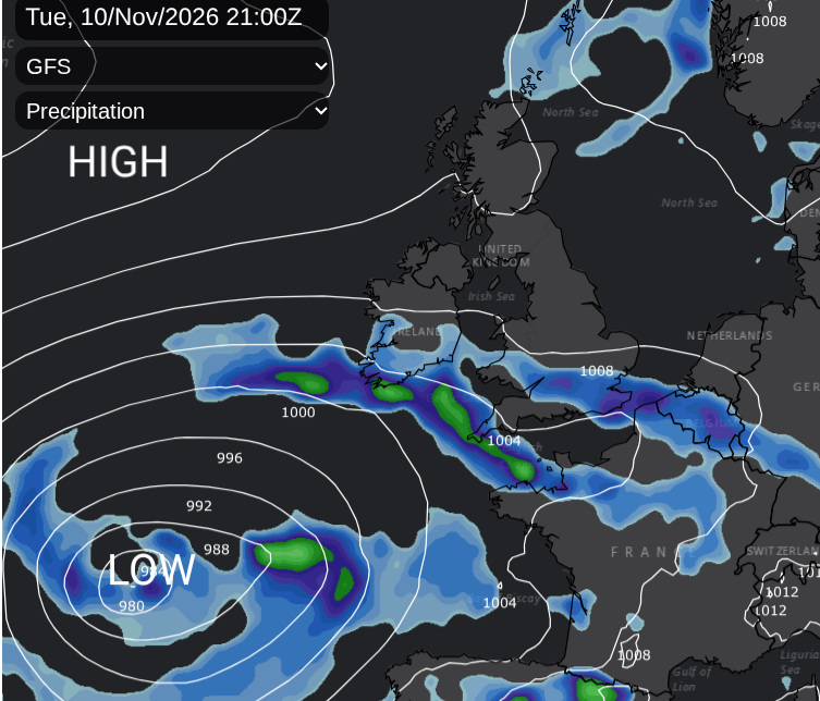
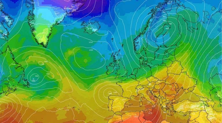
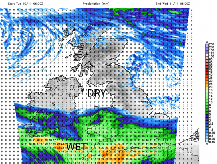
A change midweek will keep pollution levels low. Frontal cloud and rainbands associated with a large area of low pressure out in the Atlantic will bring welcome rainfall to southern Britain as the drought conditions continue. However, the incoming frontal bands are battling against a high pressure in the north, and the signal for rain seems further south, with more dry weather across central parts of Britain.
Later on Wednesday a northerly flow will set in, around the high pressure. Thursday morning will feel colder with a frost for inland northern Britain, and a few spots in Northern Ireland. Most of the UK will be chilly, calm and sunny, but there will be showers from the north of rain, sleet, hail and mountain snow.
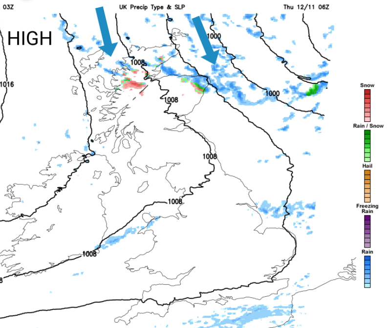
A wintry turn for northern Scotland but also cleaner Arctic air filtering down the UK. Thursday night will be cold and frosty for more of the UK, with sunshine on a colder Friday. It's still too dry for England and Wales, we need more rain.
Loading recent activity...